Lake Michigan gets regular health checkups, but like many people, it sometimes needs special monitoring or scanning to get to the bottom of symptoms or concerns. The latest results from some of these tests and evaluations are now available in an Environmental Systems Research Institute Story Map, Lake Michigan Health: A Deeper Dive.
The Cooperative Science and Monitoring Initiative (CSMI) intensive examination of Lake Michigan occurs every five years through an initiative that rotates around the Great Lakes—scientists in the region coordinate their efforts to answer critical questions and fill science information gaps for each lake.
Each year since 2002, through CSMI, multiple federal, provincial, state, and university scientists have joined forces on one of the Great Lakes to take part in coordinated research. This binational program is organized through the U.S. Environmental Protection Agency Great Lakes National Program Office and Environment and Climate Change Canada in support of the Great Lakes Water Quality Agreement Science Annex.
Unlike your medical records, information on the health of Lake Michigan is available to everyone, including environmental managers, scientists, educators, students, boaters, anglers and lake enthusiasts in general. On the story map, information is presented through interactive graphics, easy-to-understand diagrams and photos of science in action.
“Having this straight-forward tool that helps us explain to anglers and other stakeholders how bottom-up factors affect fish populations is a great thing and very timely, given the changing Lake Michigan ecosystem,” said Vic Santucci, Lake Michigan program manager, Illinois Department of Natural Resources.
Lake Michigan: A Deeper Dive, which was developed by Illinois-Indiana Sea Grant, includes a brief history of the lake as well as information on several key areas of study from 2015—Lake Michigan’s most recent CSMI field year focusing on the lower food web, prey fish and contaminants.
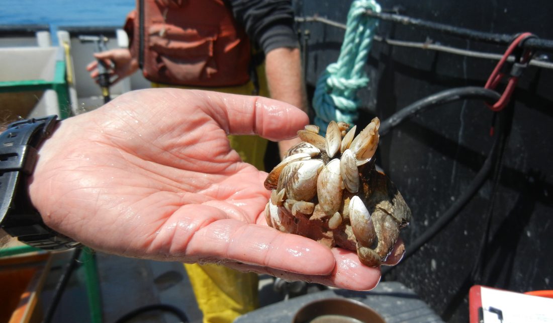
The invasive quagga mussels featured prominently in the scientists’ reports. They found that their lakewide numbers have declined, but that quagga biomass has increased as mussels age and grow larger. In deeper parts of the lake, quagga mussel populations increased between 2010 and 2015.
One way that scientists can assess the number of quagga mussels on the lake bottom is using a towed benthic sled, which, equipped with a camera, visually records mussel distribution and numbers at the bottom of the lake. While visiting the CSMI story map, you can ride along on the benthic sled and see what the scientists saw. Also, Lake Michigan: A Deeper Dive provides graphic illustrations of how the lake food web has changed since the influx of invasive species.
Another key finding is that, in general, larval fish are growing about half as fast as they did before quagga mussels were established in the early 2000s. In fact, quagga mussels, by filtering large amounts of plankton, may be having a negative impact on fish production.
Next year, CSMI scientists will once again gather on Lake Michigan for monitoring and testing to assess the health of the lake. To set 2020’s research priorities, scientists and resource managers came together in 2018 to discuss the latest findings and to define critical data needs. Over the next couple of years, scientists will report the results of their fieldwork and the CSMI story map will be updated with information from this upcoming Lake Michigan checkup.
This project was supported by the Great Lakes Restoration Initiative.
Illinois-Indiana Sea Grant is a part of University of Illinois Extension and Purdue Extension.
Writer: Irene Miles
Videographer: Hope Charters
Contacts (CSMI): Paris Collingsworth
Contacts (Story Map): Kristin TePas, Allison Neubauer

