 Sea Grant Illinois-Indiana
Chicago beach sand data provides management insights
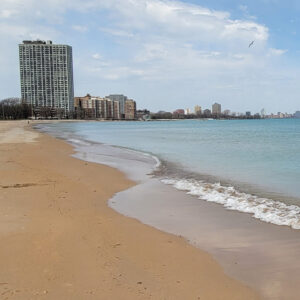 Dramatically variable Lake Michigan water levels, bigger storms, and stronger winds have made managing sand along Chicago area beaches more challenging. However, if resource managers have the latest data on beach and offshore sand distributions and understand how it moves from one place to another, they can make more informed decisions regarding changes to these popular and typically fragmented urban environments.
Illinois-Indiana Sea Grant-funded scientists monitored sand distribution along 18 Chicago beaches and in nearshore waters over the summers of 2022−23. The team used a variety of technologies and tools, for example, sonar, drones and underwater grabbers to sample sand, combining what they learned with historical data and previous studies, which provided guidance on their approach to data collection, filled in information gaps, and supplied context for their data.
This project was the first high-resolution sand assessment along the Chicago shoreline. The scientists found that sand levels in nearshore waters are important in terms of changes that take place on the beach. And they found that when it comes to rising lake levels, solutions need to be site-specific. Thus, the monitoring team compiled an extensive report that provides beach-by-beach information, which had been requested by managers to better contend with sand movement, especially from changing lake levels.