2016 top-to-bottom temperatures in nearshore #LakeMichigan, data recorded by the @ILINSeaGrant #MichiganCityBuoy and visualized by @PurdueCE pic.twitter.com/5wBRYiJY9i
— Two Yellow Buoys (@TwoYellowBuoys) January 20, 2017
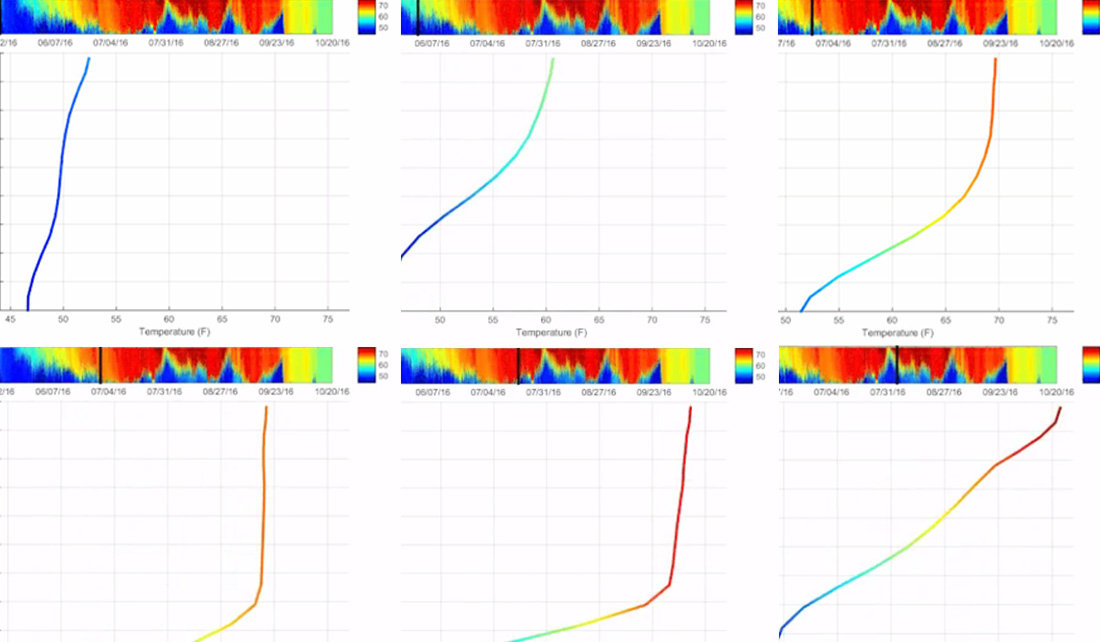
Our Michigan City buoy has a lot of sensors on it, but none are quite so popular as the temperature chain.
Every 10 minutes, 17 loggers, all at different depths, record and transmit the average water temperature of the lake.
Using data collected in 2016, Purdue University School of Civil Engineering student David Cannon visualized what happened in the top 45 feet of Lake Michigan, 3.5 miles northwest of Michigan City, Indiana.
The results shows just how variable the nearshore water is: one day it can be warm all the way to the bottom, and a week later it can be very cold way up at the surface.
For more information on buoys, winds, waves, and how they affect water temperature in nearshore Lake Michigan, see Lake Michigan By the Numbers.
Illinois-Indiana Sea Grant is a part of University of Illinois Extension and Purdue Extension.

