Meet Our Grad Student Scholars is a series from Illinois-Indiana Sea Grant (IISG) celebrating the students and research funded by our scholars program. To learn more about our faculty and graduate student funding opportunities, visit Fellowships & Scholarships.
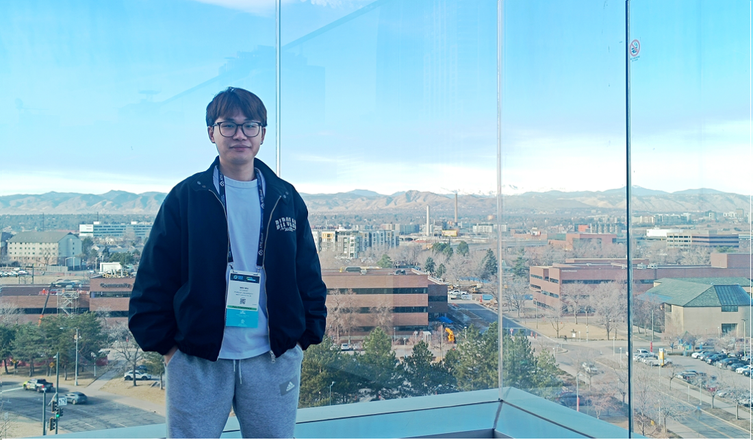
Wei Wu is a Ph.D. student at Purdue University focused on building AI-powered tools for coastal resilience. His research interests are combining drone sensing, 3D modeling, and immersive visualization to make environmental change more visible and measurable. Through IISG-supported research, he is advancing innovative approaches to monitor and strengthen communities along Southern Lake Michigan.
On a windy day along southern Lake Michigan, the shoreline tells a quiet but powerful story. Bluffs gradually erode. Water levels fluctuate. Infrastructure that appears stable today may face stress tomorrow. These changes often happen slowly—almost invisibly—until a storm makes them impossible to ignore.
My research begins with a simple question: What if we could see these changes clearly, in real time, before they become a crisis?
As a PhD student at Purdue University, I work at the intersection of artificial intelligence, 3D reconstruction, and coastal resilience. With support from Illinois-Indiana Sea Grant and my advisor, Qingchun Li, and co-advisor, Yu Hou, I am developing AI-enhanced tools to help communities better understand and respond to shoreline changes along Lake Michigan.
Lake Michigan supports vibrant ecosystems, critical infrastructure, tourism, and millions of residents. Yet monitoring coastal dynamics remains resource-intensive. Traditional surveying methods are powerful, but often time-consuming and costly.
AI-enhanced reconstruction workflows provide a complementary path. By automating parts of the modeling process and accelerating data generation, we can reduce barriers to frequent monitoring and long-term observation.
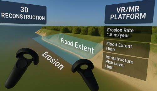
From 3D reconstruction to immersive visualization: integrating coastal modeling into an interactive VR/MR decision-support platform.
My work starts in the field. Using unmanned aerial vehicles, I collect high-resolution imagery of coastal environments, capturing bluff geometry, terrain variation, vegetation, and infrastructure conditions.
But the real innovation happens after the flight. Collecting accurate 3D data is only the first step. The ultimate goal is to transform complex spatial information into tools that communities can use.
Instead of manually processing imagery into static maps, I apply AI-driven 3D reconstruction methods to convert raw images into immersive, measurable digital environments. Techniques such as neural rendering and Gaussian-based modeling enable us to rapidly and efficiently generate high-resolution 3D coastal representations.
These digital shorelines are not just visual models. They are structured environments that can be measured, compared across time, and explored interactively.
In practical terms, this allows us to capture shoreline geometry with high spatial precision, monitor seasonal erosion patterns, quantify terrain changes over time, and support scenario-based visualization. Rather than reacting after damage occurs, communities can begin identifying patterns earlier.
By integrating reconstructed coastal models into virtual and mixed reality environments, planners and stakeholders can step into a digital version of the shoreline. Instead of interpreting abstract charts, they can visually explore bluff edges, terrain gradients, and proximity to infrastructure.
Making environmental change spatially intuitive strengthens communication. It helps bridge the gap between scientists, policymakers, and the public. When risk becomes visible, decisions become clearer.
This IISG-supported work has also been shared with the broader geospatial and research community.
At GEO Week 2026, a major industry gathering focused on geospatial technologies, remote sensing, and 3D mapping. I participated in the conference through the ASPRS-WGL Travel Grant Scholarship and engaged with researchers and industry leaders working on advanced sensing platforms and spatial data solutions. Conversations there reinforced how rapidly AI and sensing technologies are evolving—and how important it is to connect academic research with real-world applications.
Presenting IISG-supported coastal 3D reconstruction research at ICIR 2025, where the work received the Best Paper Award.
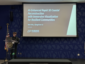
In addition, I presented our IISG coastal 3D reconstruction research at the International Conference on Intelligent Reality in 2025 where the project received a Best Paper Award. The presentation highlighted how AI-enhanced modeling combined with immersive visualization can accelerate coastal monitoring workflows and improve interpretability for decision-makers.
These experiences demonstrate that the research is not only technically innovative but also recognized as impactful in the broader community.
With IISG support, I continue to refine and validate this system using real-world shoreline data. Upcoming field campaigns along southern Lake Michigan will further test how these tools perform under dynamic environmental conditions because coastal resilience is not only about responding to storms. It is about anticipating change.
By combining drone-based sensing, artificial intelligence, and immersive visualization, my research aims to make shoreline change visible, measurable, and actionable.
If we can see the shoreline more clearly, we can plan more confidently. And that is where resilience begins.

