November 20th, 2014 by iisg_superadmin
Eliana Brown recently joined the Illinois Water Resources Center as an outreach specialist. Prior to starting at IWRC, she worked at University of Illinois at Urbana-Champaign Facilities & Services as the MS4 coordinator and at Illinois EPA as a field engineer. Eliana has a M.S. in environmental engineering and a B.S. in general engineering and marketing from the University of Illinois.
The following is a contributing post from Eliana, who has a passion for rain gardens and green infrastructure:
When you were a university student, did you ever reimagine your campus landscape? Students at the University of Illinois did exactly that as an assignment for Landscape Architecture (LA) 452, Native Plants and Design.
The U of I campus has 84 miles of storm sewer, most of which drain rainwater directly to Boneyard Creek. The LA 452 students designed landscapes with elements that capture water and allow it to soak in on-site to reduce loads to the existing storm sewer and creek. These elements (called green infrastructure) include rain gardens, swales, and green roofs. The Environmental Protection Agency (EPA) sees green infrastructure as a way to create sustainable, resilient communities that improve water quality.
EPA has a competition called the Campus RainWorks Challenge that invites “student teams to design an innovative green infrastructure project for their campus showing how managing stormwater at its source can benefit the campus community and the environment.”
According to Jason Berner, EPA environmental protection specialist, who has been involved with administering the competition, it is a great way for students to see how green infrastructure is related to the larger campus master plan. “It moves us beyond single pilot projects, but at the same time, blends both small and large scale thinking,” he explained.
LA 452 instructor Tawab Hlimi is leading the U of I Campus RainWorks entry. Students in his class helped brainstorm ideas for the entry. One of those ideas is pictured. Student Jiwon
Kim reimagined the grounds at the National Soybean Research Building (which happens to house Illinois-Indiana Sea Grant and the Illinois Water Resources Center). Native plant rain gardens intercept stormwater from the building roof and parking lot. During large storms, the design takes advantage of existing storm sewers by overflowing excess water to them.
Like many cities and universities, the U of I began installing storm sewers more than 100 years ago. Storm sewers benefit cities by draining flooded areas. However, they can overload receiving streams and cause unintended damage. Adding green infrastructure elements to the existing infrastructure helps ensure a healthier ecosystem on-site and downstream.
Per Hlimi, “Through a campus wide application of rain gardens, students hybridized native plantings with a superficial stormwater management strategy to meet multiple objectives: accommodating the ‘first flush’ of frequent storm events through detention, infiltration, and biofiltration, reducing the load on existing subsurface infrastructure, improving the water quality entering into the Boneyard Creek, creating habitat for pollinators, and rendering the campus landscape as living laboratory.”
Perhaps one day in the not too distant future, students won’t have to imagine green infrastructure on campus. They’ll see it.
November 19th, 2014 by iisg_superadmin
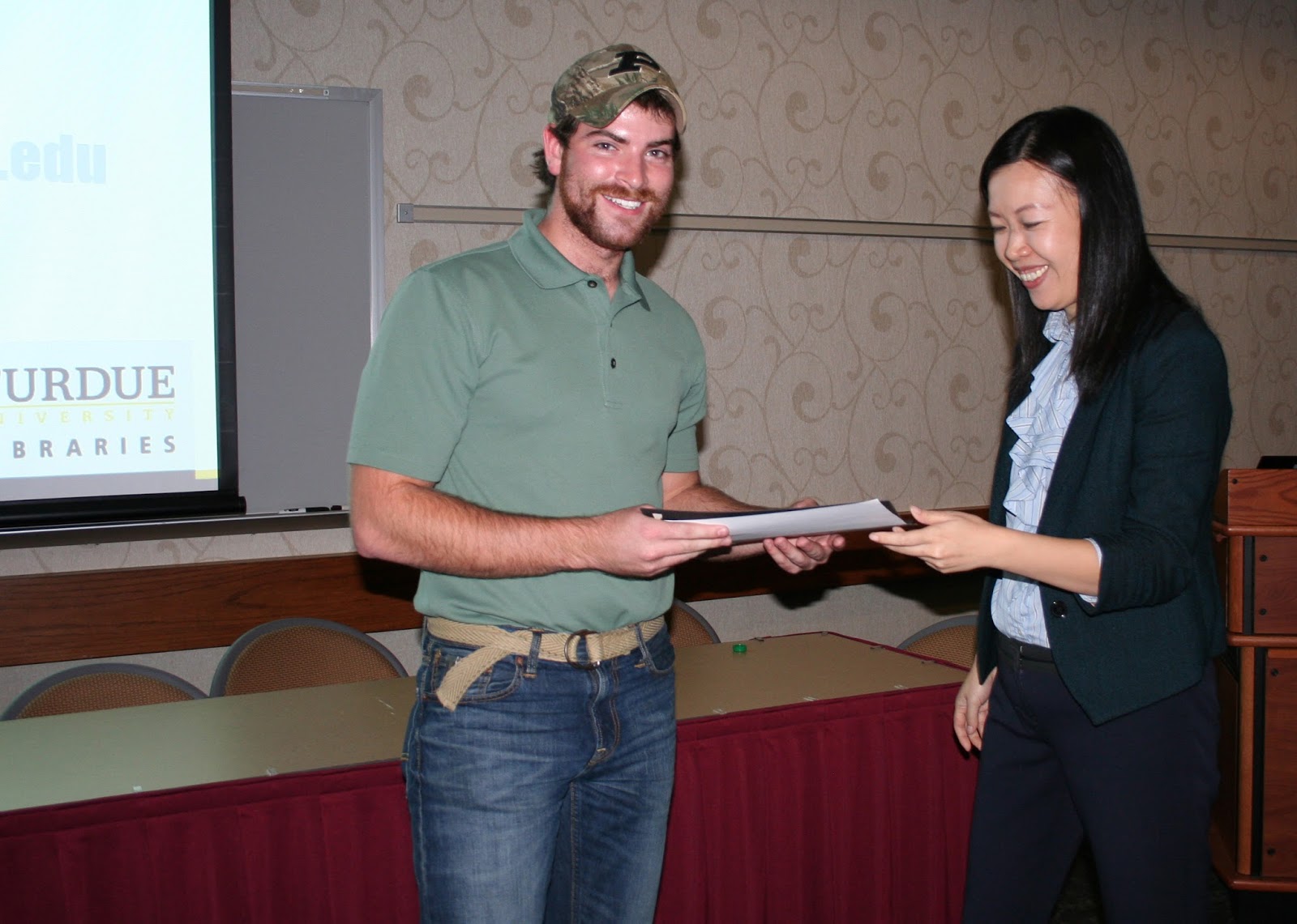
Former intern Jacob Wood received an award earlier this month for a poster he presented during Purdue University’s GIS Day, an annual event dedicated to geospatial research and geographic information systems (GIS).
“The poster detailed my work over the summer with IISG on mapping Lake Michigan catch data. Jarrod Doucette and myself have been working creating a web app for the IISG website to visualize two decades of recorded fish catch data from the Indiana, Michigan, Illinois, and Wisconsin Departments of Natural Resources. I thought presenting the poster at Purdue’s GIS Day would be a great way to show the work that I accomplished for IISG over the summer.”
Read more about our summer internship program and hear from past interns about what they are up to now.
November 17th, 2014 by iisg_superadmin
Microbeads have attracted a lot of public and political attention in the Great Lakes region since Sam Mason and her lab first discovered the tiny beads in staggering numbers in lakes Huron, Superior, and Erie in 2012. Since then, sampling excursions on the remaining lakes—conducted with help from Illinois-Indiana Sea Grant and 5 Gyres—have turned up similar findings.

In many ways, the results of these studies raise more questions than they ask. One of the most important, though, is “What effect do microbeads and other plastic pollutants have on Great Lakes food webs and ecosystems?” Research into this question has only just begun, but years of studies in the oceans provide some insight. Some of these latest findings come from our friends at South Carolina Sea Grant.
From Coastal Heritage:
John Weinstein is studying how grass shrimp (Palaemonetes pugio) respond to a diet of plastic beads. A crustacean about the size of half of a shelled peanut, a grass shrimp consumes microalgae that grow on plant detritus—especially decomposing saltmarsh stems called “wrack”—along estuaries and coasts, but it’s also a predator on a wide variety of small animals.
Because of its abundance, sensitivity, and ecological importance in southeastern U.S. estuaries, the grass shrimp is often used to study the effects of pollution in the field and laboratory.
In Weinstein’s lab, Austin Gray, a graduate student in biology at The Citadel, has been feeding grass shrimp two types of beads: one a bright green and the other one translucent.
The green beads are polyethylene, the type of plastic used in plastic bags, bottles, plastic wrap and other films for food preservation, and many other products. Polyethylene is the most common type of plastic found in marine debris around the world.
The translucent beads are polypropylene, a type of plastic used in bottle caps, candy- or chip-wrappers, and food containers. Polypropylene is the second most common type of plastic found in marine debris.
In a lab dish, Austin Gray deposits translucent 75-micron beads. But a visitor looks in the dish and can’t find a single bead. Under the dissecting microscope, though, dozens of tiny spheres suddenly appear. To put it in perspective, an item at about 40 microns is the width of two spooning human hairs.
Gray fed 16 grass shrimp a diet of brine shrimp mixed in with plastic beads. Each grass shrimp was isolated in water that was changed every other day. Eight animals were fed polyethylene beads and eight were fed polypropylene beads. After six days, all of the 16 shrimp were dead.
Dissecting the animals, Gray found plastic beads in their guts and gills. One individual had 10 tiny beads in its gut and 16 in its gills.
The gut blockages, though, were deadlier. The grass shrimp could still take in water through their partly blocked gills. But they stopped eating with clogged guts—or couldn’t eat—and died.
“In my mind,” says Weinstein, “it’s consistent with starvation. The more particles in guts, the more quickly the grass shrimp die.
Concern about results like these has led Illinois to become the first state to ban the sale of microbeads in personal care products. The law, passed in June, is slated to take full effect in 2019. Similar legislation has also been considered in New York and California.
Click on the link above to read the full article.
***Photo: Collecting plastic samples in southern Lake Michigan in 2013.
November 13th, 2014 by iisg_superadmin
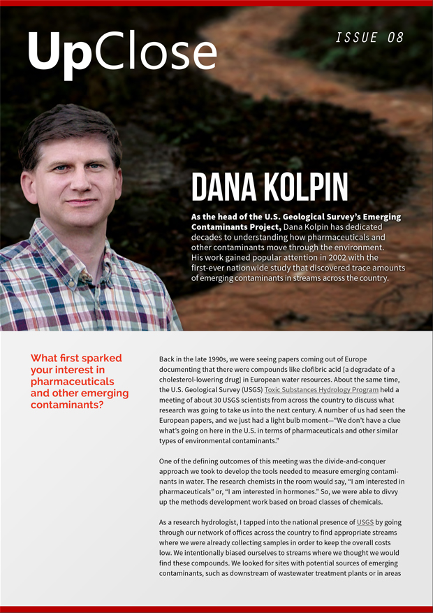
It’s been two years since our first edition of UpClose, and we decided to celebrate the occasion by taking a behind-the-scenes look at the study that launched an era of scientific and public interest in pharmaceuticals and other emerging contaminants.
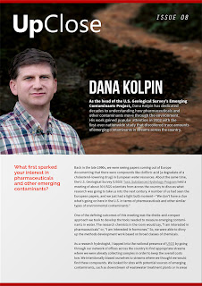
And to top it off, we’ve given the award-winning interview series a fresh new look.
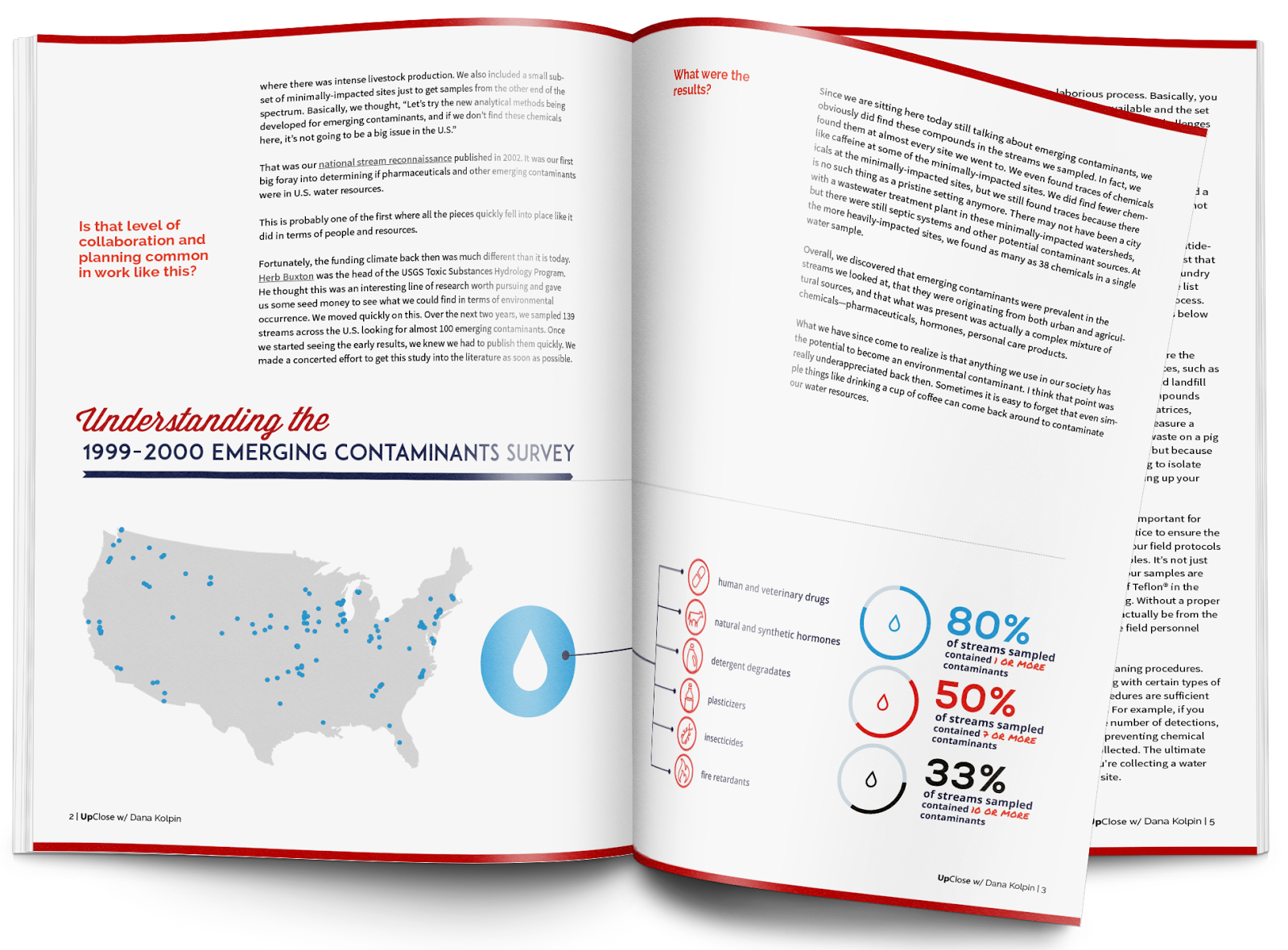
Dana Kolpin, a research hydrologist and head of the U.S. Geological Survey Emerging Contaminants Project, played a key role in the first-ever nationwide survey of emerging contaminants. The study found pharmaceuticals, detergents, hormones, and other chemicals in streams across the country. When the results were published in the journal Environmental Science & Technology in 2002, they sparked a of flurry of media and research attention. To this day, in fact, it is still the most cited study in the journal’s history.
In the eighth issue of UpClose, Kolpin looks back on the challenges of designing and conducting a national study—particularly one in search of everyday chemicals like caffeine—and the cutting-edge methods scientists created to analyze the results. He also talks about the gaps in understanding that remain after more than a decade of investigating these contaminants and gives a sneak-peak at USGS’s latest projects.
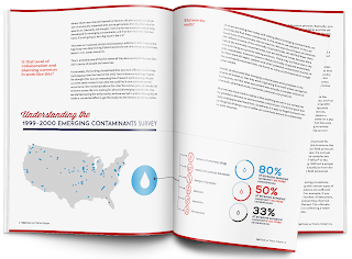
Find previous issues of UpClose and additional resources at unwantedmeds.org.
November 11th, 2014 by iisg_superadmin
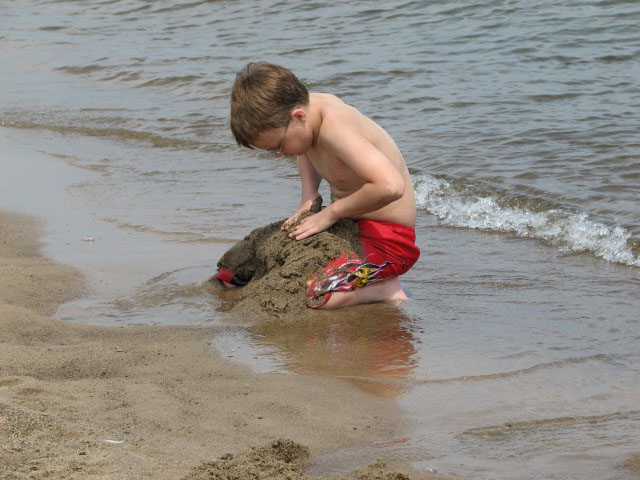
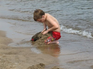 If you’re a regular visitor to Great Lakes beaches, you likely noticed that this year’s swim season was chillier than normal. Cold enough, in fact, that many chose to skip swimming in favor of other beach activities. And according to officials at the National Weather Service, this may explain the unusually low number of current-related fatalities and rescues this year.
From Michigan Sea Grant:
There were 6 fatalities and 12 rescues related to currents on the Great Lakes, which is below the 12-year average of 12 fatalities and 25 rescues per year.
As is typical, the majority of the 2014 incidents occurred along Lake Michigan. On average from 2002-2014, Lake Michigan had 25 incidents per year, while Lake Erie had 5 incidents per year, Lake Superior had 3 incidents and Huron and Ontario average 1 to 1.5 per year, respectively.
The data for 2014 has now been updated in the Great Lakes Current Incident Database, available at DangerousCurrents.org. The database was developed and is maintained by Michigan Sea Grant and National Weather Service (NWS). Megan Dodson, a NWS meteorologist, gathers the statistics for the database and provides yearly swim season assessments of conditions related to currents.
Dodson noted the cool weather influenced not just the below-average number of incidents, but where they happened too.
“A majority of the current-related incidents in 2014 occurred near river mouths, which is unusual when compared with past years,” she said. “The cooler air and water temperatures may have driven beachgoers to swim near river mouths and other outlets, where the water is much warmer. However, there are currents present that can be strong and vary depending on the flow of the outlet and the waves at the beach. While these currents are most dangerous during times of high waves, they can still be strong despite calmer lake conditions — as we saw during the 2014 swim season.” Read more
Swim season may be over, but it is never too early to start planning for next year. To stay safe in the water, be sure to:
- Steer clear of the pier — Nearly 60 percent of fatalities and rescues in the Great Lakes database occurred near breakwaters and piers. Structural currents are nearly always present near these barriers, even when waves are low. Breaking waves can also bounce off the structure, making swimming nearly impossible.
- Stay dry when waves are high — Nearly 85 percent of fatalities and rescues in the Great Lakes database happened when waves are 3-5 feet or greater. Unlike in the oceans, Great Lakes waves crash against the shoreline in rapid succession, making it difficult to swim. Additionally, strong rip currents are more likely when waves are above 3 feet. The combination of quickly approaching waves and strong currents create extremely dangerous conditions for swimmers.
- Don’t swim in the outlet — Water flowing from a river mouth or other outlet can push swimmers out into the lake. Nearly 40 percent of the 2014 incidents were outlet-current related.
November 5th, 2014 by iisg_superadmin
In Alaska’s Kachemak Bay Research Reserve, invasive species prevention is taking on a new look. To prevent the spread of the invasive invertebrates while a local harbor undergoes renovations, officials have adopted the Be a Hero – Transport Zero logo and slightly modified the message to encourage those involved in the reconstruction to follow a few easy before moving all docks and other infrastructure.
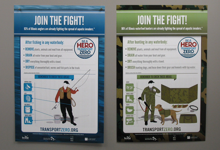 Closer to home, the outreach campaign developed by Illinois-Indiana Sea Grant and the Illinois Department of Natural Resources is also expanding to include hunting, hiking, and other terrestrial pathways. Posters asking customers to “join the fight” can be found in outdoor supply shops in several Illinois cities, including Springfield. The message also made an appearance at this year’s state fair in August.
When it launched last year, Be a Hero – Transport Zero became the primary invasive species prevention message in Illinois. It’s simple call for boaters, anglers, and other recreational water users to “remove, drain, dry” before leaving a waterbody has been featured in magazines, broadcast on radio and television, and wrapped into outreach programs like Clean Boats Crew.
To learn more about aquatic invasive species and what you can do to prevent their spread, visit our invasive species page.
November 3rd, 2014 by iisg_superadmin
After decades of remediation work, two Michigan sites are no longer considered Areas of Concern (AOCs). The U.S. Environmental Protection Agency officially removed Deer Lake in the Lake Superior basin and White Lake in the Lake Michigan Basin from the list of toxic hot spots last week.
These are the third and fourth U.S. sites to be delisted since a 1987 cleanup agreement with Canada identified areas hit hardest by legacy pollutants like PCBs and mercury. The Oswego River in New York became the first in 2006, and Pennsylvania’s Presque Isle Bay was delisted last year.

From the Detroit Free Press
The Deer Lake AOC, along the southern shore of Lake Superior on the Upper Peninsula, was listed because of mercury contamination that leached into water flowing through an abandoned iron mine, as well as other pollutants. Mercury contamination in fish—and reproductive problems—also were documented in animals and birds, including bald eagles.
The remediation efforts included a Great Lakes Restoration Initiative grant for $8 million that helped pay for a project diverting water from Partridge Creek. It previously fed the stream flowing through old mine workings under Ishpeming, which then ran into another creek and into Deer Lake.
The White Lake AOC was on Lake Michigan in Muskegon County and had been contaminated by pollution—especially organic solvents—from tannery operations, chemical manufacturing and other sources, degrading fish and wildlife habitats.
A $2.5-million grant was used to remove contaminated sediment and restore shoreline, with more than 100,000 cubic yards being removed.
More than two dozen AOCs remain throughout the Great Lakes states. But as many as 10 are targeted for completion in the next five years thanks in part to funding from the Great Lakes Restoration Initiative, which will enter its second phase next year.
Two of the sites slated for delisting are the Buffalo and Grand Calumet rivers, where IISG’s Caitie McCoy has partnered with federal, state, and local groups under the Great Lakes Legacy Act to connect nearby communities with the remediation and restoration. A big part of this work has focused on integrating environmental cleanup projects into the classroom with place-based curriculum and stewardship projects.
***Deer Lake in Ishpeming. Credit: Stephanie Swart, Michigan Department of Environmental Quality.
October 30th, 2014 by iisg_superadmin
For anyone familiar with the Grand Calumet River, the changes over the last few years are impossible to miss. The historically industrialized river, long ago abandoned by both people and wildlife, is now home to birds, fish, and other aquatic life in many areas. The revitalization is due to a series of remediation and restoration projects that will remove more than 2 million cubic yards—roughly 130,000 dump trucks—of contaminated sediment and add native plants to banks and marshes by 2015.
The east branch of the river is one of these revitalized areas, and it is there that representatives from government agencies and non-profit organizations, including IISG’s Caitie McCoy, met earlier this month for a tour of the remediation projects.
From the Times of Northwest Indiana:
The tour, coordinated by Save the Dunes, was aimed at highlighting the work and thanking representatives from the offices of U.S. Rep. Pete Visclosky, D-Merrillville, and U.S. Sen. Joe Donnelly, D-Ind., for their support in the efforts and encouraging support for future funding.
“They’ve been our champions to maintain (Great Lakes Restoration Initiative) funding for the last four or five years,” Nicole Barker, executive director of Save the Dunes, said. “We are indebted to them.”
The group visited some of the river’s biggest success stories, including Roxana Marsh, which has been free of high levels of PCBs and heavy metals for over two years. They also heard from officials about local changes that are helping to secure the long-term health of the river. In Hammond, IN, for example, raw sewage that was previously discharged into the newly-remediated river is now being redirected to the city’s wastewater treatment plant.
Perhaps the most interesting part of the tour came during the stop at Seidner Marsh. Remediation for this part of the river wrapped up earlier this year and attention has been turned to dredging wetlands and rebuilding habitats. The group was able to see these efforts first-hand as workers delivered barge after barge of fresh sand to be spread along the riverbed.
“It is important that these restoration projects do more than just remove contaminated sediment,” said Caitie. “We also want to help jumpstart wildlife populations, and that includes the invertebrates and microorganisms that live at the bottom of the river. The clean sand gives them a home, a place to burrow in.”
Cleanup and restoration on the Grand Calumet will continue for many years—six of the nine project areas are still in progress. But residents and visitors can expect to see a clean river bottom with a thriving plant community as early as 2024.
October 29th, 2014 by iisg_superadmin
The Gulf of Mexico dead zone was the topic of discussion by government officials and non-profit organization representatives from across the Mississippi River Basin in Alton, IL last week. Our own Michael Brennan and Lisa Merrifield were among those in the room and wrote in to share their impressions of the meeting.
But first, Michael brings us up to speed on the reason for the meeting and the group behind it all.
 “The hypoxic zone is a seasonal phenomenon in the Gulf region, where sudden outbreaks in algal communities spurred on by excess nitrogen and phosphorus lead to depleted oxygen levels in an area the size of New Jersey. Since it is rain events that wash excess nutrients into the Mississippi River and down to the Gulf, the size of the hypoxic zone varies year-to-year. However, the average annual size has remained unchanged for decades.
“State and federal agencies have been working towards a solution to the Gulf of Mexico dead zone for decades,” he added. “The Hypoxia Task Force, a group consisting of federal and state representatives, was established in 1997 to oversee a unified regional effort to reduce the size of the dead zone. Last week’s event was the group’s fall meeting.”
The day-long meeting touched on a variety of issues, including updates on ongoing efforts to understand the dynamics of the dead zone and to reduce the amount of nutrients carried from farm fields and city streets in stormwater runoff.
“The task force has been doing a lot of modeling exercises to determine the size and spread of the hypoxic zone,” said Lisa. “They are starting to think beyond the basics about how to more accurately characterize the impact of the zone, from biological to social and economic impacts. Many members expressed interest in engaging social scientists as they think about future strategies.”
“My main purpose for being there was to hear about the Illinois Nutrient Loss Reduction Strategy, which will be released this fall,” Lisa added. The strategy lays out a suite of best management practices for reducing nutrient losses from both point and non-point sources. It was developed by representatives from government agencies, agriculture, and non-profits as well as scientists and wastewater treatment professionals and represents the most comprehensive and integrated approach to date for tackling nutrients in Illinois. Along with the rest of the staff at the Illinois Water Resources Center, Lisa has spent the last year facilitating the development of the state’s nutrient strategy.
As a water quality specialist focused on nutrients in the Mississippi River, the meeting was particularly interesting for Michael.
“The most encouraging part was a hearing from a new organization that has thrown their hat into the ring: the Mississippi River Cities and Towns Initiative. The group consists of 65 mayors of riverfront communities from Minnesota to New Orleans who came together to preserve the local economies that depend on the Mississippi River and improve the integrity and sustainability of the river. They have already begun implementing practices that protect and restore water quality. The city of Grafton, IL, for example, restored a wetland in their community. Wetlands are natural landscape features that facilitate flood water storage, foster native vegetation, and provide valuable habitat for a wide variety of birds and other wildlife.”
To learn more about hypoxia in the Gulf of Mexico, visit the task force website.