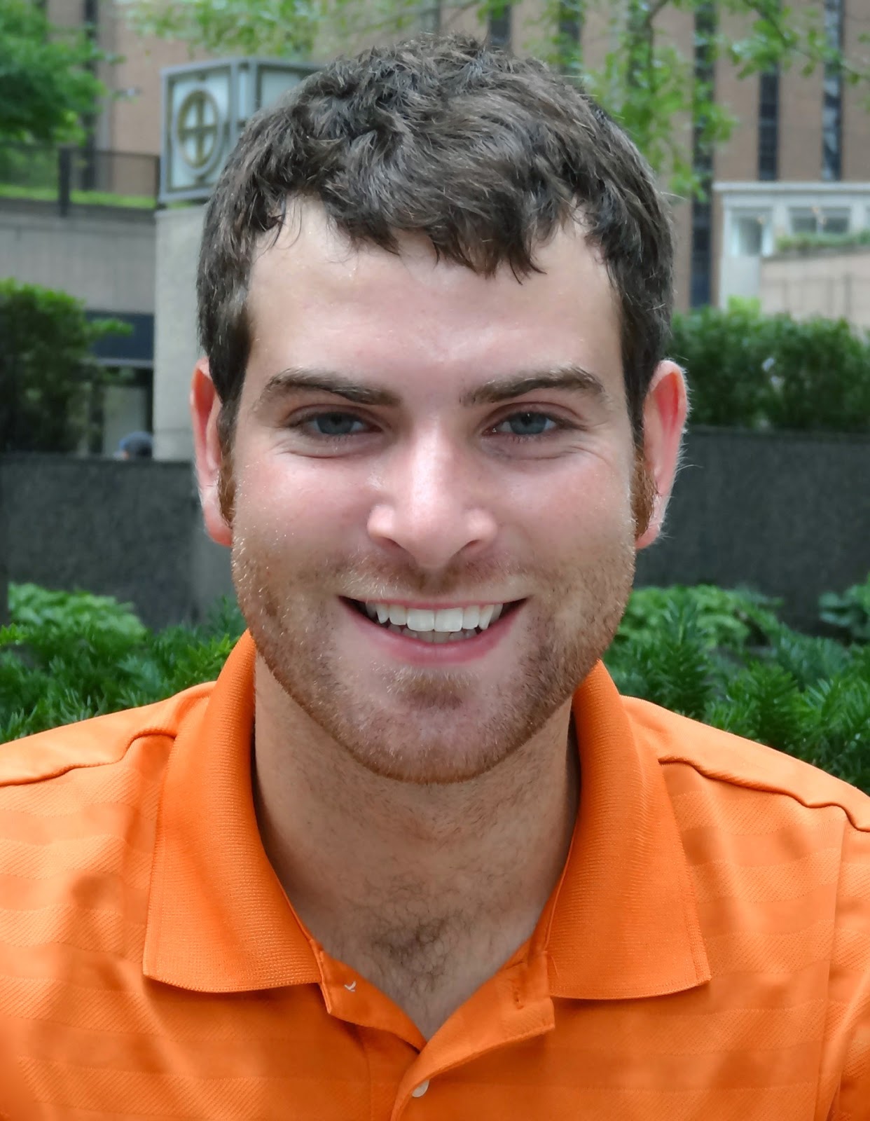
One year has passed for Monica Gregory, Illinois-Indiana Sea Grant’s first NOAA Coastal Management Fellow. We caught up with her to hear about her first year. Monica will be finishing her two-year fellowship in July 2018. Stay tuned for her final installment.
“It’s hard to believe that it’s been over a year since I was selected as a NOAA Coastal Management Fellow (CMF) for North Carolina. I remember receiving the email invitation to interview for the project; I was thrilled (and nervous!) for the opportunity to fly to Charleston and meet potential employers. I was lucky enough to connect with the project in North Carolina, and here I am!
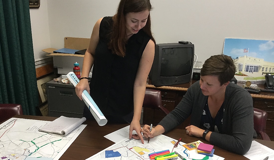
My office is with the Division of Coastal Management in Morehead City. I am halfway through my main project on community resilience planning. I am working with five pilot communities in North Carolina to map their social and physical vulnerabilities to coastal hazards. I have completed my work with town managers and planners to map their towns. This fall, I will be facilitating workshops and public meetings for resident input.
We hope to use the maps to identify priority areas for resilience work, then create a comprehensive list of resilience projects that could be feasible for each town depending on their unique circumstances. The overall idea is to create a larger framework guide on resilience planning for coastal communities in North Carolina. Our five case studies will be references for communities that are experiencing similar issues.
Monica (left) and DCM planner Rachel Love-Adrick mapping Town of Edenton’s vulnerabilities
August marks my one year anniversary as a CMF. In that time, I have had the chance to dig into my project, to learn all about the field of resilience and hazard mitigation, and to meet inspiring people in local government, as well as NOAA and The Nature Conservancy, to name a few.
I have used my skills in research, survey design, and community engagement. I have improved essential skills like networking, public speaking, and partnership-building. I have traveled around the south and southeast to attend conferences on topics from climate change adaptation to technology in coastal management. Most of all, I have found a new home in North Carolina, and I have fallen even more in love with the Southeast region.”
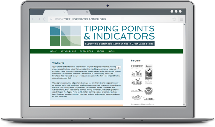
A closer look at web tools and sites that boost research and empower Great Lakes communities to secure a healthy environment and economy. For community planners, balancing community growth and environmental health can be a challenge. Putting down roads, building along waterways, or converting prairies to farmland puts stress on local ecosystems—sometimes so much that it can trigger rapid and potentially irreversible shifts in how they function. Fortunately, Tipping Points and Indicators gives watershed planning groups and others the information they need to avoid these tipping points while still meeting community needs. The web tool uses the latest watershed research and cutting-edge technology to show planners how close their watershed is to known tipping points and what the watershed will look like if land use decisions continue “business as usual.” Planners can also test how developing more in one location or restoring habitats in another moves ecosystems closer to or further from tipping points. With help from a Sea Grant facilitator, planners can use these interactive maps and simulators—along with recommended policies, ordinances, and outreach efforts—to prevent aquatic ecosystems from being degraded beyond repair. Since it was launched in 2013, Tipping Points and Indicators has undergone many design and feature updates inspired by months of pilot testing. Larger maps and detailed legends that toggle on and off give users a closer look at their watershed and make information on characteristics like stream quality and land cover types more accessible. Users can also easily track how proposed land use changes will effect ecosystem health with updates to the planning simulators. To learn more about the tool and see key features in action, watch this introductory video created by the IISG team leading the project.
Tipping Points and Indicators was developed in collaboration with Purdue University, University of Michigan, Michigan State University, University of Minnesota Duluth, University of Windsor, the Great Lakes Environmental Research Laboratory, the Cooperative Institute for Limnology and Ecosystem Research, the Great Lakes Restoration Initiative, NOAA, and the Sea Grant Great Lakes Network. Funding for the four-year project comes from NOAA and EPA.
Former intern Jacob Wood received an award earlier this month for a poster he presented during Purdue University’s GIS Day, an annual event dedicated to geospatial research and geographic information systems (GIS).
“The poster detailed my work over the summer with IISG on mapping Lake Michigan catch data. Jarrod Doucette and myself have been working creating a web app for the IISG website to visualize two decades of recorded fish catch data from the Indiana, Michigan, Illinois, and Wisconsin Departments of Natural Resources. I thought presenting the poster at Purdue’s GIS Day would be a great way to show the work that I accomplished for IISG over the summer.”
Read more about our summer internship program and hear from past interns about what they are up to now.
We’ve talked a lot in the last year about our Tipping Points Planner, which helps watershed planning groups develop effective strategies for the protection of natural resources. But what about the people behind the tool? Its use of the latest research and cutting-edge technology is made possible by the tireless efforts of Jarrod Doucette and a team of web developers that now includes Brandon Beatty.
Jarrod, our GIS and database specialist, began work on the decision support tool roughly three years ago. Throughout the process, he worked closely with researchers and outreach specialists to ensure the Tipping Points Planner includes the latest data and is accessible to a wide range of audiences. Jarrod’s extensive experience as a GIS specialist and web developer working with universities and state agencies has been recognized by the GIS company Esri and from the Indiana Geographic Information Council. He holds a Master’s in geospatial information systems from State University of New York College of Environmental Sciences and Forestry.
The tipping points and indicators program is now up and running, but there is still a lot to do to make sure the tool stays current and user-friendly. More and more watershed groups are integrating it into their planning process, including several in northwestern Indiana and northeastern Illinois. That is where Brandon Beatty comes in.
Brandon joined Sea Grant earlier this year as our web designer and developer. Prior to that, he worked as a software developer on a project with the Purdue University libraries. His past work in design and development earned him an American Advertising Award in 2009. Brandon earned a Bachelor’s in computer graphics technology at Purdue University.
Our summer internship program has wrapped up for another year. This summer, seven students and recent graduates worked with our specialists on a broad range of issues, including AIS prevention, sediment remediation, and water supply planning. Jacob Wood spent his internship working with several members of our Purdue staff. He had this to say about his summer experiences:
“I applied for the IISG internship because I wanted to get more experience with GIS work related to the environment. And that is exactly what I got.
I spent most of the summer creating GIS maps that represent fish catch data for Lake Michigan so that local fisherman can get a better idea of fishing trends and hotspots. The overall goal is to make a web app to helps users determine the historically-best spots to catch fish like Chinook salmon and Lake Trout during a specific time of year. Towards the end of the summer, I also started working on maps representing climate change predictions for Lake Michigan. These maps will go towards aiding fisheries managers in understanding future biotic and abiotic conditions. Lastly, I worked on incorporating updated stream and land coverage data into the tipping points webtool, which shows individuals and planning groups how close a watershed is to known tipping points or ecosystem thresholds.
One of the things I liked the most about my internship is that I was encouraged to explore the software I was working with and any information related to the projects. Rather than just focusing on completing a job or making a deadline, I was able to set aside some time each week to discover different aspects of software and just try learning new things. Because of this, I developed numerous GIS skills this summer. Specifically, I have a stronger grasp now of how to use model building features to make work faster, easier, and replicable, as well as how to make maps that represent data clearly for everyone.”
Jacob is now a senior at Purdue University studying environmental and natural resources engineering. After graduation, he hopes to work as an environmental engineer with an agency like the Natural Resources Conservation Service or the Indiana Department of Natural Resources.
Trash talk + trivia + Great Lakes science at a brewery on Earth Day.
Science Sips: Trash Talk about Chicago Waterways brought together researchers, curious locals, and trivia bingo to talk about what’s really floating in Lake Michigan and what we can do about it.
Thank you to everyone who came out and to @sketchbookbrew for hosting!
Located in Washington, D.C., the Sea Grant Knauss Fellowship provides a unique educational and professional experience to graduate students who have an interest in ocean, coastal and Great Lakes resources, and in the national policy decisions affecting those resources. This is a one-year fellowship open to any student, regardless of citizenship, who is enrolled toward a degree in a graduate or professional program on the day of the deadline.
Students enrolled at an Illinois or Indiana university or college should submit their applications through Illinois-Indiana Sea Grant by emailing Angela Archer at amcbride@purdue.edu. Students in surrounding states without a Sea Grant program should contact the National Sea Grant College Program at oar.sg.fellows@noaa.gov for a referral.
Application deadline: June 3, 2026.
To learn more about the fellowship, visit the link in bio.
Illinois-Indiana Sea Grant has five educator workshops lined up for spring and summer 2026, covering birds, watersheds, coastal science, earth systems, and engineering design.
🐦 May 3 · 💧 June 10 · 🌊 July 16 · 🌍 July 31–Aug 1 · 🏗️ Aug 18
Real-world connections. Field experiences. Takeaways your students will actually feel.
We brought the Great Lakes to @c2e2 in Chicago, and thousands of visitors discovered that food webs, invasive species, and aquaponics can be just as wild as surviving an alien ocean.
(Yes, we used Subnautica as a gateway to Great Lakes science. Yes, it worked.)
What topic do you think got people the most excited?


