October 9th, 2014 by iisg_superadmin
 Anjanette Riley was at last week’s Resilient Chicago workshop on climate trends and adaptive planning. She had this to say about the event:
Presentation after presentation, what struck me most is just how much climate change already is and will continue to impact our daily lives—and how interconnected those impacts are. Actually, a quick glance at the agenda was all it took to realize this workshop was going to be about much more than just predictions of yearly rainfall or average temperatures. The speakers were climatologists, public health experts, community planners, and policy specialists. And the participants were just as diverse—educators, urban planners, local officials, and private consultants.
Of course, we did talk about climate concepts and trends. IISG’s Molly Woloszyn kicked things off by making sure we were all on the same page about the difference between weather and climate—short-term changes vs. long-term averages. And throughout the day, Illinois State Climatologist Jim Angel told us that temperatures have risen by roughly 1.5o F over the last century and that we can expect drier summers and more precipitation in winter, spring, and fall.
Much of the day, though, was dedicated to what these changes mean for the people and wildlife that call the Chicago area home. Some impacts are pretty straightforward—you have likely seen them already. Warmer temperatures mean greater strain on an aging energy infrastructure and higher rates of heatstroke. Wetter springs means more stormwater runoff and basement flooding. And summertime droughts could lower crop yields and increase food prices.
Many were hard to see at first glance. As nice as they sound to many of us, warmer winters could have serious repercussions for public health, infrastructure, and Great Lake ecosystems. For example, with less frequent deep freezes, some disease-carrying insects could persist throughout the year. Fluctuations between freezing and thawing will also create more potholes and cracks in building exteriors. And—most unexpected to me—warmer water temperatures could make Lake Michigan and surrounding waterways more welcoming to a whole new suite of invasive species that could never have lived there before.

Fortunately, presenters came armed with solutions as well. Most were adaptation strategies—steps to prepare for climate change impacts. Speakers from Chicago Wilderness, the Alliance for the Great Lakes, and Hey and Associates, for example, showed how planting native trees, building rain gardens, and restoring natural areas could simultaneously filter pollutants from stormwater, lower air temperatures, and reconnect habitats divided by urbanization. Samuel Dorevitch, a professor at the University of Illinois at Chicago, and Dan Gabel from ComEd talked about the importance of early warning systems and emergency response plans. And the Center for Neighborhood Technology’s Harriet Festing introduced their Rain Readyprogram, which helps homeowners and communities understand flooding causes and prepare for future storms.
But don’t just take my word for it. All the presentations will soon be available on the Resilient Chicago website. In the meantime, peruse the many Midwestern Regional Climate Center resources on climate change predictions and adaptation planning.
September 26th, 2014 by iisg_superadmin
 The U.S. EPA announced a new plan to improve water quality and restore habitats in the Great Lakes earlier this week during a meeting of region’s mayors in Chicago. The five-year plan, known as the Great Lakes Restoration Initiative Action Plan II, calls for a dramatic expansion of urban stormwater management projects and a more than 1,400 ton reduction in phosphorus fertilizer runoff. It also roughly doubles the number of acres covered by efforts to control invasive species and requires that new wetlands include plants that can thrive as climate change brings warmer temperatures.
From The New York Times
It builds on a four-year initiative, begun in President Obama’s first term, that has already spent $1.6 billion on more than 2,100 restoration projects on the lakes’ American side. The added initiative, which extends through 2019, is expected to cost roughly the same.
The government says the project is the largest conservation program in the nation’s history, involving 15 federal agencies and the eight Great Lakes states. Read more
 In addition to laying out new strategies, the latest phase of the Great Lakes Restoration Initiative continues efforts to clean up Areas of Concern across the region, where polluted water and contaminated sediment pose a risk to wildlife and public health. Five of these largely industrial rivers and harbors have been restored in the last four years, and 10 more are slated for cleanup by 2019.
August 14th, 2014 by iisg_superadmin
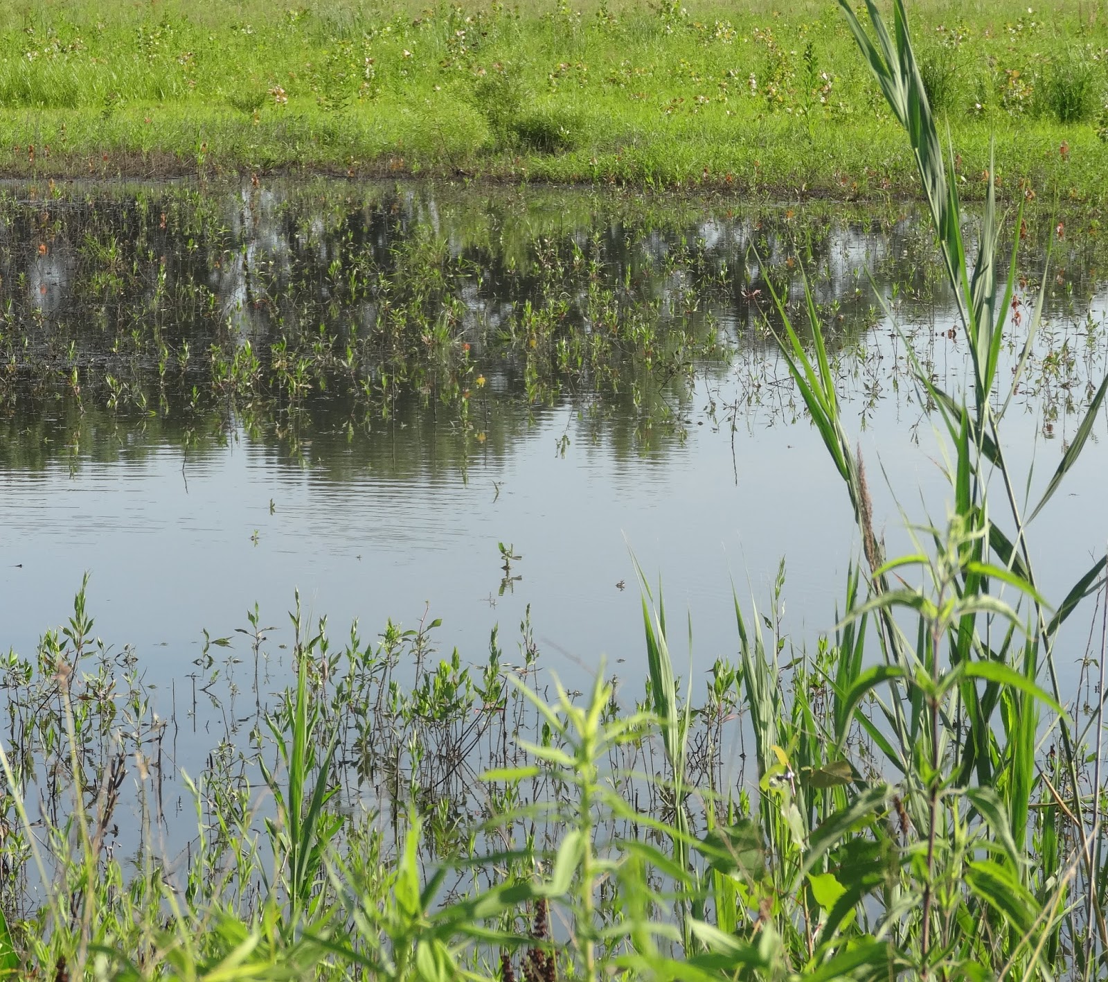
In a world of streets, parking lots, and sidewalks, rain gardens can be a place for stormwater to go besides flowing into sewers and ultimately, nearby lakes and rivers. As it flows towards waterbodies, rainwater picks up pollutants like pesticides and fertilizers along the way. Precipitation that is absorbed into rain gardens recharges groundwater 30 percent more than even that of a typical lawn.
Besides that, rain gardens are pretty.
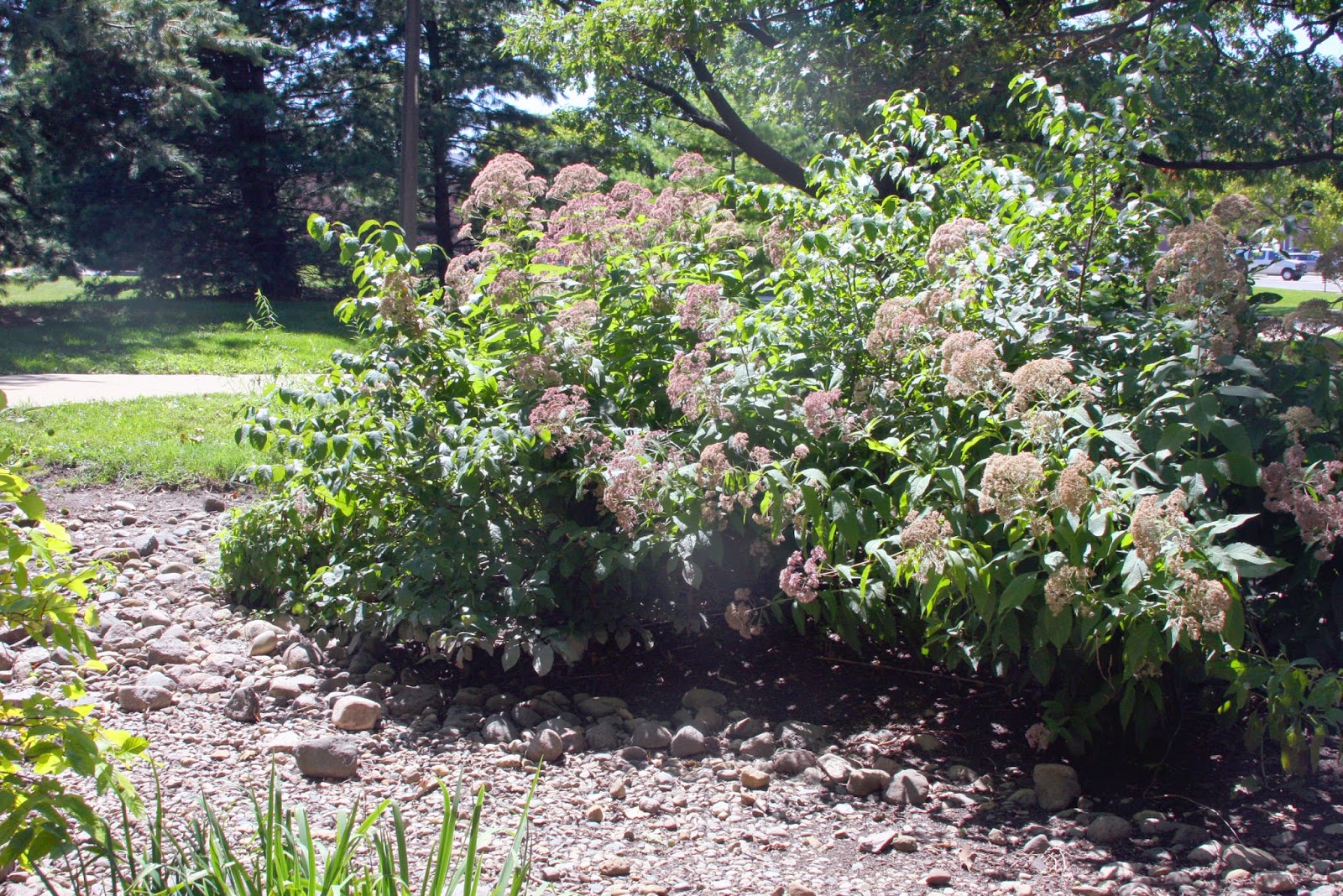
The Southern Lake Michigan Rain Garden Manual is a how-to for homeowners, landscape architects, city planners, and anyone interested in creating a garden to “absorb the storm.” This booklet is chock full of information–from choosing a location to designing and installing a rain garden to care and maintenance. You can find a plant list, including those suited for shade and clay soils, and sample garden plans.
This publication is adapted from the Vermont Rain Garden Manual for the southern Lake Michigan region. The manual was developed through Lawn to Lake, which is a collaborative program to protect water resources in the Great Lakes region by promoting healthy lawn and landscape practices.
**The Red Oak Rain Garden at University of Illinois Urbana-Champaign
August 13th, 2014 by iisg_superadmin
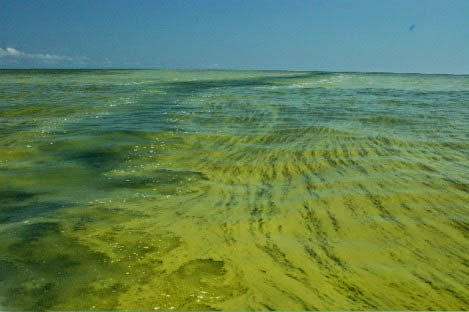
The recent contamination of drinking water in Toledo, Ohio brought the risks of algal blooms center stage and raised serious concerns for the future. Questions on everybody’s mind are what are toxic algal blooms, what causes them, and what can we do? Michael Brennan, IISG’s water quality outreach specialist, has some answers:
Regional scientists have been concerned about algal blooms like the one we saw a few weeks ago for some time. Its unique conditions make western Lake Erie particularly susceptible to algae blooms, both toxic and non-toxic. Warm temperatures, shallow, slow-moving water, and excessive nitrogen and phosphorus concentrations create optimal conditions for algae to thrive during summer months.
Let’s step back a bit. Algal blooms are essentially overgrowths of algae triggered by excess concentrations of nitrogen and phosphorus carried in stormwater runoff from lawns, leaky septic systems, golf courses, and agricultural fields to nearby waterbodies. The severity of a seasonal algal bloom is directly related to annual rainfall accumulation and the number of severe rainfall events
Non-toxic blooms occur all over the Great Lakes. Occasionally, the algae associated with blooms—a cyanobacteria—releases a toxin known as microcystin. This is the toxin responsible for contaminating the drinking water of over 500,000 people in the Toledo area.
But even non-toxic algal blooms are harmful. When rapid algal growth dies off, decomposition sucks oxygen out of the water, depriving freshwater organisms of the oxygen needed to survive. Decomposition also slowly releases nitrogen and phosphorus back to the water column, setting the stage for the cycle to start again next season.
There are no quick fixes in Lake Erie or any of the other lakes. But there are things we can do. Better stormwater management through green infrastructure is key. Unlike impervious surfaces, the plants and trees used in green infrastructure can absorb water and filter out pollutants before it reaches a waterbody.
Individuals can help prevent algal blooms as well. Homeowners and gardeners can adopt natural lawn and landscaping practices that conserve water and reduce stormwater runoff. Most of these practices are simple and cost-effective, like applying nitrogen fertilizer only in fall, removing weeds by pulling and hoeing, and limiting watering to the mornings and evenings.
**Photo courtesy of Ohio Department of Natural Resources
July 31st, 2014 by iisg_superadmin
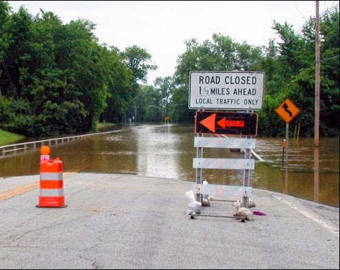
In July, the Taste of Chicago closed down for a day due to heavy rain. In the suburbs, storms are flooding streets and basements. It’s a rainy year—the month of June had the third highest rainfall at Chicago O’Hare since records have been kept in 1959.
City sewers built to take on storms from days gone by are no match for today’s rainfall that lands mostly on parking lots, streets, and sidewalks instead of being absorbed into fields and patches of forest. What’s more, climate change predictions appear to be coming true—larger storms are hitting more frequently.
Basements and streets underwater are a serious concern, but when Superstorm Sandy hit the east coast two years ago, it illustrated that flooding of critical facilities, such as hospitals, can have widespread and possibly catastrophic impacts.
IISG’s climate specialist, Molly Woloszyn, is tackling the issue of flooding from the angle of better preparation and prediction. She is part of a project that is assessing the flooding vulnerability of critical buildings in Chicago, including utility providers, transportation facilities, and hospitals. She is looking at factors like location, elevation, and flooding history of the facility, but also the placement of critical systems, such as generators and potable water supplies. Ultimately, this will result in recommendations on how these facilities can shore up their structures and systems to reduce this risk in the face of future storms.
Molly and other project contributors at the Midwestern Regional Climate Center are also dipping into 25 years of data from the Cook County Precipitation Network to connect large rain events with their consequences, such as combined sewer overflows and reports of basement and viaduct flooding. The goal here is to help the National Weather Service make forecasts that are impact-based for the city of Chicago.
Updating rain event reports for what constitutes a 5-year storm or a 100-year storm, for example, (meaning the probability of these storms happening is 1 in 5 or 1 in 100 years) is one part of the city’s plan for getting ahead of flooding concerns as detailed in the City of Chicago Green Stormwater Infrastructure Strategy. Planners and engineers use long term rainfall data to make decisions going forward, but the last report was released in 1992 with data up to the mid-80s. By all accounts, big storms are getting bigger and more frequent. More data is key for local decision makers. The Midwestern Regional Climate Center’s analysis of the Cook County data will provide new rainfall thresholds for various sized events over the course of the last 25 years.
.jpg)
