My name is Josh Hewitt and I am a web developer intern for the IISG Tipping Points and Indicators project at Purdue University. I graduated from Purdue in the fall of 2014 with a degree in computer graphics technology (CGT) with a focus on web development.
I started in the summer and was really excited about working on the Tipping Points project. Tipping Points and Indicators is a collaborative program that gives watershed planning groups across the Great Lakes the information they need to protect natural resources and enhance local economies. The process evaluates the users’ community characteristics, displays maps full of data about the watershed, and ends by creating action plans to achieve the desired goals of the user. The platform they use to do this is the web.
That’s where I come in!
My job is to fix bugs on the website and to add features to give the user a better experience. Recently, we have talked about redesigning the layout of the website because the current design is a bit outdated.
The past few weeks I have been talking with my team to figure out a layout that would enhance the users’ experience. I create mock-ups of layouts in Photoshop and then code it in Dreamweaver. We’re really excited to get this redesign done and show it to our users. We think they’ll be blown away with the improvement.
My internship has been great so far and I have learned A LOT. I would definitely recommend it to anyone looking to get some experience in web development. Not only is the web experience great but my team is really friendly and helpful. They’re always willing to give me advice when I’m stuck.
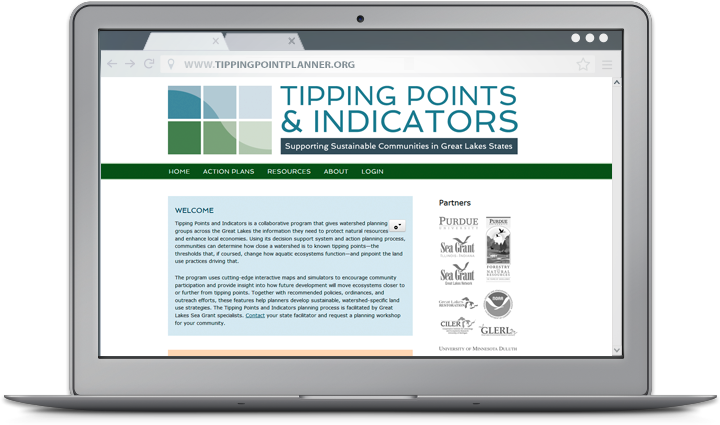
A closer look at web tools and sites that boost research and empower Great Lakes communities to secure a healthy environment and economy. For community planners, balancing community growth and environmental health can be a challenge. Putting down roads, building along waterways, or converting prairies to farmland puts stress on local ecosystems—sometimes so much that it can trigger rapid and potentially irreversible shifts in how they function. Fortunately, Tipping Points and Indicators gives watershed planning groups and others the information they need to avoid these tipping points while still meeting community needs. The web tool uses the latest watershed research and cutting-edge technology to show planners how close their watershed is to known tipping points and what the watershed will look like if land use decisions continue “business as usual.” Planners can also test how developing more in one location or restoring habitats in another moves ecosystems closer to or further from tipping points. With help from a Sea Grant facilitator, planners can use these interactive maps and simulators—along with recommended policies, ordinances, and outreach efforts—to prevent aquatic ecosystems from being degraded beyond repair. Since it was launched in 2013, Tipping Points and Indicators has undergone many design and feature updates inspired by months of pilot testing. Larger maps and detailed legends that toggle on and off give users a closer look at their watershed and make information on characteristics like stream quality and land cover types more accessible. Users can also easily track how proposed land use changes will effect ecosystem health with updates to the planning simulators. To learn more about the tool and see key features in action, watch this introductory video created by the IISG team leading the project.
Tipping Points and Indicators was developed in collaboration with Purdue University, University of Michigan, Michigan State University, University of Minnesota Duluth, University of Windsor, the Great Lakes Environmental Research Laboratory, the Cooperative Institute for Limnology and Ecosystem Research, the Great Lakes Restoration Initiative, NOAA, and the Sea Grant Great Lakes Network. Funding for the four-year project comes from NOAA and EPA.
We’ve talked a lot in the last year about our Tipping Points Planner, which helps watershed planning groups develop effective strategies for the protection of natural resources. But what about the people behind the tool? Its use of the latest research and cutting-edge technology is made possible by the tireless efforts of Jarrod Doucette and a team of web developers that now includes Brandon Beatty.
Jarrod, our GIS and database specialist, began work on the decision support tool roughly three years ago. Throughout the process, he worked closely with researchers and outreach specialists to ensure the Tipping Points Planner includes the latest data and is accessible to a wide range of audiences. Jarrod’s extensive experience as a GIS specialist and web developer working with universities and state agencies has been recognized by the GIS company Esri and from the Indiana Geographic Information Council. He holds a Master’s in geospatial information systems from State University of New York College of Environmental Sciences and Forestry.
The tipping points and indicators program is now up and running, but there is still a lot to do to make sure the tool stays current and user-friendly. More and more watershed groups are integrating it into their planning process, including several in northwestern Indiana and northeastern Illinois. That is where Brandon Beatty comes in.
Brandon joined Sea Grant earlier this year as our web designer and developer. Prior to that, he worked as a software developer on a project with the Purdue University libraries. His past work in design and development earned him an American Advertising Award in 2009. Brandon earned a Bachelor’s in computer graphics technology at Purdue University.
Our summer internship program has wrapped up for another year. This summer, seven students and recent graduates worked with our specialists on a broad range of issues, including AIS prevention, sediment remediation, and water supply planning. Jacob Wood spent his internship working with several members of our Purdue staff. He had this to say about his summer experiences:
“I applied for the IISG internship because I wanted to get more experience with GIS work related to the environment. And that is exactly what I got.
I spent most of the summer creating GIS maps that represent fish catch data for Lake Michigan so that local fisherman can get a better idea of fishing trends and hotspots. The overall goal is to make a web app to helps users determine the historically-best spots to catch fish like Chinook salmon and Lake Trout during a specific time of year. Towards the end of the summer, I also started working on maps representing climate change predictions for Lake Michigan. These maps will go towards aiding fisheries managers in understanding future biotic and abiotic conditions. Lastly, I worked on incorporating updated stream and land coverage data into the tipping points webtool, which shows individuals and planning groups how close a watershed is to known tipping points or ecosystem thresholds.
One of the things I liked the most about my internship is that I was encouraged to explore the software I was working with and any information related to the projects. Rather than just focusing on completing a job or making a deadline, I was able to set aside some time each week to discover different aspects of software and just try learning new things. Because of this, I developed numerous GIS skills this summer. Specifically, I have a stronger grasp now of how to use model building features to make work faster, easier, and replicable, as well as how to make maps that represent data clearly for everyone.”
Jacob is now a senior at Purdue University studying environmental and natural resources engineering. After graduation, he hopes to work as an environmental engineer with an agency like the Natural Resources Conservation Service or the Indiana Department of Natural Resources.
Our summer internship program has wrapped up for another year. This summer, seven students and recent graduates worked with our specialists on broad range of issues, including AIS prevention, sediment remediation, and water supply planning. Brittany Sievers spent her internship working with Kara Salazar, IISG’s sustainable communities specialist. She had this to say about her summer experiences:
“Since my internship covered many programs, I worked on different projects every day, which kept me busy and engaged. Some of my favorite projects were those that gave me an opportunity to develop my professional writing skills and become a published author. I wrote several curriculum pieces for the Enhancing Public Spaces program and pieces that will appear on the program’s website once it is complete. I expanded the Green Meetings and Events Planning Guide that a previous intern created by adding ‘cheat sheets’ for large events and professional meetings that summarized the information provided within the publication. Finally, I wrote scripts for two rainscaping training videos—plant selection and rain garden design.
I was also able to get out of the office and work directly with the public and other key stakeholders on several occasions. I was at the Wabash Riverfest with a trivia game geared towards children that I developed. I also assisted Kara during pilot testing of the Tipping Points and Indicators tool in Hobart, IN and with a presentation of the program during the 2014 Institute for Sustainable Development in Nashville, IN.
Since I plan to work in an outreach position in the future, this internship was perfect for me. I had not had work experience in outreach before, but I have enjoyed being active in several outreach clubs at Purdue to facilitate positive change on the Purdue University campus and the surrounding community. I know my experiences this summer will help my chances of landing a job and excelling in that position in the future.”
With her undergraduate work in natural resources and environmental sciences complete, Brittany is turning her sights to graduate school. In fact, she began work on a Master’s in marine conservation and policy earlier this week at Stony Brook University in New York.
For land use planners, balancing community growth and environmental health is always a challenge. But after months of pilot testing, IISG is putting the final touches on a new web-based tool that will help them do just that.
The Tipping Points and Indicators tool uses the latest watershed research and cutting-edge technology to show planners where aquatic ecosystems in their area are in danger of crossing a “tipping point,” triggering rapid and sometimes irreversible shifts in how they function. With help from a Sea Grant facilitator, planners can use the tool’s interactive maps, simulators, and recommended response strategies to develop watershed-specific plans that prevent ecosystems from being degraded beyond repair.
Specialists from Ohio, New York, Minnesota, Wisconsin, Michigan and Illinois-Indiana Sea Grant programs have spent the last few months testing the tool in broad range of communities and divers audiences. Planning groups from the industrialized southern Lake Michigan to the more preserved northern Wisconsin and Minnesota can now use the decision support system to kick off the watershed planning process. In Indiana, Ohio, and New York, facilitators have also introduced planning consultants and state employees to toolmodulesso they can take the process back to their own communities.
Experiences so far have been positive, with many users expressing excitement about the role Tipping Points and Indicators could play in improving watershed planning. Community members, local officials, and consultants were particularly interested in the tools’ recommended policies, ordinances, and outreach efforts tailored to local needs. In fact, a watershed advocacy group from the Duluth area mentioned they could have spent a whole day on that module alone.
To further enhance the tool, users also recommended making maps and planning strategies more watershed-specific. Many of these refinements are being made now. Others, including the addition of the new land cover data and models that predict future tipping points, are expected in the coming months.
And as the project grows, so does the lead team. Last month, IISG brought Purdue software developer Brandon Beatty onboard to help boost the usability of Tipping Points and Indicators and ensure it continues to rely on the latest research and technology.
The tipping points tool is part of a four-year project funded by NOAA and EPA and coordinated by Illinois-Indiana Sea Grant. Partners include Purdue University, University of Michigan, Michigan State University, University of Minnesota Duluth, University of Windsor, Great Lakes Environmental Research Laboratory, the Cooperative Institute for Limnology and Ecosystem Research, the Great Lakes Restoration Initiative, and the Sea Grant Great Lakes Network.
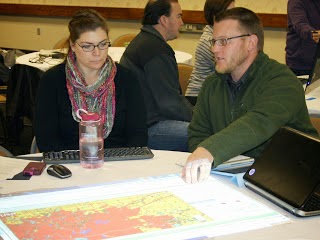
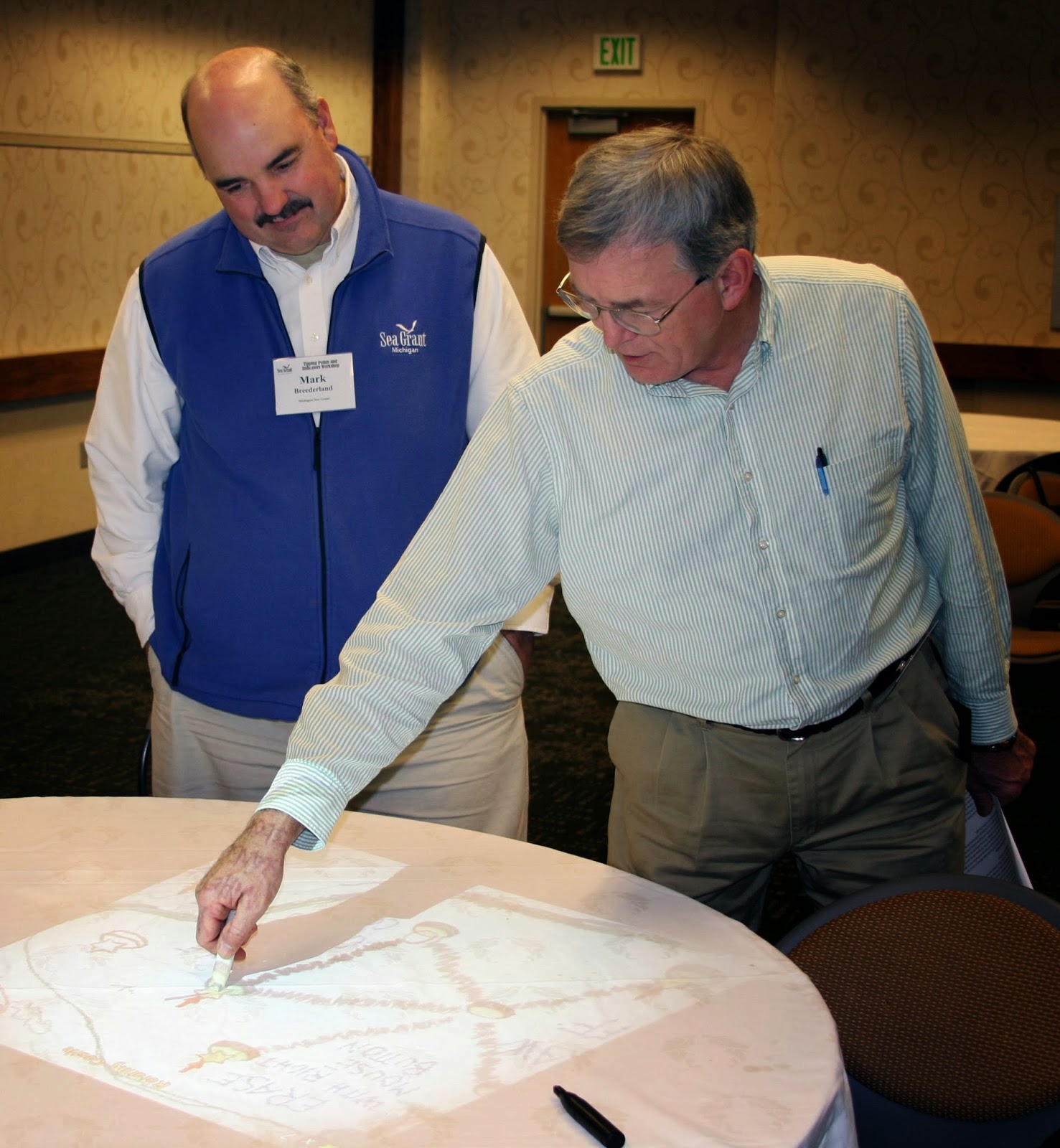
Staff members from six Great Lakes Sea Grant programs met at Purdue University last week to preview a new web-based tool that will help local planners make sustainable land use decisions. The two-day workshop gave Sea Grant specialists a chance to work through the tool’s four-step process and suggest changes before they start using it with planning groups and communities next spring.
The Tipping Points and Indicators tool uses watershed data and cutting-edge research to show planners where aquatic ecosystems in their region are stressed by various factors to the degree that they are in danger of crossing a “tipping point,” triggering rapid and sometimes irreversible shifts in their functioning. With help from a Sea Grant facilitator, planners can use the tool’s interactive maps and simulators to specify important regional priorities, pinpoint specific land use practices that threaten ecosystem health, and test how further development, restoration, or conservation projects would help or hurt. Together with suggested policies, ordinances, and outreach efforts, these features help planners develop watershed management plans that prevent ecosystems from being degraded beyond repair.
Future facilitators from Ohio, New York, Minnesota, Wisconsin, Michigan, and Illinois-Indiana Sea Grant programs worked in groups to build mock watershed management plans for rural, suburban, and urban watersheds. Hands-on activities helped participants get familiar with the tool’s features, as well as ways to customize the process to meet the needs of communities they work with. They also learned how to use and set up different technologies that help larger groups collaboratively use computer-based programs, including the weTable, which transforms a regular tabletop into an interactive computer screen.
Perhaps the most important result of the workshop, though, was a list of feature and design changes to further increase the usability of the tool. Many of the suggestions focused on making land use data more accessible for the residents who join non-profits and local agencies in watershed planning groups. These and other refinements, including the addition of new data, will be made in the coming months.
The tipping points tool is part of a four-year project funded by NOAA and EPA and coordinated by Illinois-Indiana Sea Grant. Research and outreach partners include Purdue University, University of Michigan, Michigan State University, University of Minnesota Duluth, University of Windsor, the Great Lakes Environmental Research Laboratory, the Cooperative Institute for Limnology and Ecosystem Research, the Great Lakes Restoration Initiative, NOAA, and the Sea Grant Great Lakes Network.
*Pictures: Top – Mark Breederland (Michigan Sea Grant) and Brian Miller (IISG) Middle – Joe Lucente (Ohio Sea Grant) and Julie Noordyk (Wisconsin Sea Grant) Bottom – Mary Penney (New York Sea Grant) and Jarrod Doucette (Purdue University)
As summer begins to wind down, so do IISG’s summer internships. For John Saltanovitz, though, working as an intern at Purdue University’s Sustainable Communities Extension Program is just the beginning. With a summer full of hands-on outreach experience under his belt, John plans to pursue a career as an environmental engineer so he can continue to help communities and organizations better use and conserve natural resources.
Many of the issues surrounding community sustainability—such as land use planning, pollution prevention, and water conservation—were not new to John when he started working with IISG’s Kara Salazar earlier this summer. As a senior working towards a degree in Natural Resources and Environmental Science and a life-long resident of Northwest Indiana, he was even familiar with some outreach efforts already underway in the Lake Michigan region. His summer internship gave him a chance to apply what he has learned over the years and work firsthand with communities.
“We hear a lot about sustainability in our classes and talk about what needs to be done” said John. “This internship gave me a chance to do something instead of just talk it. It’s really exciting to be working on things that you always said you wanted to do.”
Much of his summer efforts went towards developing a guide for conducting “green” meetings and events. At the heart of the guide is a checklist of best practices that advise anyone planning or managing events, helping them make sustainable decisions. Some of these best practices include relying on public transportation, composting leftover food, and reducing waste. Throughout his internship, John worked directly with Purdue Extension educators and specialists, the guide’s primary audience, to determine what information they needed and develop the checklist. The Best Practices Guide for Green Meetings and Events will soon be sent to Purdue Agriculture Communications for peer review and editing before publishing the finalized version through Extension.
In addition to his work on the guide, John helped develop a new Purdue Master Gardener advanced training program for rain gardeners, provided content on education strategies for the Tipping Points and Indicators Project, contributed information to the new Sustainable Communities website, and led outreach activities at the IISG booth during the Wabash Riverfest in West Lafayette. He was also involved in planning for IAGLR, and joined three other IISG interns as a volunteer during the week-long conference.
“Through his enthusiasm, detailed work, and dedication, John has truly helped to advance new program offerings and education materials that will support sustainability programs in communities state-wide,” said Kara. “I look forward to continuing to work with John as we complete the peer review and editing process for the Best Practices Guide for Green Meetings and Events publication.”
Got a research idea worth a bigger room? The 2026 State of Lake Michigan Meeting is accepting proposals for symposia and workshops, and we want to hear yours!
📅 Nov. 4–6 | Michigan City, IN ⏰ Proposals due June 1 at 1 PM ET
Help shape what the Great Lakes research community discusses this year.


