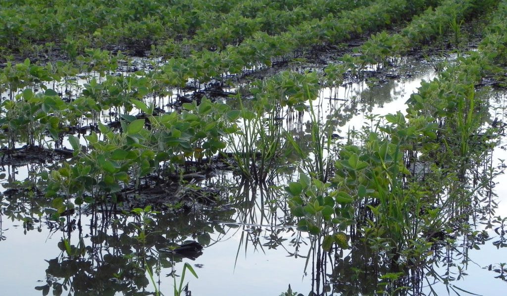
Nutrients that flow into lakes and streams from urban and rural environments are a key cause of algal blooms, which can then crash into low-oxygen ‘dead zones.’ In fact, Illinois, with its many acres of farmland and its major municipalities, is a key contributor to nutrient pollution in the Gulf of Mexico. Researchers at the Illinois State Water Survey set out to better calculate nutrient levels in waterways, the dynamics of when nutrient pollution happens, and what this means in the face of a changing climate.
With support from Illinois-Indiana Sea Grant (IISG), hydrologist Momcilo Markus and his team looked at years of data from 14 rural and suburban watersheds in Illinois, Indiana, and Ohio to get a better understanding of the factors that influence pollution rates.
The project is part of a larger regional effort to understand the science behind nutrient pollution and develop management strategies based on the findings. This effort is being led by University of Illinois Extension, Prairie Research Institute, Illinois Environmental Protection Agency (Illinois EPA), Illinois Department of Agriculture (IDOA), Illinois Water Resources Center, and IISG.

Markus’ work improved the accuracy of estimating nutrient loading from limited monitoring data. Typically, for most waterways, monitoring is infrequent—several data points are extrapolated for a year. The researchers used a rich Ohio data source where there is as much as 38 years of daily measures from 10 streams. This served as a Rosetta stone of sorts, and by modifying their calculations, they were able to make estimates of nutrient loading in Illinois and the Midwest more accurate.
“We adjusted our model to reflect reality as measured in real data,” explained Markus.
This new model could help scientists better measure of the amount of nutrients leaving the 13 watersheds prioritized in the Illinois Nutrient Loss Reduction Strategy. In addition to continuous statewide tracking by eight U.S. Geological Survey super gauges for roughly the past year, natural resource managers have historic data that can be analyzed using Markus’ model to estimate long-term trends in Illinois’ statewide contributions to the Gulf.
 The comprehensive study also reveals key patterns in nitrate, phosphorus, and sediment pollution. For example, although there is more precipitation in summer, river flows and nutrient levels are at their highest in winter and spring, when there are fewer plants to help prevent erosion and absorb nutrients. In fact, the five largest river flow events in a watershed carry more than half of the nutrients that run off it each year.
“A wet year in terms of nutrient loading is defined by large storm events,” said Markus. “More precipitation, on average, in a given year doesn’t necessarily lead to an increase in pollution. The increase is tied to heavy precipitation.”
The consensus of climate models shows that by mid-century in northern Illinois, there may well be a 15-30 percent increase in intensity and frequency of heavy storms.
For Illinois EPA, IDOA, and others charged with implementing the state’s nutrient strategy and reducing nutrient loading to the Gulf by 45 percent, these findings could lead to a more accurate understanding of the impact of their efforts. Farmers, city officials, and wastewater treatment plants across the Prairie State have been ramping up practices that reduce nitrogen and phosphorus loss since the state began work on the strategy in 2012.
 At the same time, government agencies, university researchers, and others are keeping an eye on the amount of nutrients leaving the state to help determine whether current strategy practices are enough to reach reduction goals. Understanding the critical role high-intensity storms play in nutrient loads could help ensure the value of these efforts isn’t obscured by a wet year. And knowing that these types of storms will be more frequent gives the state lead time to adapt strategy practices to the changing climate.
“What we design today, may not be sufficient in the future,” said Markus. “We can speculate that there will be more pollution, so management strategies that work today may not down the road.”
Anjanette Riley is a contributing author.
Illinois-Indiana Sea Grant is a part of University of Illinois Extension and Purdue University Extension.

