How does “green infrastructure” go from being just a good idea to actually being implemented in municipalities? At the recent Resilient Chicago workshop, we learned how this happens from a variety of perspectives.
Blue Island, Ill., a Chicago suburb with a growing problem with flooded basements, has become a leader in executing green infrastructure initiatives in recent years.
Jason Berry, deputy director of planning and building, described how at one point, even city engineers needed convincing that green infrastructure is not a “feel-good” project, but an effective and sustainable way to address stormwater issues.
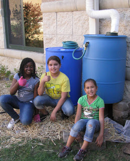
Much of the city’s success is due to grant support from local, state, and even national sources. And, there is public involvement. As part of its Blue Island, Blue Water project, the city engaged many of its residents in installing rain barrels and planting rain gardens. The city is putting in permeable pavement, a bioswale, and numerous rain gardens.
“Green infrastructure is visible infrastructure,” explained Berry. “You can see it work.”
It also takes maintenance, which Berry described as a challenge for the city going forward.
Most communities will need to fund green infrastructure through limited municipal budgets, according to Josh Ellis, program director with the Metropolitan Planning Council. But he thinks green infrastructure has the possibly of becoming the new normal for infrastructure through “optimization.”
Optimization, as done by the City of Chicago, means maximizing investments through partnerships, leveraged funds, and multiple goals. Aaron Koch, deputy commissioner for sustainability, explained that the city has been employing green infrastructure for many years with green roofs and alleys, for instance. Now efforts are being planned more strategically.
For example, through the Space to Grow program, the city is partnering with Chicago Public Schools and nonprofits to “green” Chicago schoolyards. By planting rain gardens, and adding landscaping and playgrounds, students have a dryer, safer, greener, and more fun environment to play.
Argyle Street on Chicago’s north side is in the process of getting a facelift with porous pavement, planters, and trees that will go far to create community gathering spaces as well as enhance stormwater management. The Argyle Streetscape will be Chicago’s first “shared street” where pedestrians, cars, and bicycles will all co-exist in a curb-free world.
According to Kate Evasic, associate planner, CMAP provides a process to collect data related to surface drainage, including historic conditions, topography, impervious cover, land use, and repetitive flood claims. And, the process provides the opportunities for shared solutions. CMAP has 50 projects underway right now.
-Irene Miles
(Photos from the Blue Island and the site design group, ltd. websites)


