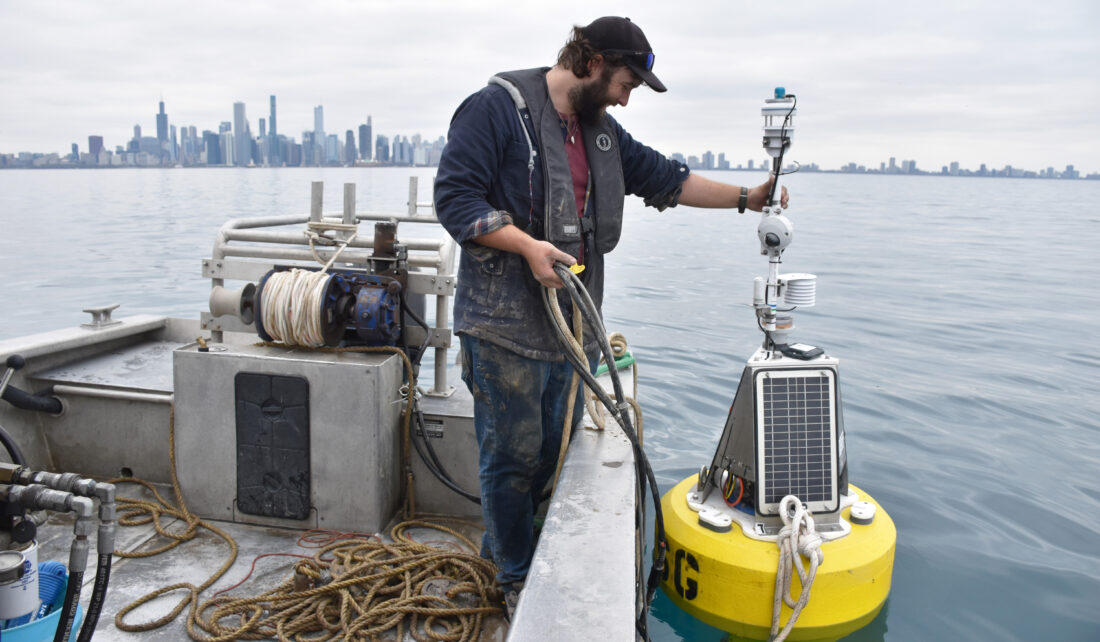
Last May, Illinois-Indiana Sea Grant (IISG) launched its third buoy in southern Lake Michigan—this one based in the busy waters off Navy Pier. This new buoy with its flow of in-the-moment data is helping the National Weather Service (NWS) Chicago develop more accurate forecasts and warnings, especially related to nearshore wave heights and wind speeds.
This third buoy, known affectionately as Chuoy, joins IISG buoys in the nearshore waters of Michigan City, Indiana and Wilmette, Illinois. Together, these three, along with two University of Illinois buoys closer to the Wisconsin border, paint a comprehensive picture of coastal lake conditions in the two states. In addition to meteorologists, the data is used by scientists, boaters, anglers and beach goers.
“Information from these buoys allows recreational water users to make better informed decisions when it comes to safety,” said Ben Szczygiel, IISG buoy specialist. “The data allows people to plan for current conditions and avoid the water when there are increased safety concerns.”
At NWS Chicago, IISG buoys in nearshore waters have proven to be particularly helpful in filling in information gaps and validating nearby observations, most pointedly with regards to wave height. Previously, meteorologists had to make assumptions on how waves would impact the Illinois shore based on open water buoys.
“The initial arrival of the buoy off of Wilmette opened our eyes to the increase in waves in the nearshore areas,” said Kevin Donofrio, NWS science and operations officer. “We have learned that waves don’t always come down as quickly as winds decrease.”
This new understanding of wave action has only been enhanced with the addition of Chuoy. And its location near Navy Pier puts it right where many boaters are sailing or buzzing by, plus it is directly upstream of many Chicago beaches.
Over the summer, the buoy also helped keep NWS forecasters up to speed on wind velocity, providing data measured much closer to the water than from the top of a nearby water intake facility—the Harrison-Dever Crib, which has been a long-time wind data resource.
The results of all this information are more accurate forecasts and advisories for boaters and swimmers. “We used this buoy to determine the risk level for our Surf Zone Forecasts and it plays a direct role in our Nearshore Marine Forecasts,” said Donofrio.
In the summer of 2022, Chuoy was also there to help with one of Chicago’s major lakefront events. In August, the annual Chicago Air and Water Show brings an average of two million people down to Lake Michigan’s beaches, marinas and parks as well as out in boats to experience the spectacle up close. Chuoy data helped inform on-the-ground decisions with regard to water and weather conditions and safety concerns.
As Dononfrio described it: “Forecasting for the marine environment can be very challenging with the limited observation network, but it can be very impactful.”
Illinois-Indiana Sea Grant is a partnership between NOAA, University of Illinois Extension, and Purdue University Forestry and Natural Resources, bringing science together with communities for solutions that work. Sea Grant is a network of 34 science, education and outreach programs located in every coastal and Great Lakes state, Lake Champlain, Puerto Rico and Guam.
Writer: Irene Miles
Contact: Ben Szczygiel

