A closer look at web tools and sites that boost research and empower Great Lakes communities to secure a healthy environment and economy. For community planners, balancing community growth and environmental health can be a challenge. Putting down roads, building along waterways, or converting prairies to farmland puts stress on local ecosystems—sometimes so much that it can trigger rapid and potentially irreversible shifts in how they function. Fortunately, Tipping Points and Indicators gives watershed planning groups and others the information they need to avoid these tipping points while still meeting community needs. The web tool uses the latest watershed research and cutting-edge technology to show planners how close their watershed is to known tipping points and what the watershed will look like if land use decisions continue “business as usual.” Planners can also test how developing more in one location or restoring habitats in another moves ecosystems closer to or further from tipping points. With help from a Sea Grant facilitator, planners can use these interactive maps and simulators—along with recommended policies, ordinances, and outreach efforts—to prevent aquatic ecosystems from being degraded beyond repair. Since it was launched in 2013, Tipping Points and Indicators has undergone many design and feature updates inspired by months of pilot testing. Larger maps and detailed legends that toggle on and off give users a closer look at their watershed and make information on characteristics like stream quality and land cover types more accessible. Users can also easily track how proposed land use changes will effect ecosystem health with updates to the planning simulators. To learn more about the tool and see key features in action, watch this introductory video created by the IISG team leading the project.
Tipping Points and Indicators was developed in collaboration with Purdue University, University of Michigan, Michigan State University, University of Minnesota Duluth, University of Windsor, the Great Lakes Environmental Research Laboratory, the Cooperative Institute for Limnology and Ecosystem Research, the Great Lakes Restoration Initiative, NOAA, and the Sea Grant Great Lakes Network. Funding for the four-year project comes from NOAA and EPA.
Eliana Brown recently joined the Illinois Water Resources Center as an outreach specialist. Prior to starting at IWRC, she worked at University of Illinois at Urbana-Champaign Facilities & Services as the MS4 coordinator and at Illinois EPA as a field engineer. Eliana has a M.S. in environmental engineering and a B.S. in general engineering and marketing from the University of Illinois.
The following is a contributing post from Eliana, who has a passion for rain gardens and green infrastructure:
When you were a university student, did you ever reimagine your campus landscape? Students at the University of Illinois did exactly that as an assignment for Landscape Architecture (LA) 452, Native Plants and Design.
The U of I campus has 84 miles of storm sewer, most of which drain rainwater directly to Boneyard Creek. The LA 452 students designed landscapes with elements that capture water and allow it to soak in on-site to reduce loads to the existing storm sewer and creek. These elements (called green infrastructure) include rain gardens, swales, and green roofs. The Environmental Protection Agency (EPA) sees green infrastructure as a way to create sustainable, resilient communities that improve water quality.
EPA has a competition called the Campus RainWorks Challenge that invites “student teams to design an innovative green infrastructure project for their campus showing how managing stormwater at its source can benefit the campus community and the environment.”
According to Jason Berner, EPA environmental protection specialist, who has been involved with administering the competition, it is a great way for students to see how green infrastructure is related to the larger campus master plan. “It moves us beyond single pilot projects, but at the same time, blends both small and large scale thinking,” he explained.
LA 452 instructor Tawab Hlimi is leading the U of I Campus RainWorks entry. Students in his class helped brainstorm ideas for the entry. One of those ideas is pictured. Student Jiwon
Kim reimagined the grounds at the National Soybean Research Building (which happens to house Illinois-Indiana Sea Grant and the Illinois Water Resources Center). Native plant rain gardens intercept stormwater from the building roof and parking lot. During large storms, the design takes advantage of existing storm sewers by overflowing excess water to them.
Like many cities and universities, the U of I began installing storm sewers more than 100 years ago. Storm sewers benefit cities by draining flooded areas. However, they can overload receiving streams and cause unintended damage. Adding green infrastructure elements to the existing infrastructure helps ensure a healthier ecosystem on-site and downstream.
Per Hlimi, “Through a campus wide application of rain gardens, students hybridized native plantings with a superficial stormwater management strategy to meet multiple objectives: accommodating the ‘first flush’ of frequent storm events through detention, infiltration, and biofiltration, reducing the load on existing subsurface infrastructure, improving the water quality entering into the Boneyard Creek, creating habitat for pollinators, and rendering the campus landscape as living laboratory.”
Perhaps one day in the not too distant future, students won’t have to imagine green infrastructure on campus. They’ll see it.
For land use planners, balancing community growth and environmental health is always a challenge. But after months of pilot testing, IISG is putting the final touches on a new web-based tool that will help them do just that.
The Tipping Points and Indicators tool uses the latest watershed research and cutting-edge technology to show planners where aquatic ecosystems in their area are in danger of crossing a “tipping point,” triggering rapid and sometimes irreversible shifts in how they function. With help from a Sea Grant facilitator, planners can use the tool’s interactive maps, simulators, and recommended response strategies to develop watershed-specific plans that prevent ecosystems from being degraded beyond repair.
Specialists from Ohio, New York, Minnesota, Wisconsin, Michigan and Illinois-Indiana Sea Grant programs have spent the last few months testing the tool in broad range of communities and divers audiences. Planning groups from the industrialized southern Lake Michigan to the more preserved northern Wisconsin and Minnesota can now use the decision support system to kick off the watershed planning process. In Indiana, Ohio, and New York, facilitators have also introduced planning consultants and state employees to toolmodulesso they can take the process back to their own communities.
Experiences so far have been positive, with many users expressing excitement about the role Tipping Points and Indicators could play in improving watershed planning. Community members, local officials, and consultants were particularly interested in the tools’ recommended policies, ordinances, and outreach efforts tailored to local needs. In fact, a watershed advocacy group from the Duluth area mentioned they could have spent a whole day on that module alone.
To further enhance the tool, users also recommended making maps and planning strategies more watershed-specific. Many of these refinements are being made now. Others, including the addition of the new land cover data and models that predict future tipping points, are expected in the coming months.
And as the project grows, so does the lead team. Last month, IISG brought Purdue software developer Brandon Beatty onboard to help boost the usability of Tipping Points and Indicators and ensure it continues to rely on the latest research and technology.
The tipping points tool is part of a four-year project funded by NOAA and EPA and coordinated by Illinois-Indiana Sea Grant. Partners include Purdue University, University of Michigan, Michigan State University, University of Minnesota Duluth, University of Windsor, Great Lakes Environmental Research Laboratory, the Cooperative Institute for Limnology and Ecosystem Research, the Great Lakes Restoration Initiative, and the Sea Grant Great Lakes Network.
Go To 2040—northeastern Illinois’ compressive development plan—received a 2013 National Award for Smart Growth Achievement earlier this month for its innovative approach to conserving natural resources, protecting public health, and strengthening local economies. Developed by the Chicago Metropolitan Agency for Planning (CMAP), the plan addresses transportation needs, energy efficiency, and other long-term concerns for the ever-growing metropolitan area.
Illinois-Indiana Sea Grant’s Margaret Schneeman and Martin Jaffe worked closely with CMAP to develop the water supply planning recommendations included in the regional plan. IISG has also taken the lead in implementing key recommendations such as full-cost water pricing and outdoor water conservation. And Molly Woloszyn, IISG’s extension climatologist, assisted in the development of climate adaptation recommendations for municipalities.
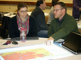
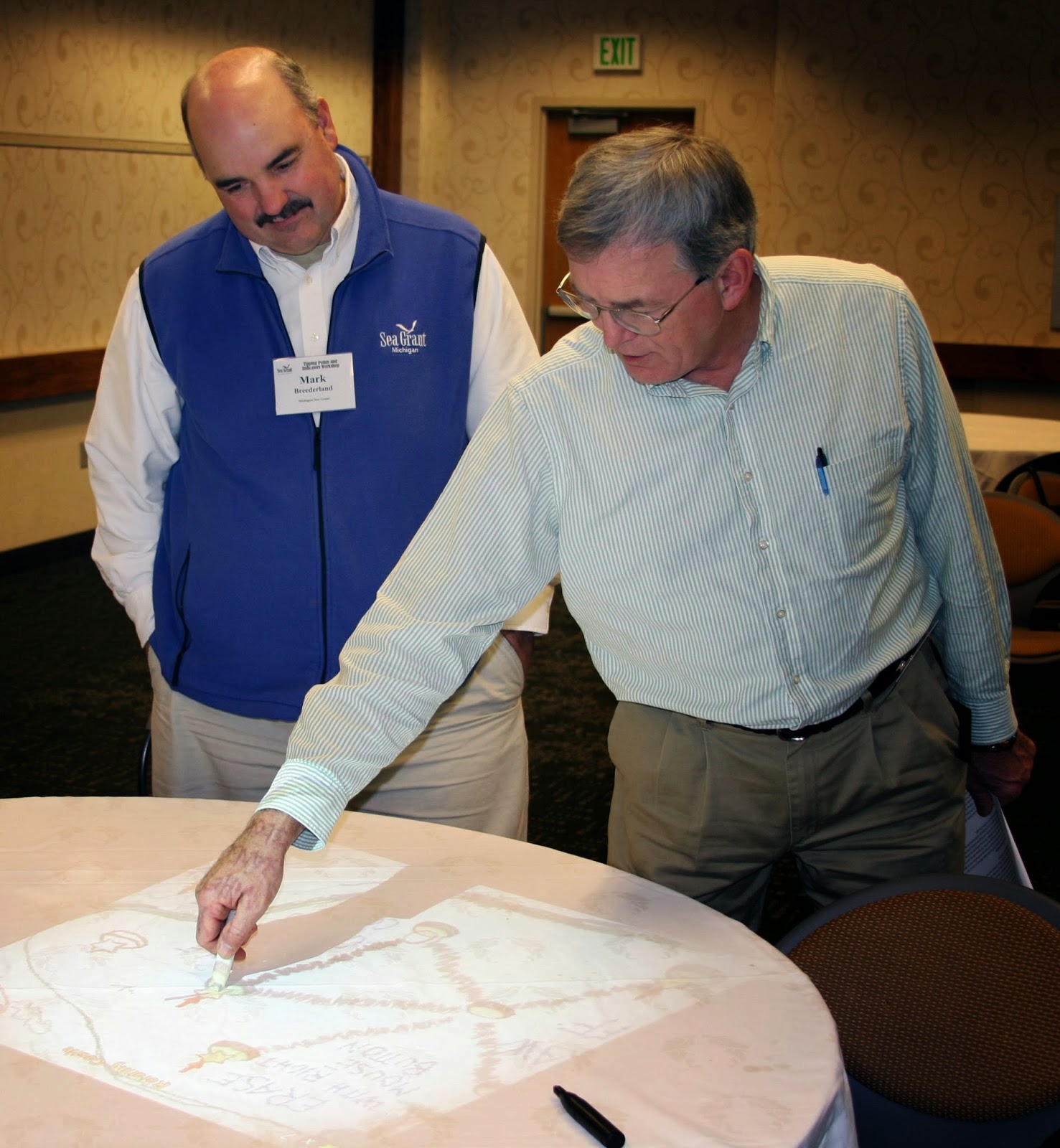
Staff members from six Great Lakes Sea Grant programs met at Purdue University last week to preview a new web-based tool that will help local planners make sustainable land use decisions. The two-day workshop gave Sea Grant specialists a chance to work through the tool’s four-step process and suggest changes before they start using it with planning groups and communities next spring.
The Tipping Points and Indicators tool uses watershed data and cutting-edge research to show planners where aquatic ecosystems in their region are stressed by various factors to the degree that they are in danger of crossing a “tipping point,” triggering rapid and sometimes irreversible shifts in their functioning. With help from a Sea Grant facilitator, planners can use the tool’s interactive maps and simulators to specify important regional priorities, pinpoint specific land use practices that threaten ecosystem health, and test how further development, restoration, or conservation projects would help or hurt. Together with suggested policies, ordinances, and outreach efforts, these features help planners develop watershed management plans that prevent ecosystems from being degraded beyond repair.
Future facilitators from Ohio, New York, Minnesota, Wisconsin, Michigan, and Illinois-Indiana Sea Grant programs worked in groups to build mock watershed management plans for rural, suburban, and urban watersheds. Hands-on activities helped participants get familiar with the tool’s features, as well as ways to customize the process to meet the needs of communities they work with. They also learned how to use and set up different technologies that help larger groups collaboratively use computer-based programs, including the weTable, which transforms a regular tabletop into an interactive computer screen.
Perhaps the most important result of the workshop, though, was a list of feature and design changes to further increase the usability of the tool. Many of the suggestions focused on making land use data more accessible for the residents who join non-profits and local agencies in watershed planning groups. These and other refinements, including the addition of new data, will be made in the coming months.
The tipping points tool is part of a four-year project funded by NOAA and EPA and coordinated by Illinois-Indiana Sea Grant. Research and outreach partners include Purdue University, University of Michigan, Michigan State University, University of Minnesota Duluth, University of Windsor, the Great Lakes Environmental Research Laboratory, the Cooperative Institute for Limnology and Ecosystem Research, the Great Lakes Restoration Initiative, NOAA, and the Sea Grant Great Lakes Network.
*Pictures: Top – Mark Breederland (Michigan Sea Grant) and Brian Miller (IISG) Middle – Joe Lucente (Ohio Sea Grant) and Julie Noordyk (Wisconsin Sea Grant) Bottom – Mary Penney (New York Sea Grant) and Jarrod Doucette (Purdue University)
John Saltanovitz, currently a senior at Purdue earning a bachelor’s degree in Natural Resources and Environmental Science, worked this past summer as a sustainable communities outreach intern with IISG’s Kara Salazar. He wrote in to detail his experience getting hands-on in the environmental science field.
“When I started college, I was not aiming towards a career in environmental science. But as my classes progressed and I learned more about the topics, I realized how important the field was. There are so many issues that, if left ignored, could cause problems for future generations. Working to solve these problems is why I chose environmental science as my major. I learned about the internship with IISG from an email my department sent out, and it seemed like an amazing opportunity to get hands-on with the field I wanted to be involved in.
My specific focus was with community outreach. I worked with Kara on creating publications that could help communities be more aware of environmental problems and how to fix them. My main project was creating a zero waste guide that could be used for planning local events in the future. The guide helps to provide ideas and statistics behind zero waste events, how they work, and how to plan for them. My hope is that this document will encourage people in the community to work towards being more environmentally friendly.
My work this summer has showed me how much effort those in the outreach field put forth to help make a difference. I’ve always grown up around the Great Lakes, but this internship really opened my eyes to all of the different projects people are doing to assist and protect the Great Lakes region. Before this internship, the idea of research/outreach with the Great Lakes hadn’t crossed my mind, but this summer’s experiences have greatly increased my interest in and passion for the subject. I’ve learned that no problem is too small or unimportant when it comes to creating a better place to live and a healthier environment.
I plan on continuing my studies in environmental science and working towards a degree in environmental engineering. My internship showed me how many possibilities are out there and what can be accomplished with hard work. I’ve met so many great people through IISG who all have a passion for what they do. It was a blessing to be involved in an organization like IISG. The only downside is that the summer felt like it went by so fast. I wish that I could have had more time to continue working and networking in the field.”
John is one of four interns who worked with IISG this summer. You can look forward to additional posts soon.
A collaboration between Illinois-Indiana Sea Grant, the Chicago Metropolitan Agency for Planning, the Metropolitan Planning Council, and several other agencies across Illinois and Indiana, the new Outdoor Water Use Manual is now available from NWPA. Completed as part of a larger goal to help reduce and curb outdoor water use, the manual provides necessary information on discretionary water use, costs to utilities and municipalities, and steps to develop more efficient outdoor water use policies and plans.
The manual comes just as the height of the summer season has led some areas to enact strict watering policies or, in the recent case of Lake Forest, institute a temporary ban on outdoor watering altogether.
Peter Wallers of the NWPA writes on page four of the manual, “The significance of this guide and what separates it from the average lawn care guide is its emphasis on efficient lawn care, using as little water and fertilizer as possible while achieving maximum performance for your lawn.”
By providing information and planning steps for proper water and fertilizer usage, the manual offers not only steps for reducing current use levels, but gives municipalities a way to plan for sustainably meeting their needs well into the future.
For more information about this project and other water usage materials, contact IISG’s Margaret Schneeman.
As summer begins to wind down, so do IISG’s summer internships. For John Saltanovitz, though, working as an intern at Purdue University’s Sustainable Communities Extension Program is just the beginning. With a summer full of hands-on outreach experience under his belt, John plans to pursue a career as an environmental engineer so he can continue to help communities and organizations better use and conserve natural resources.
Many of the issues surrounding community sustainability—such as land use planning, pollution prevention, and water conservation—were not new to John when he started working with IISG’s Kara Salazar earlier this summer. As a senior working towards a degree in Natural Resources and Environmental Science and a life-long resident of Northwest Indiana, he was even familiar with some outreach efforts already underway in the Lake Michigan region. His summer internship gave him a chance to apply what he has learned over the years and work firsthand with communities.
“We hear a lot about sustainability in our classes and talk about what needs to be done” said John. “This internship gave me a chance to do something instead of just talk it. It’s really exciting to be working on things that you always said you wanted to do.”
Much of his summer efforts went towards developing a guide for conducting “green” meetings and events. At the heart of the guide is a checklist of best practices that advise anyone planning or managing events, helping them make sustainable decisions. Some of these best practices include relying on public transportation, composting leftover food, and reducing waste. Throughout his internship, John worked directly with Purdue Extension educators and specialists, the guide’s primary audience, to determine what information they needed and develop the checklist. The Best Practices Guide for Green Meetings and Events will soon be sent to Purdue Agriculture Communications for peer review and editing before publishing the finalized version through Extension.
In addition to his work on the guide, John helped develop a new Purdue Master Gardener advanced training program for rain gardeners, provided content on education strategies for the Tipping Points and Indicators Project, contributed information to the new Sustainable Communities website, and led outreach activities at the IISG booth during the Wabash Riverfest in West Lafayette. He was also involved in planning for IAGLR, and joined three other IISG interns as a volunteer during the week-long conference.
“Through his enthusiasm, detailed work, and dedication, John has truly helped to advance new program offerings and education materials that will support sustainability programs in communities state-wide,” said Kara. “I look forward to continuing to work with John as we complete the peer review and editing process for the Best Practices Guide for Green Meetings and Events publication.”
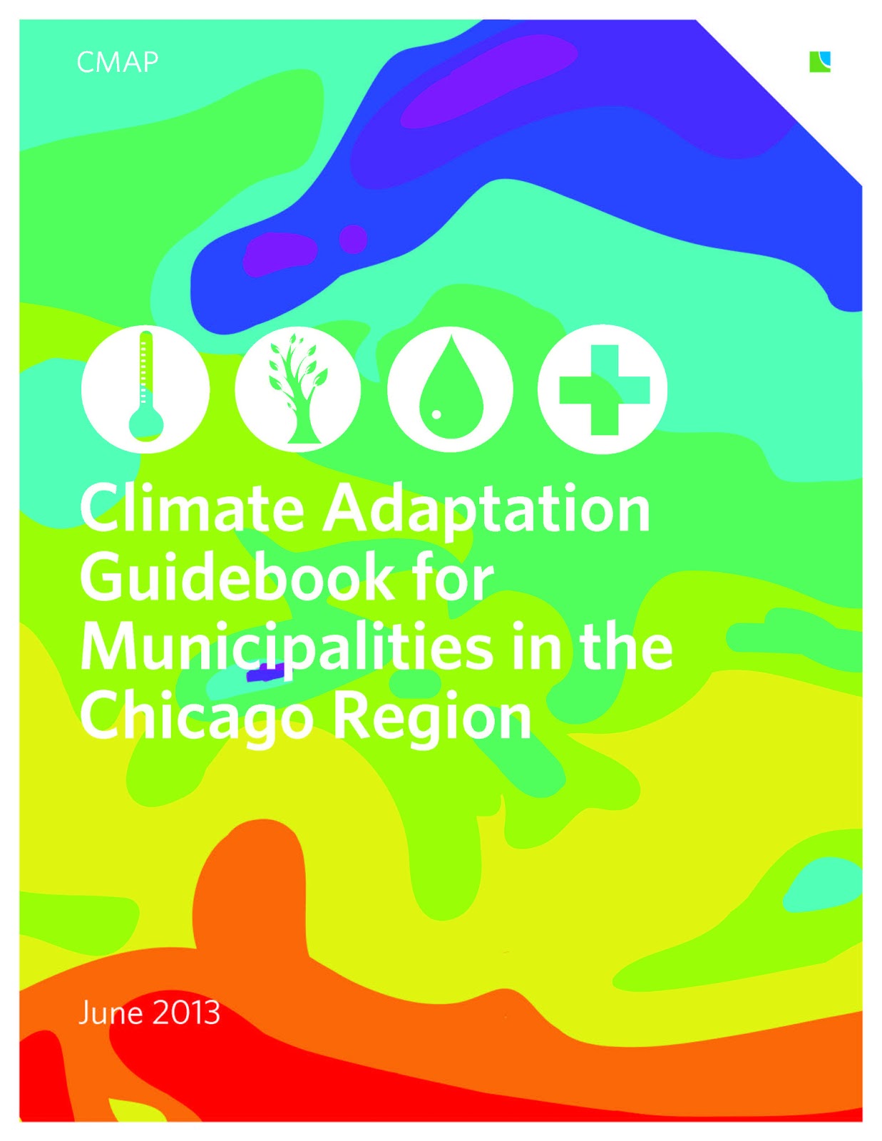
The guidebook serves as a toolkit of sorts to help planners, administrators, and others formulate comprehensive plans and responses to current and future effects resulting from a changing climate. The guidebook addresses a number of water related issues and vulnerabilities, including flood protection and mitigation, meeting drinking water needs, and more.
Illinois-Indiana Sea Grant’s extension climatologist Molly Woloszyn assisted in the creation of the toolkit, specifically in drafting the guidebook’s Primary Impacts of Climate Change in the Chicago Region appendix (PDF), along with the Illinois State Climatologist Office and the Midwestern Regional Climate Center. The section reviews the state of scientific knowledge regarding climate change in northeastern Illinois with a particular focus on variables of interest to municipalities. The section offers information on several anticipated impacts from changing climate conditions, including periods of heavy rain and corresponding flooding, increased drought conditions, weather variability that can affect utilities, and additional concerns.
The guidebook is one part of northeastern Illinois’ comprehensive plan GO TO 2040, which addresses environmental impacts, energy efficiency, transportation needs, and other areas of concern for growing municipal populations in the coming years.
Add a Great Lakes twist to your summer reading! Discover stories inspired by our region with Great Lakes Great Reads. Check out reading lists perfect for beach days or quiet evenings. https://greatlakesgreatread.org/
Real-time coastlines, real-world insights. Check out the LIVE feed of Lake Michigan at Indiana Dunes State Park Beach – supporting recreationalists, researchers, and the broader public at the link in bio.
This work is in partnership between Southeast Coastal Ocean Observing Regional Association (@secoora_org), the Great Lakes Observing System (@greatlakesobservingsystem), Indiana Dunes State Park (@indianadunessp), Indiana Department of Natural Resources (@indianadnr), and Illinois-Indiana Sea Grant with support from Surfline (@surfline).
Check out IISG’s website for more information on this collaborative project at the link in bio.
Also featured on Seagull and Indiana Coastal Atlas.
Purdue Forestry and Natural Resources University of Illinois Extension Southern Lake Michigan Water Safety Task Force US National Weather Service Chicago Illinois Save the Dunes Shirley Heinze Land Trust Indiana Dunes National Park Indiana Dunes Friends of Indiana Dunes, Inc.
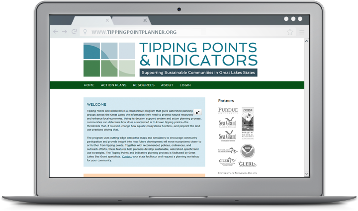 For community planners, balancing community growth and environmental health can be a challenge. Putting down roads, building along waterways, or converting prairies to farmland puts stress on local ecosystems—sometimes so much that it can trigger rapid and potentially irreversible shifts in how they function. Fortunately, Tipping Points and Indicators gives watershed planning groups and others the information they need to avoid these tipping points while still meeting community needs.
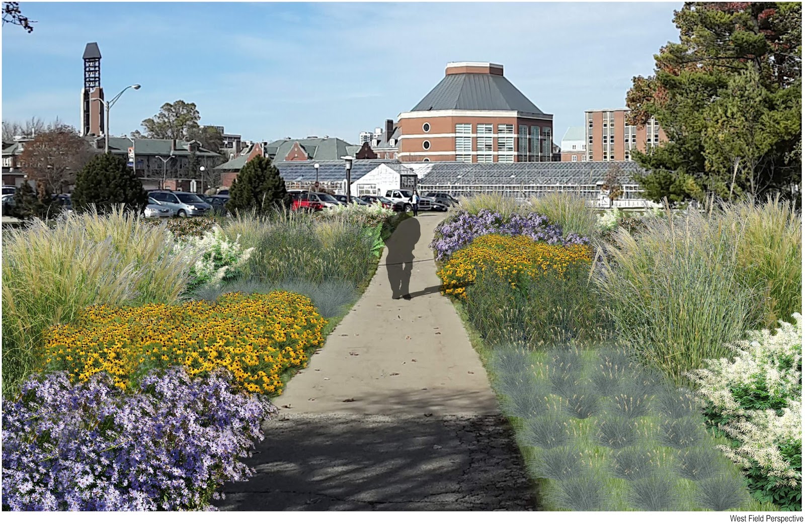


