“Meet Our Grad Student Scholars” is an article series from Illinois-Indiana Sea Grant (IISG) celebrating the graduate students doing research funded by the IISG scholars program. To learn more about our faculty and graduate student funding opportunities, visit our Fellowships & Scholarships page. Shuyu Chang, a member of the inaugural Illinois-Indiana Sea Grant graduate student scholar cohort, began her Ph.D. program at the University of Illinois Chicago and is now a Ph.D. candidate in the Department of Geography at Penn State University. Trained as a physical geographer, hydrologist, data scientist, and researcher, Shuyu strives to develop data-driven and process-based models to support decision-making within the realm of water policy and landscape management. She is particularly interested in exploring the ways in which human activity changes the delivery of nutrients (nitrogen, phosphorus, carbon, silicon) to, and water quality of, downstream water bodies by combining remote sensing techniques, machine learning, and hydrological modeling.
Microscopic nutrients, like nitrogen and phosphorus, determine the composition and health of entire ecosystems. Shuyu Chang, a Ph.D. student in ecohydrology, is using remote sensing and machine learning to study how humans influence nutrient flow in the Upper Mississippi River basin, including the Lake Michigan watershed. Ecohydrologists study connections between living things (eco) and characteristics of water such as movement (hydro), and Shuyu’s research will ultimately help managers who wish to create and implement policies to protect Lake Michigan nearshore waters and ecosystems.
While nutrients are needed to support a healthy system, nutrients at very high concentrations may be considered pollutants because they support extremely fast rates of algae growth. This can be dangerous to other lifeforms because algae may use up all available oxygen and their mats may block sunlight, essentially suffocating plants and other organisms in the area. Excess algal growth may also lead to Harmful Algal Blooms (HABs), where particularly toxic forms of algae grow and thrive. HABs are hazardous to humans who take their drinking water from an affected area, as well as pets, wild fish and shorebirds exposed to the toxic algae. While HABs are typically not a major problem in nearshore Lake Michigan, they are considered one of the greatest inland water quality threats to public health and aquatic ecosystems, such as inland reservoirs, and they may occur more often or in different areas as the climate warms. Locations such as the Montrose Dog Beach in Chicago may be at risk, and Shuyu’s research aims to help managers prepare for these possibilities.
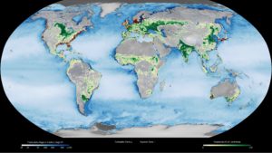
Yellow circles on this map show the location of observed eutrophic (or nutrient-rich) zones. Red dots show where hypoxic (or oxygen-poor) zones have been observed. Satellites can observe changes in the way the ocean surface reflects and absorbs sunlight when the water holds a lot of particles of organic matter. Darker blues in this image show higher concentrations of particulate organic matter, an indication of the overly fertile waters that can potentially lead to HABs or other issues. (Image source https://svs.gsfc.nasa.gov/30479)
Shuyu uses existing data about land use, temperature, climate and other aspects of her study sites, then references remote sensing data to help understand where algal blooms occur. Remote sensing is a way to gather information without physically visiting a location, for example from a NOAA or NASA satellite that has passed overhead. The satellites can detect different aspects of the earth, including the presence of algal blooms, over broad geographic areas. Shuyu then gathers in situ data, for example, water samples from a specific location that are analyzed to help her understand and ground-truth—or verify the accuracy of data with real-world conditions—the remote sensing images.
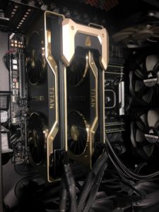
Two titan Graphics Processing Units, used by Shuyu Chang for deep learning and machine learning research.
Because Shuyu has so many different types of data from reservoirs across the Upper Mississippi River Basin, she needs a way to efficiently process the information. For this, she uses machine learning, or writing code to combine large amounts of different types of data and create models based on detected patterns. With enough data and good ground-truthing, this system can predict how climate change, human activities and changing land use may affect delivery of nutrients to water bodies. Developing and calibrating models is always time-consuming, especially when working on a very complicated model with lots of data. For her first scientific publication, Shuyu calibrated each catchment in the Chesapeake Nontidal Watershed more than 50 times because data kept being updated or the model structure needed to change. This is a great example of real-life scientific challenges, and Shuyu’s tenacity has led to various accolades.
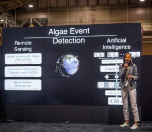
Shuyu Chang presents the work from her NASA DEVELOP project at the AGU 2021 Conference.
The code Shuyu wrote for her Upper Mississippi River Basin project can also be applied in other parts of the world. During the summer of 2021, she served as a NASA DEVELOP intern, where she used machine learning to develop a HABs detection system. This work earned Shuyu the grand prize in the highly competitive 2021 American Geophysical Union (AGU) Michael H. Freilich Student Visualization Competition, and the second prize of the Association of American Geographers (AAG) Remote Sensing Student Illustrated Paper Competition. A keen scientist, Shuyu first learned about remote sensing and Geographic Information Systems (GIS) in her undergraduate studies, and believes that technology like this can expand the traditional scope of hydrology, to weave together elements of practice and thinking among different disciplines.
As successful as Shuyu has been in her project, research isn’t always easy. She said, “Research is a process that I have to try and try again. It is a struggle sometimes, but I also really enjoy the moment I make progress and breakthrough.” For anyone considering pursuing academic research, Shuyu said it’s important to make a routine and stick with it. She starts her day with a cup of coffee, then moves to her workstation to write code about water. Shuyu’s interest in water is not confined to her studies—she loves to kayak, surf and swim in the Great Lakes and the ocean. Her research will help those waters become healthier places for people and animals alike.
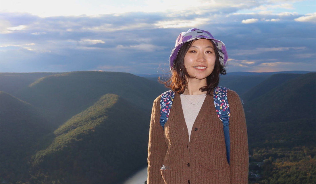
Shuyu Chang surfs in her spare time.
To learn more about Shuyu’s research, you can follow @shuyo5 on Twitter, or explore the Van Meter Lab Website.
Illinois-Indiana Sea Grant is a part of University of Illinois Extension and Purdue Extension.
Writers: Sarah Gediman, Carolyn Foley
