Every day, remote sensing is used to collect data about any number of on-the-ground conditions in environments all around the world. An Illinois-Indiana Sea Grant faculty scholar is studying how this rich data set can be used to help better monitor and manage restored wetlands.
In Illinois, for example, 90% of wetlands that once covered nearly a quarter of the state’s landscape have been drained for agriculture and urban development. But wetlands play important roles in the environment, from filtering contaminants to providing a home for rare flora and fauna, so natural resource managers are restoring wetlands or creating them in new locations.
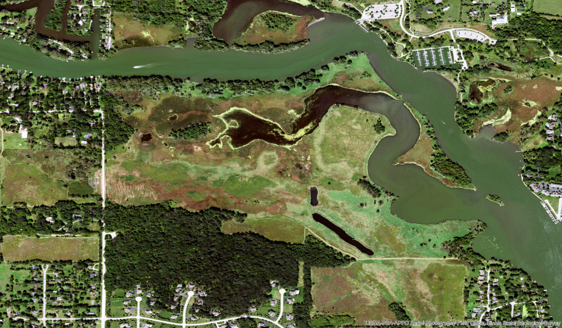
How are these restored or created wetlands faring over time—especially with threats from encroaching invasive species, climate change and other stressors? Monitoring can provide some insights, but regular visits to some sites can also be challenging.
“Oftentimes, water levels in these sites are high and beyond one’s waders,” said Sophie Taddeo, a faculty member in Plant Biology and Conservation at Northwestern University and conservation scientist at the Chicago Botanic Garden. “And some wetlands are just difficult to access—you might need a boat to get there.”
Sometimes it comes down to a lack of funding for short- or long-term monitoring.
On the other hand, remote sensing data—which is acquired from satellites, airplanes, or by cameras or other instruments not actually on the ground—is abundant and available. NASA, for example, has more than 30 years of free, high-quality satellite data.
Taddeo is using a data set from the Illinois Natural History Survey, which monitors more than 100 wetlands, to see is if trends seen on the ground at those sites match the trends that are visible from the skies in satellite images.
She is also using this data to develop metrics, such as shifts in species composition or a decrease in diversity, for practitioners and managers to assess changes in wetlands as they mature.
“Using Google Earth Engine, I’m applying long-term data to see the trajectory of different restoration projects and how they’re evolving over time,” said Taddeo. “I’m writing a code that can be adapted by students, scientists or project managers to use remote sensing to evaluate how their site has changed.”
Taddeo’s literature search on related uses of remote sensing data—understanding how a site recovers after a disturbance, such as a fire—showed that remote sensing is often used to compare sites across the board to see if many of them are responding to stresses or management activities in the same manner. If so, what do these sites have in common?
The answers can help inform management choices going forward.
“Remote sensing data can enable us to monitor wetlands on broad scales and to keep an eye on them individually in between field sampling efforts,” said Taddeo.
She is one of nine faculty and seven graduate students who are or have been Illinois-Indiana Sea Grant scholars. The program helps develop a community of scientists to research critical issues related to Lake Michigan and the Great Lakes region through funding and other opportunities for one year.
Illinois-Indiana Sea Grant is a part of University of Illinois Extension and Purdue Extension.
Writer: Irene Miles

