May 16th, 2017 by IISG
Researchers, federal and state government and non-government officials, students, and representatives from Ohio, Wisconsin, and Michigan Sea Grants gathered at Purdue University recently to take part in the two-day Tipping Point Planner collaboration workshop.
The web tool uses the latest watershed research and cutting-edge technology to show planners how close their watershed is to known environmental tipping points and what the watershed will look like if land use decisions continue “business as usual.”
Planners can also test how developing more in one location or restoring habitats in another moves ecosystems closer to or further from tipping points. With help from a Sea Grant facilitator, planners can use these interactive maps and simulators—along with recommended policies, ordinances, and outreach efforts—to prevent aquatic ecosystems from being degraded beyond repair.
The program’s name is shorter and the homepage has a new look, but the goals for this powerful watershed-planning tool are the same. Some of those in attendance were part of the original team that helped get the program off the ground in 2010 and others were using it for the first time.
The purpose of this workshop was to gather researchers and end-users of this decision-support system as well as partner government agencies to take part in feedback sessions to help inform the development of the upcoming redesign of the Tipping Point Planner website.
Kara Salazar, IISG sustainable communities outreach specialist, has helped communities since 2012 learn how to use Tipping Point Planner in their area. Now Salazar, along with Dan Walker, community planning specialist and Lydia Utley, data analyst, are continuing to expand the tool’s use and functionality.
“Communities plan for many reasons. The Tipping Point Planner process can support a community’s vision for managing land use while minimizing impacts on water quality,” Salazar said.
The first day of the workshop featured talks from researchers from the Great Lakes region followed by breakout sessions led by Purdue researchers on emerging issues. The second day addressed nutrients and food webs, new topics to the Tipping Point Planner tool.
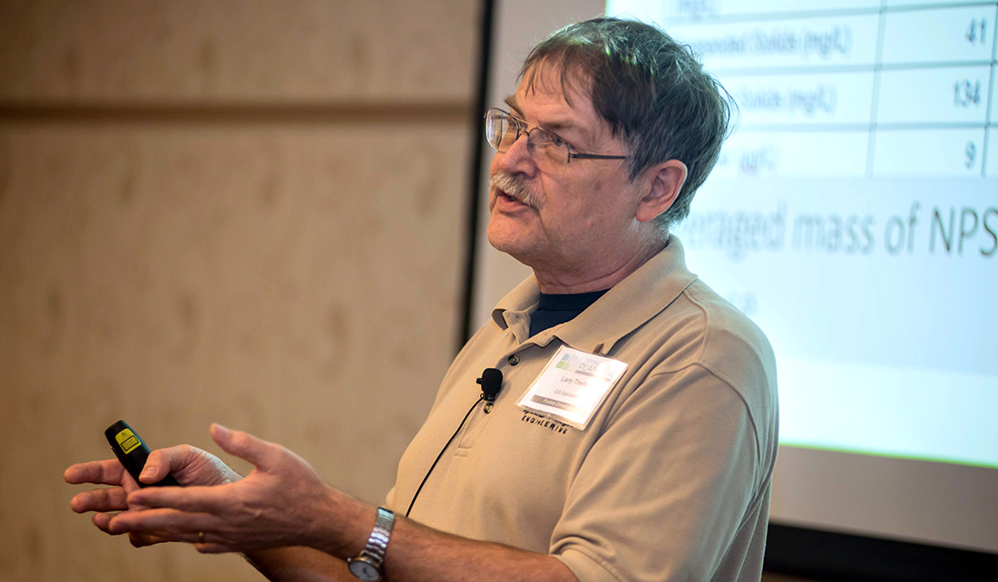
Larry Theller of Purdue gives a talk on “L-THIA works inside Tipping Point Planner.” L-THIA was developed as a straightforward analysis tool to provide estimates of changes in runoff, recharge, and nonpoint source pollution resulting from past or proposed land use changes.
Chelsea Cottingham, watershed specialist at the Indiana Department of Environmental Management sees Tipping Point Planner as a tool for groups she works with that are in the early stages of the land-use planning process. The watershed she manages in northwest Indiana includes agriculture and urban land.
“In large watersheds there are various types of land uses and some of those uses have competing interest in terms of social priorities for the groups of people that live there, as a result we’ve got competing interests,” Cottingham said. “We’re trying to put management practices on the ground to help reduce our nonpoint source pollution and our impact.”
Joe Lucente, Ohio Sea Grant, extension educator, community development, has been involved with Tipping Point Planner from the beginning. Much of his work with communities focuses on economic development and sees how Tipping Point Planner can help.
“We’re trying to gather and see where we’re at in the development of this program and then see how it fits in to the particular community, how we can integrate (Tipping Point Planner) into their comprehensive planning process,” Lucente said. “We’re trying not to take a one-size-fits-all approach, we’re trying to see what makes sense, to see the benefits of it and hopefully start to really put it to use.”
To address that need for more specialized land-use needs, developers of the tool are working to make its calculations more exact to an area.
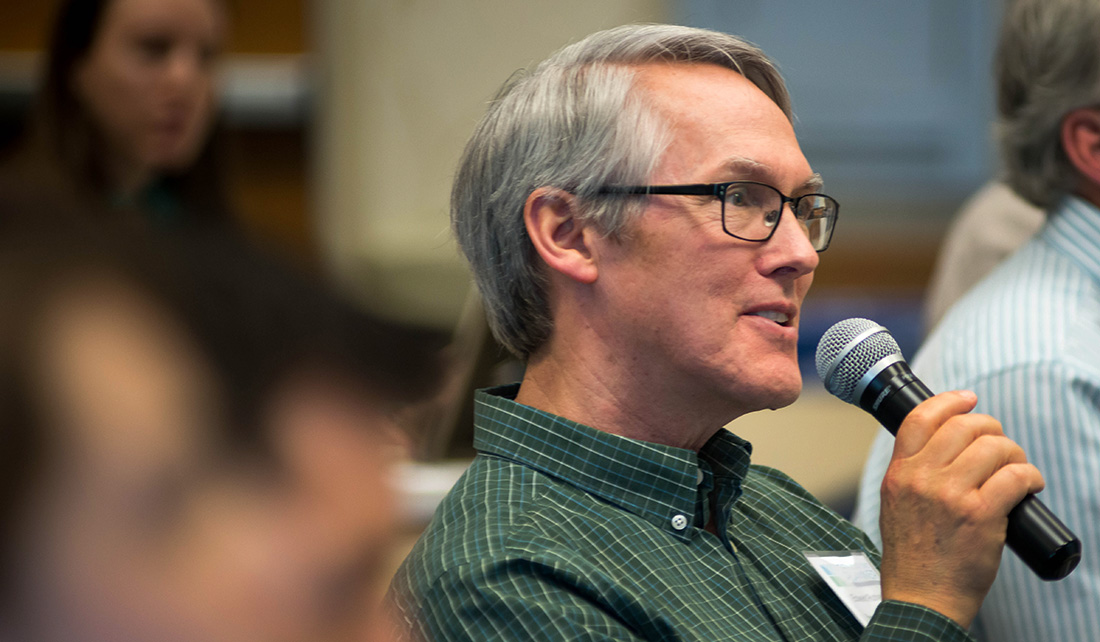
Edward Rutherford, a fishery biologist at NOAA in Michigan, asks a question during the researcher presentation portion of the workshop.
“It’s still at a watershed basis. We’re making it more goal specific so when a community begins the planning process for a specific topic or goal, we’ll be able to more effectively streamline them through the process,” Salazar said.
“Going forward, we’ll have data maps and information that are tailored to that specific area.”
Tipping Point Planner was developed in collaboration with Purdue University, University of Michigan, Michigan State University, University of Minnesota Duluth, University of Windsor, the Great Lakes Environmental Research Laboratory, the Cooperative Institute for Limnology and Ecosystem Research, the Great Lakes Restoration Initiative, NOAA, and the Great Lakes Sea Grant Network. Funding for the four-year project comes from NOAA and EPA.
Illinois-Indiana Sea Grant is a part of University of Illinois Extension and Purdue University Extension.
February 27th, 2017 by iisg_superadmin
When communities look to address water quality issues like nutrient pollution, there are an assortment of computer models to help them simulate scenarios to solve their problems.
But how do local officials and watershed planners know which models will best address their needs? Which ones will consider cost as part of the solution?
“When watershed planners want additional information that will help them make decisions about nutrient management and land-use issues, they want to do it in the most expeditious way possible—with the data they have available, as well as economically, quickly, and with confidence in the results,” said Purdue University agricultural engineer Bernard Engel.
With funding from IISG, Engel and his team analyzed these tools to assess their value in addressing community land use and water concerns.
“Models vary greatly in terms of data inputs, level of expertise needed to use them, what exactly they model or simulate—each has strengths and weaknesses because of that,” said Engel. The researchers compared model performances to observed data sets, which allows them to make some recommendations on when you might use the models and what you might expect from them.
Engel’s team is hoping to push for some models that they feel very confident about to be more accessible to stakeholders. And some are already available in more comprehensive decision support tools, such as Tipping Points and Indicators.
Tipping Points is a complex web-based tool that uses data to help communities planners understand how close their watershed is to ecological thresholds related to a range of water issues and what the watershed will look like if land-use decisions continue on the same course.
Through facilitation, communities develop an action plan that includes customized steps to improve current conditions and steer clear of tipping points.
Engel’s team spends most of their time developing and improving land-use computer models. One of their additions to Tipping Points is a tool to analyze the impacts of land-use changes due to urbanization and the construction of green infrastructure such as rain barrels, porous pavement or green roofs. It was incorporated when decision makers in Peoria, Illinois signed up to use Tipping Points to develop a green infrastructure plan to address the city’s stormwater issues.
Engel’s assessment project has helped inform what direction the team is heading. For example, they plan to explore ideas to improve speed and cost effectiveness. “If the models are faster, they will be more accessible for people,” said Engel.
Illinois-Indiana Sea Grant is a part of University of Illinois Extension and Purdue University Extension.
June 13th, 2016 by IISG
Every day millions of barrels of crude oil are piped, trucked, freighted, and shipped throughout the Great Lakes basin from the Canadian Alberta oil sands and the Bakken oil fields to refineries across the nation. This much crude oil moving around the Great lakes region is not only a challenge for transportation systems but is bringing concerns over the safety of crude oil transport front and center.
Yet crude oil is important to the region, creating economic growth in the form of jobs, industry, agriculture, and government revenue.
Last fall, the Great Lakes Sea Grant Network invited people from academia, industry, and non-profit organizations to Chicago to discuss research that would address concerns inherent to transporting this vital commodity. The goal of the resulting research agenda is to support optimal movement of crude oil throughout the Great Lakes with regards to public safety, the economy, and environmental protection of coastal resources.
“We learned that decision makers have many questions that need to be answered related to the transportation of crude oil,” said Margaret Scheneemann, IISG water resource economist and one of the meeting facilitators.
The Chicago workshop followed an initial two-day spring gathering held at Wingspread in Racine, Wisconsin, which brought a diverse set of stakeholders together to get on the same page regarding this complex issue. They reached an agreement on the primary issues surrounding crude oil movement.
“The first workshop really set the stage for subsequent dialogue,” said Schneemann. “Given that we’re going to move oil in the basin, can we work together to look at our options and identify what we need to do to better understand those options?”
For example, oil pipelines have become a hot-button issue, especially for some environmental groups and activists.
Ever since the first black gold was commercially drilled in western Pennsylvania in 1859, getting the oil to market has been a challenge. Initially the cost to transport it to the railroad was more than the oil itself was worth. So in 1865 the first reliable pipeline was built and the U.S. hasn’t stopped expanding pipelines since.
Today there is more oil than ever before traveling existing routes. Thousands of pipelines snaking through the nation move the bulk of the oil on land. Where pipelines don’t exist or aren’t sufficient, oil is moved by water, truck, or rail. In the past five years, railroads have seen a 700 percent increase in transporting oil on a system that was never meant to carry that amount.
Regardless of the method of transporting oil, incidents are bound to happen.
Dale Bergeron, Minnesota Sea Grant marine extension educator, is using his background in strategic planning and conflict resolution to encourage stakeholders to slow down and address the situation with a sound science-based, management strategy.
In addition, Schneemann will encourage stakeholders to undertake a monetary accounting of the benefits and risks so that decision makers can make apples-to-apples comparisons.
Statistically speaking, the risk is low that pipelines will fail, but one major spill can be catastrophic as residents near the Kalamazoo River in Michigan saw in 2010 when an Enbridge pipeline ruptured and caused the largest inland oil leak in the United States.
“What is the reality today and what are the impacts of various choices?” Bergeron said. “If we shut down a pipeline, it would not stop the flow of oil. It would just seek another route and perhaps a less safe one. Because refineries need stock, industry needs it, agriculture depends on it, and citizens demand it.”
This story appears in the latest edition of The Helm.
Illinois-Indiana Sea Grant is a part of University of Illinois Extension.
June 13th, 2016 by IISG
Three Purdue University students working with IISG researchers took home awards at this year’s IAGLR conference in Guelph, Ontario.
JGLR/Elsevier Early Career Scientist Award went to Jonah Withers, Purdue University, for his article “Diets and growth potential of early stage larval yellow perch and alewife in a nearshore region of southeastern Lake Michigan,” in the Journal of Great Lakes Research. This $750 award recognizes a scientist at the early stages of his or her career and is first author on the top-ranked article in the Journal of Great Lakes Research. Co-authors include, IISG’s Carolyn Foley, associate research coordinator and Tomas Höök, associate director for research and Timothy Sesterhenn, and Cary Troy.
IAGLR-Hydrolab Best Student Paper Award
Margaret Hutton, a Master’s student with Paris Collingsworth, IISG Great Lakes ecosystems specialist, received one of two top oral presentations given by students at the Vermont IAGLR 2015 meeting for “Nearshore primary production in Lake Michigan: Analysis of trends using remote sensing techniques.”
Paul W. Rodgers Scholarship
The 2016 winner is Timothy Malinich, who works with Tomas Höök, for his project on the “Phenotypic plasticity of yellow perch and the role of phenotypic diversity in fish populations.” The $2,000 scholarship was established in memory of Paul W. Rodgers, who was vice president of LimnoTech, a Great Lakes researcher, and active supporter of IAGLR. It is given to a student to support the advancement of knowledge relating to Great Lakes aquatic ecosystem health and management. This is the final year this scholarship will be awarded.
June 6th, 2016 by IISG
IISG is excited to welcome four student interns this summer to help our specialists with everything from needs assessments, to outreach, to strategy facilitating, to economic valuations—and more. These four will spend 12 weeks working closely with a Sea Grant specialist on the issues affecting the Great Lakes.
 Jordan Lillybridge
Green Infrastructure Workforce Intern
Margaret Schneemann
Located at Chicago Metropolitan Agency for Planning
Jordan is a senior at Carthage College in Kenosha, Wisconsin majoring in geospacial science with a minor in geographic information systems.
He will be conducting a needs assessment and market analysis to ensure that training and workforce development efforts are in line with the Calumet region’s occupational and employment needs, leveraging the relationship gap between stakeholders and the community, and making sure all aspects (skill gaps, design standards, municipal regulations and the regional environment policies) are being looked at when achieving a Green Infrastructure program
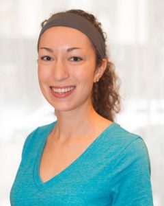
Abigail Petersen
Community Sustainability Intern
Kara Salazar
Located at Purdue University
Abigail graduated in May from the University of Illinois in natural resources and environmental sciences. She will be pursuing a Master’s degree in August 2016 in agriculture education at the University of Illinois.
During her summer internship, Abigail will collaboratively develop new extension education and training materials (case studies, fact sheets, excerpts of guide books) related to public spaces, rain gardens, and watershed management topics. She will also be help campus specialists deliver extension and training programs to communities across Indiana.
Abigail has hit the ground running in the two weeks since her internship began. She has attended the inaugural train the trainer program for the Enhancing the Value of Public Spaces program, supported the first meeting and launch of the advisory board and program development effort for the new Natural Resources Leadership Program, attended strategic planning meetings for IISG in Chicago, and helped to host a community meeting to start the Enhancing the Value of Public Spaces program in Columbus, Indiana.
Ashley Rice
Science Writer and Nutrient Strategy Facilitator Intern
Anjanette Riley, Eliana Brown, and Lisa Merrifield
Located at University of Illinois
Ashley comes to us from the agricultural communications program at Illinois State University, where she is about to start her senior year.
This summer, Ashley will wear two hats: a science writer and nutrient strategy facilitator. For her part in the communications team, Ashley oversees the Illinois Water blog, writing news and feature articles on IWRC research projects and important water issues facing the state.
She will also work closely with IWRC and IISG’s Eliana Brown to help facilitate Illinois Nutrient Loss Reduction Strategy implementation and support Eliana’s other stormwater and water quality outreach efforts.
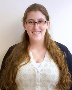 Lauren Schnoebelen
Water Pricing Intern
Margaret Schneemann
Located at Chicago Metropolitan Agency for Planning
Lauren is a recent graduate from Northern Michigan University with a major in environmental science, a concentration in natural resources and a minor in sustainability.
She will be working on the Ecosystem Services Project helping with organizing tables of articles and writing the literature reviews on their economic valuations.
Lauren will also be on the water rates database where she will be working with water rates and pricing ordinances.
Illinois-Indiana Sea Grant is a part of University of Illinois Extension.
