May 16th, 2017 by IISG
Researchers, federal and state government and non-government officials, students, and representatives from Ohio, Wisconsin, and Michigan Sea Grants gathered at Purdue University recently to take part in the two-day Tipping Point Planner collaboration workshop.
The web tool uses the latest watershed research and cutting-edge technology to show planners how close their watershed is to known environmental tipping points and what the watershed will look like if land use decisions continue “business as usual.”
Planners can also test how developing more in one location or restoring habitats in another moves ecosystems closer to or further from tipping points. With help from a Sea Grant facilitator, planners can use these interactive maps and simulators—along with recommended policies, ordinances, and outreach efforts—to prevent aquatic ecosystems from being degraded beyond repair.
The program’s name is shorter and the homepage has a new look, but the goals for this powerful watershed-planning tool are the same. Some of those in attendance were part of the original team that helped get the program off the ground in 2010 and others were using it for the first time.
The purpose of this workshop was to gather researchers and end-users of this decision-support system as well as partner government agencies to take part in feedback sessions to help inform the development of the upcoming redesign of the Tipping Point Planner website.
Kara Salazar, IISG sustainable communities outreach specialist, has helped communities since 2012 learn how to use Tipping Point Planner in their area. Now Salazar, along with Dan Walker, community planning specialist and Lydia Utley, data analyst, are continuing to expand the tool’s use and functionality.
“Communities plan for many reasons. The Tipping Point Planner process can support a community’s vision for managing land use while minimizing impacts on water quality,” Salazar said.
The first day of the workshop featured talks from researchers from the Great Lakes region followed by breakout sessions led by Purdue researchers on emerging issues. The second day addressed nutrients and food webs, new topics to the Tipping Point Planner tool.
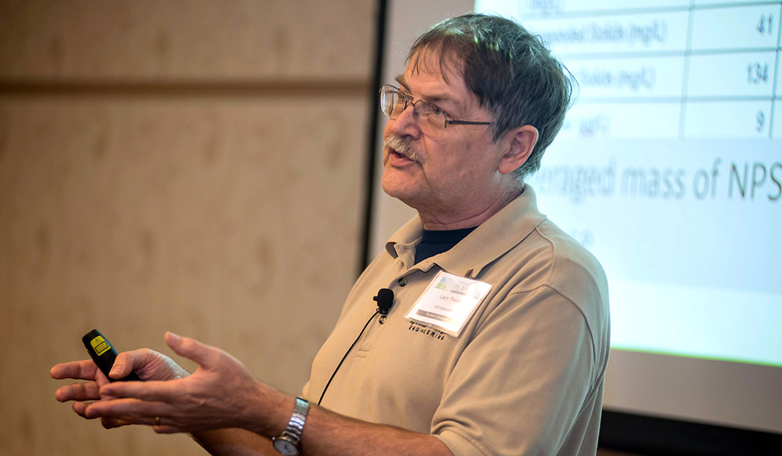
Larry Theller of Purdue gives a talk on “L-THIA works inside Tipping Point Planner.” L-THIA was developed as a straightforward analysis tool to provide estimates of changes in runoff, recharge, and nonpoint source pollution resulting from past or proposed land use changes.
Chelsea Cottingham, watershed specialist at the Indiana Department of Environmental Management sees Tipping Point Planner as a tool for groups she works with that are in the early stages of the land-use planning process. The watershed she manages in northwest Indiana includes agriculture and urban land.
“In large watersheds there are various types of land uses and some of those uses have competing interest in terms of social priorities for the groups of people that live there, as a result we’ve got competing interests,” Cottingham said. “We’re trying to put management practices on the ground to help reduce our nonpoint source pollution and our impact.”
Joe Lucente, Ohio Sea Grant, extension educator, community development, has been involved with Tipping Point Planner from the beginning. Much of his work with communities focuses on economic development and sees how Tipping Point Planner can help.
“We’re trying to gather and see where we’re at in the development of this program and then see how it fits in to the particular community, how we can integrate (Tipping Point Planner) into their comprehensive planning process,” Lucente said. “We’re trying not to take a one-size-fits-all approach, we’re trying to see what makes sense, to see the benefits of it and hopefully start to really put it to use.”
To address that need for more specialized land-use needs, developers of the tool are working to make its calculations more exact to an area.
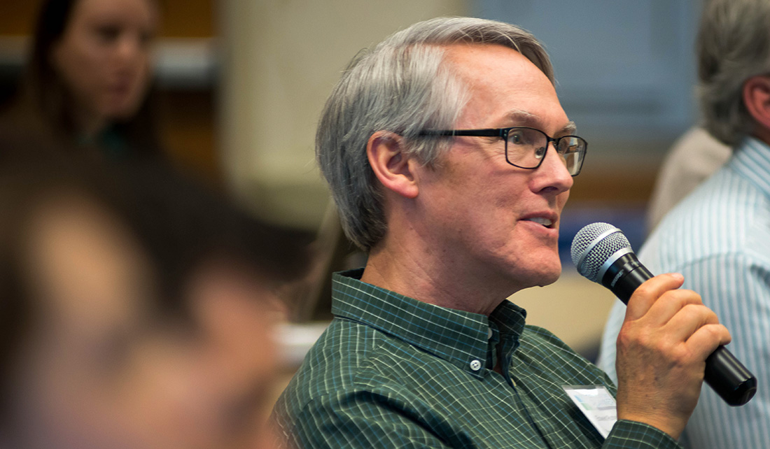
Edward Rutherford, a fishery biologist at NOAA in Michigan, asks a question during the researcher presentation portion of the workshop.
“It’s still at a watershed basis. We’re making it more goal specific so when a community begins the planning process for a specific topic or goal, we’ll be able to more effectively streamline them through the process,” Salazar said.
“Going forward, we’ll have data maps and information that are tailored to that specific area.”
Tipping Point Planner was developed in collaboration with Purdue University, University of Michigan, Michigan State University, University of Minnesota Duluth, University of Windsor, the Great Lakes Environmental Research Laboratory, the Cooperative Institute for Limnology and Ecosystem Research, the Great Lakes Restoration Initiative, NOAA, and the Great Lakes Sea Grant Network. Funding for the four-year project comes from NOAA and EPA.
Illinois-Indiana Sea Grant is a part of University of Illinois Extension and Purdue University Extension.
February 27th, 2017 by iisg_superadmin
When communities look to address water quality issues like nutrient pollution, there are an assortment of computer models to help them simulate scenarios to solve their problems.
But how do local officials and watershed planners know which models will best address their needs? Which ones will consider cost as part of the solution?
“When watershed planners want additional information that will help them make decisions about nutrient management and land-use issues, they want to do it in the most expeditious way possible—with the data they have available, as well as economically, quickly, and with confidence in the results,” said Purdue University agricultural engineer Bernard Engel.
With funding from IISG, Engel and his team analyzed these tools to assess their value in addressing community land use and water concerns.
“Models vary greatly in terms of data inputs, level of expertise needed to use them, what exactly they model or simulate—each has strengths and weaknesses because of that,” said Engel. The researchers compared model performances to observed data sets, which allows them to make some recommendations on when you might use the models and what you might expect from them.
Engel’s team is hoping to push for some models that they feel very confident about to be more accessible to stakeholders. And some are already available in more comprehensive decision support tools, such as Tipping Points and Indicators.
Tipping Points is a complex web-based tool that uses data to help communities planners understand how close their watershed is to ecological thresholds related to a range of water issues and what the watershed will look like if land-use decisions continue on the same course.
Through facilitation, communities develop an action plan that includes customized steps to improve current conditions and steer clear of tipping points.
Engel’s team spends most of their time developing and improving land-use computer models. One of their additions to Tipping Points is a tool to analyze the impacts of land-use changes due to urbanization and the construction of green infrastructure such as rain barrels, porous pavement or green roofs. It was incorporated when decision makers in Peoria, Illinois signed up to use Tipping Points to develop a green infrastructure plan to address the city’s stormwater issues.
Engel’s assessment project has helped inform what direction the team is heading. For example, they plan to explore ideas to improve speed and cost effectiveness. “If the models are faster, they will be more accessible for people,” said Engel.
Illinois-Indiana Sea Grant is a part of University of Illinois Extension and Purdue University Extension.
September 1st, 2015 by iisg_superadmin
My name is Josh Hewitt and I am a web developer intern for the IISG Tipping Points and Indicators project at Purdue University. I graduated from Purdue in the fall of 2014 with a degree in computer graphics technology (CGT) with a focus on web development.
I started in the summer and was really excited about working on the Tipping Points project. Tipping Points and Indicators is a collaborative program that gives watershed planning groups across the Great Lakes the information they need to protect natural resources and enhance local economies. The process evaluates the users’ community characteristics, displays maps full of data about the watershed, and ends by creating action plans to achieve the desired goals of the user. The platform they use to do this is the web.
That’s where I come in!
My job is to fix bugs on the website and to add features to give the user a better experience. Recently, we have talked about redesigning the layout of the website because the current design is a bit outdated.
The past few weeks I have been talking with my team to figure out a layout that would enhance the users’ experience. I create mock-ups of layouts in Photoshop and then code it in Dreamweaver. We’re really excited to get this redesign done and show it to our users. We think they’ll be blown away with the improvement.
My internship has been great so far and I have learned A LOT. I would definitely recommend it to anyone looking to get some experience in web development. Not only is the web experience great but my team is really friendly and helpful. They’re always willing to give me advice when I’m stuck.
Great experience. Great people. Great internship.
-Josh Hewitt
July 16th, 2014 by iisg_superadmin
For land use planners, balancing community growth and environmental health is always a challenge. But after months of pilot testing, IISG is putting the final touches on a new web-based tool that will help them do just that.
 The Tipping Points and Indicators tool uses the latest watershed research and cutting-edge technology to show planners where aquatic ecosystems in their area are in danger of crossing a “tipping point,” triggering rapid and sometimes irreversible shifts in how they function. With help from a Sea Grant facilitator, planners can use the tool’s interactive maps, simulators, and recommended response strategies to develop watershed-specific plans that prevent ecosystems from being degraded beyond repair.
Specialists from Ohio, New York, Minnesota, Wisconsin, Michigan and Illinois-Indiana Sea Grant programs have spent the last few months testing the tool in broad range of communities and divers audiences. Planning groups from the industrialized southern Lake Michigan to the more preserved northern Wisconsin and Minnesota can now use the decision support system to kick off the watershed planning process. In Indiana, Ohio, and New York, facilitators have also introduced planning consultants and state employees to tool modules so they can take the process back to their own communities.
Experiences so far have been positive, with many users expressing excitement about the role Tipping Points and Indicators could play in improving watershed planning. Community members, local officials, and consultants were particularly interested in the tools’ recommended policies, ordinances, and outreach efforts tailored to local needs. In fact, a watershed advocacy group from the Duluth area mentioned they could have spent a whole day on that module alone.
 To further enhance the tool, users also recommended making maps and planning strategies more watershed-specific. Many of these refinements are being made now. Others, including the addition of the new land cover data and models that predict future tipping points, are expected in the coming months.
And as the project grows, so does the lead team. Last month, IISG brought Purdue software developer Brandon Beatty onboard to help boost the usability of Tipping Points and Indicators and ensure it continues to rely on the latest research and technology.
The tipping points tool is part of a four-year project funded by NOAA and EPA and coordinated by Illinois-Indiana Sea Grant. Partners include Purdue University, University of Michigan, Michigan State University, University of Minnesota Duluth, University of Windsor, Great Lakes Environmental Research Laboratory, the Cooperative Institute for Limnology and Ecosystem Research, the Great Lakes Restoration Initiative, and the Sea Grant Great Lakes Network.
November 6th, 2013 by Irene Miles
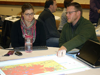
 Staff members from six Great Lakes Sea Grant programs met at Purdue University last week to preview a new web-based tool that will help local planners make sustainable land use decisions. The two-day workshop gave Sea Grant specialists a chance to work through the tool’s four-step process and suggest changes before they start using it with planning groups and communities next spring.
The Tipping Points and Indicators tool uses watershed data and cutting-edge research to show planners where aquatic ecosystems in their region are stressed by various factors to the degree that they are in danger of crossing a “tipping point,” triggering rapid and sometimes irreversible shifts in their functioning. With help from a Sea Grant facilitator, planners can use the tool’s interactive maps and simulators to specify important regional priorities, pinpoint specific land use practices that threaten ecosystem health, and test how further development, restoration, or conservation projects would help or hurt. Together with suggested policies, ordinances, and outreach efforts, these features help planners develop watershed management plans that prevent ecosystems from being degraded beyond repair.

Future facilitators from Ohio, New York, Minnesota, Wisconsin, Michigan, and Illinois-Indiana Sea Grant programs worked in groups to build mock watershed management plans for rural, suburban, and urban watersheds. Hands-on activities helped participants get familiar with the tool’s features, as well as ways to customize the process to meet the needs of communities they work with. They also learned how to use and set up different technologies that help larger groups collaboratively use computer-based programs, including the weTable, which transforms a regular tabletop into an interactive computer screen.
Perhaps the most important result of the workshop, though, was a list of feature and design changes to further increase the usability of the tool. Many of the suggestions focused on making land use data more accessible for the residents who join non-profits and local agencies in watershed planning groups. These and other refinements, including the addition of new data, will be made in the coming months.
 The tipping points tool is part of a four-year project funded by NOAA and EPA and coordinated by Illinois-Indiana Sea Grant. Research and outreach partners include Purdue University, University of Michigan, Michigan State University, University of Minnesota Duluth, University of Windsor, the Great Lakes Environmental Research Laboratory, the Cooperative Institute for Limnology and Ecosystem Research, the Great Lakes Restoration Initiative, NOAA, and the Sea Grant Great Lakes Network.
*Pictures:
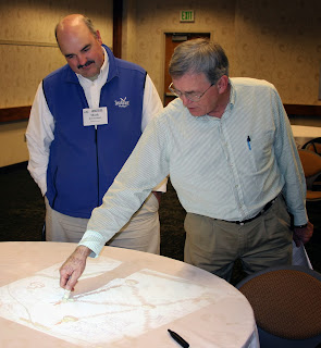
Top – Mark Breederland (Michigan Sea Grant) and Brian Miller (IISG)
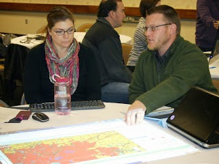
Middle – Joe Lucente (Ohio Sea Grant) and Julie Noordyk (Wisconsin Sea Grant)
Bottom – Mary Penney (New York Sea Grant) and Jarrod Doucette (Purdue University)
December 5th, 2012 by Irene Miles
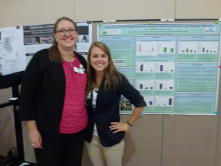
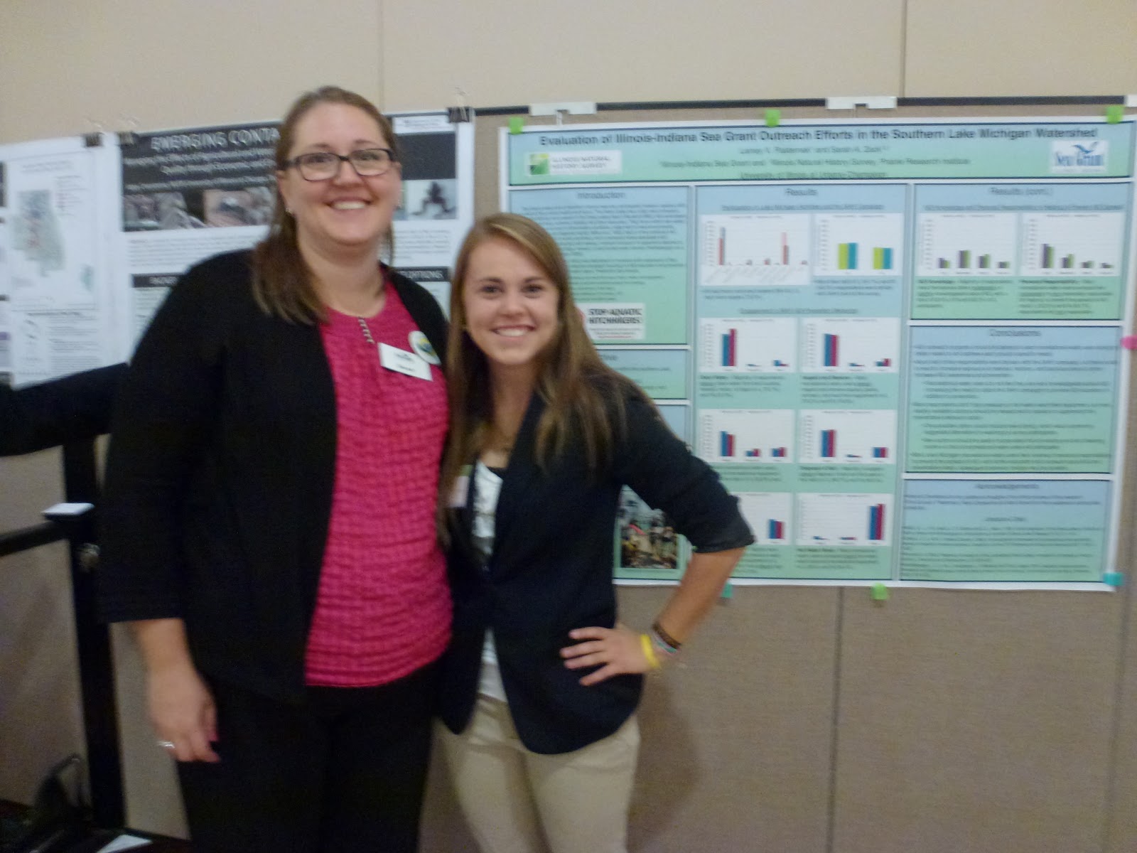
University of Illinois Junior Lainey Pasternak, who interned this past summer with IISG’s Aquatic Invasive Species (AIS) Outreach Team, wrote a guest blog about her experience working with IISG and, more importantly, about an award she received for her work.
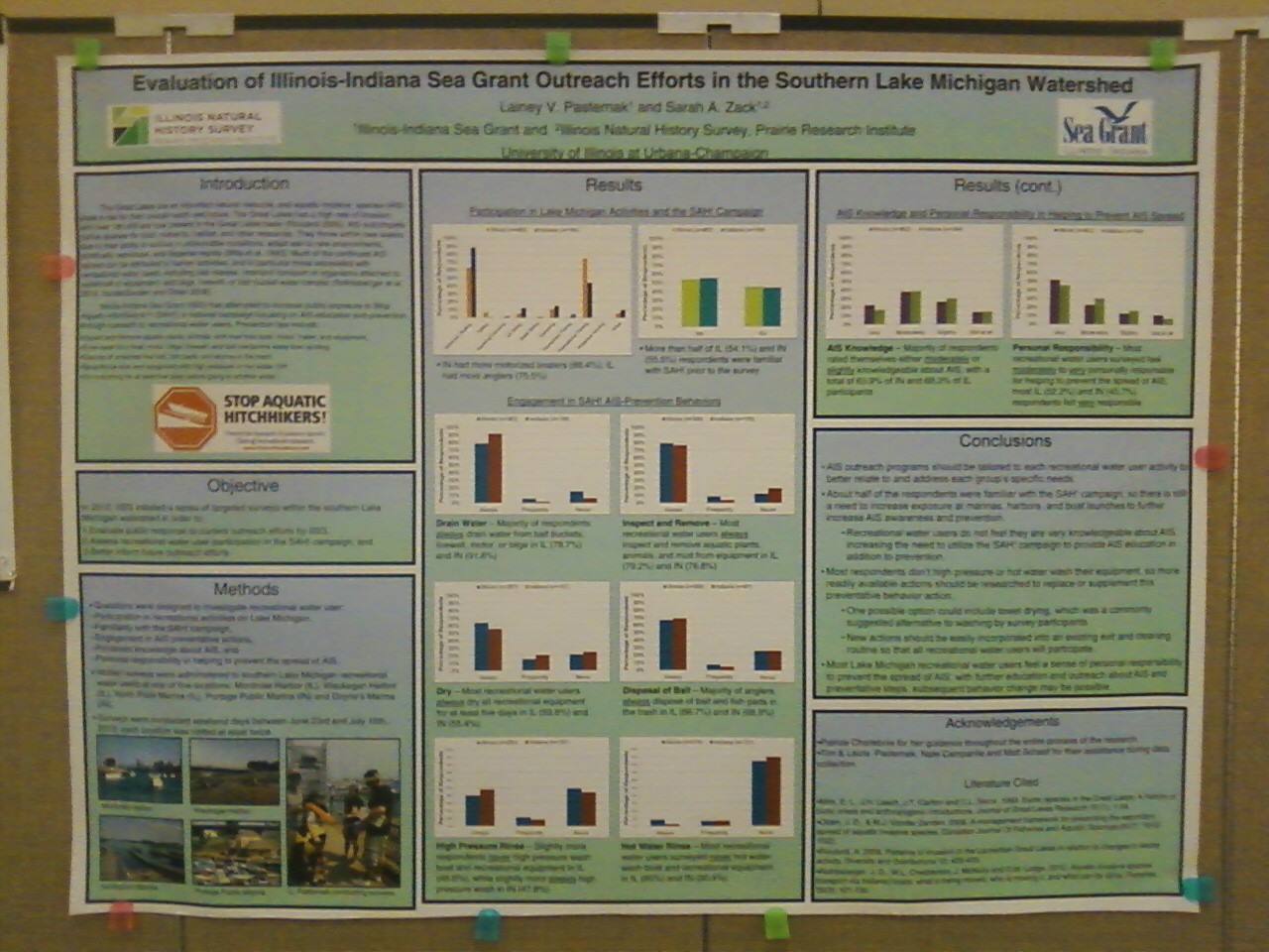
Lainey writes, “Over the summer I worked to help increase recreational water user knowledge of AIS through survey research and outreach. I designed and conducted a survey to help investigate the prevalence of AIS-preventative behaviors among boaters and anglers, a key demographic in the effort to prevent AIS spread. By the end of the summer, I had formulated a formal research report and academic poster presentation based on the final survey results. All efforts in the research and poster presentation were collaborated with my internship supervisor and coauthor, Sarah Zack. The final project of the internship was a presentation of my poster “Evaluation Illinois-Indiana Sea Grant Outreach Efforts in the Southern Lake Michigan Watershed” at the 2012 Illinois Water Conference.
 On September 24-25, I attended the Illinois Water Conference at the University of Illinois. After submitting my research abstract and poster at the conference, I was awarded a student scholarship and honorable mention award for an undergraduate student poster. I had the opportunity to present my summer research at the student poster session throughout the duration of the Illinois-Indiana Sea Grant 30th Anniversary Reception, courtesy of the Illinois Chapter of the American Water Resources Association. Among the 30 registered students of the poster competition, I was one of the two conference award recipients, and the only undergraduate to receive mention.
 My internship with Illinois-Indiana Sea Grant marked an important beginning step in my environmental science career. Attending the Illinois Water Conference not only provided me the opportunity to display my research project, but also emphasized AIS as an important issue affecting Illinois’ waters. I was immersed in a learning atmosphere of networking and the active exchange of new ideas to utilize in possible future research. This conference was the first research opportunity I participated in, and I consider it a major scholarly, professional, and personal success. Receiving a student scholarship and undergraduate honorable mention at the 2012 Illinois Water Conference marked the end to a very rewarding and fulfilling student internship with Illinois-Indiana Sea Grant. I will be continually proud of all my work and the impact I was able to make.”
Congratulations to Lainey on her award, and we look forward to your continued research and outreach efforts to keep our waters safe.
November 14th, 2012 by Irene Miles
Coal-tar sealant, a commonly used application in parking lot and other pavements, is known to be harmful to humans, and threatens to enter watersheds and Great Lakes waterways as well. That is why lawmakers in three Great Lakes states are considering or proposing a ban on the substance in order to protect those waters.
“Negative effects on fish and other aquatic animals include inhibited reproduction, fin erosion, liver abnormalities, cataracts and death, according to Geological Survey reports.
Coal-tar sealcoat makes up about half of the PAHs in lake sediment, according to Environmental Science and Technology. It is why PAH levels have increased in the sediment of urban and suburban lakes since 2000 even when other major PAH producers, like power plants, have been decreasing emissions.”
Read the complete story at the link above.
November 7th, 2012 by Irene Miles
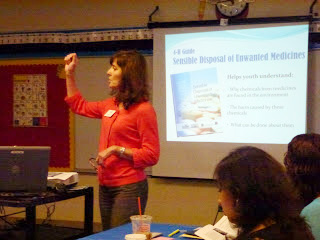
Illinois-Indiana Sea Grant’s education team led a workshop for teachers and administrators in the Blue Island, Illinois school district recently, offering lessons, materials, and training on bringing Great Lakes science to their classrooms.
Susan Ask, who works with IISG’s Lawn to Lake program, sent along some details about the workshop and the enthusiastic reception from the teachers:
“We had a fun and energetic workshop with teachers and principals in the Blue Island School District. The workshop focused on water quality and drew on three major initiatives within Sea Grant: Lawn to Lake, the Great Lakes Field Experiences for Watershed Educators (B-WET), and Increasing Citizen Involvement and Great Lakes Literacy (Center for Great Lakes Literacy).
We began with the basic definition and ecology of watersheds, then moved to an exploration of watershed and water quality issues brought on by urbanization, landscaping practices, and waste disposal. Teachers learned basic ecology that they can teach in their classrooms. We identified point- and non-point sources of pollution and talked about available solutions for individuals and communities to adopt.
After a presentation and discussion, we toured the recently installed rain gardens in the courtyard at Blue Island Elementary School so we could see theory put in to practice. The courtyard contains a rich variety of native plants that creates a beautiful garden throughout the year while also managing and controlling rainwater. Runoff from the roofs will be collected in rain barrels all around the building, and can then be used on the landscape as needed.
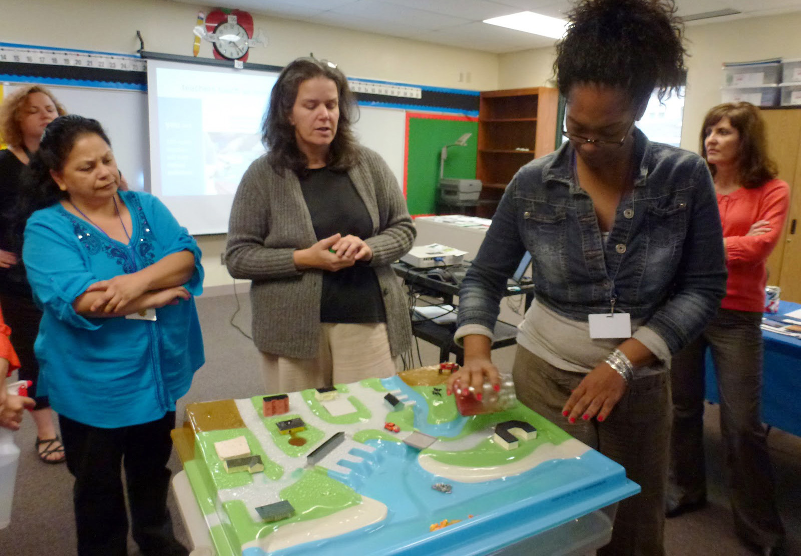
The watershed model was a big hit. We used a three-dimensional model of a watershed, with rivers and lakes, houses, farms, factories, water treatment facilities and other developments, to see how water and pollutants move through the community. Teachers will be able to borrow this model for use in their classes, helping students understand the connection between people, land use, and water. But we didn’t just look at problems. The model also let us see how natural lawn care, rain gardens, rain barrels, permeable pavement, and other practices can help prevent pollution and reduce runoff.
We showcased many of the program’s Great Lakes curricula – Fresh and Salt, Greatest of the Great Lakes, and Sensible Disposal of Unwanted Medicines. Teachers broke into groups to experience some of these classroom activities and share how they might incorporate them in their lessons. They also learned how the Great Lakes Literacy Principles will be a great way to introduce current Great Lakes issues to their students.
Most of the teachers told us that they haven’t yet integrated Great Lakes information in their educational activities, but that they plan to do so now after learning more about water quality and educational resources at the workshop.
We’re very excited to see these dedicated teachers assist and guide their students to learn more about the Great Lakes, water quality, and practical stewardship of water and land.”
In addition to Susan, the workshop was also led by IISG’s Robin Goettel and Terri Hallesy. If you are interested in educational materials and opportunities for yourself or teachers in your school/district, contact Robin or Terri at the links above or visit us online to learn more.
September 28th, 2012 by Irene Miles
A lot of people might know that Illinois-Indiana Sea Grant’s primary mission is to help protect and preserve the Southern Lake Michigan waters. But most people might not know about the many ways our program goes about doing just that.
With the help of staff members, researchers, educators, and more, we’ve produced a video that offers a glimpse at the program and the ways we work for and with the public to ensure safe waters and healthy ecosystems in both states.
Watch the video below to learn more about Illinois-Indiana Sea Grant, and share it with anyone who cares about keeping Lake Michigan healthy, beautiful, and safe.


