A closer look at web tools and sites that boost research and empower Great Lakes communities to secure a healthy environment and economy.
Residents living near sediment remediation projects can now stay up-to-date on cleanup goals and milestones with GreatLakesMud.org. Developed by IISG, this comprehensive site provides information on waterways selected for cleanup and restoration through the Great Lakes Legacy Act.
At the heart of Great Lakes Mud are site-specific pages that identify contaminants of concern and outline plans for cleanup and habitat restoration. Here, visitors will find the latest on dredging schedules, truck routes, opportunities for community involvement, and more.
The website also provides insight into how Legacy Act projects are chosen and designed and explains how cleanup strategies like dredging and capping are able to remove the dangers of contaminated sediment while improving aquatic habitats.
Illustrative photos and videos bring these processes to life and help viewers understand how project components that often span several years fit together.
The Great Lakes Legacy Act was passed in 2002 to accelerate sediment cleanup in Areas of Concern, waterways blighted by decades of industrial discharges and poor municipal sewage practices. Since then, the program has cleaned up nearly 3 million cubic yards of contaminated sediment and restored acres of habitat.
For additional information or to request that your waterbody be added to the website, contact Caitie McCoy.
A closer look at web tools and sites that boost research and empower Great Lakes communities to secure a healthy environment and economy. Even in the gloomy winter months, the beauty of southern Lake Michigan’s natural and urban landscapes is undeniable. But you don’t have to take our word for it. Our photo bank is chock full of stunning images of some of the area’s most celebrated sites—Illinois Beach, downtown Chicago, the Indiana Dunes, and more.
To see the full range of galleries, visit iisg.photoshelter.com or click on ‘Photos’ on our homepage. If you see one you’d like to include in your own print or online resources, click on ‘Contact’ at the top of the page and send us a request.
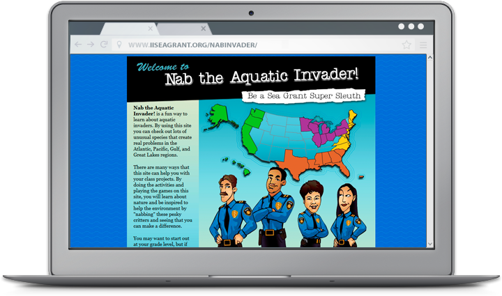
A closer look at web tools and sites that boost research and empower Great Lakes communities to secure a healthy environment and economy. Hundreds of invasive species are on the loose in U.S. waters wreaking havoc on habitats, recreation, and economies. Fortunately, a team of student detectives are on the case and ready to book these “bad guys” with help from Nab the Aquatic Invader! This educational website turns students grades 4-10 into PIs hot on the trail of some of the worst invaders in their region. After brushing up on detailed profiles complete with interrogation recordings, students take part in ongoing investigations led by veteran gumshoes. Whether they join as junior detectives or super sleuths, students learn to ID the suspects, expose the damage they cause, and stop invaders before they strike again. The site also includes a teacher Top Desk Administrator with example projects that give students a chance to share what they’ve learned with their communities. Along with detailed summary reports, these examples make it easy for teachers to plan and implement successful AIS stewardship projects in their own classroom. But you don’t have to go online to crack a case. A suite of card games and posters inspired by the website are also available. Students and adults alike can even join the hunt for the most wanted AIS at the Smithsonian National Museum of Natural History in D.C. and at Coastal Ecosystem Learning Centers throughout the country. Nab the Aquatic Invader! was created by IISG and Sea Grant programs in New York, Louisiana, Connecticut, and Oregon.
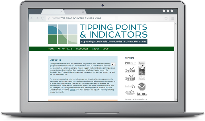
A closer look at web tools and sites that boost research and empower Great Lakes communities to secure a healthy environment and economy. For community planners, balancing community growth and environmental health can be a challenge. Putting down roads, building along waterways, or converting prairies to farmland puts stress on local ecosystems—sometimes so much that it can trigger rapid and potentially irreversible shifts in how they function. Fortunately, Tipping Points and Indicators gives watershed planning groups and others the information they need to avoid these tipping points while still meeting community needs. The web tool uses the latest watershed research and cutting-edge technology to show planners how close their watershed is to known tipping points and what the watershed will look like if land use decisions continue “business as usual.” Planners can also test how developing more in one location or restoring habitats in another moves ecosystems closer to or further from tipping points. With help from a Sea Grant facilitator, planners can use these interactive maps and simulators—along with recommended policies, ordinances, and outreach efforts—to prevent aquatic ecosystems from being degraded beyond repair. Since it was launched in 2013, Tipping Points and Indicators has undergone many design and feature updates inspired by months of pilot testing. Larger maps and detailed legends that toggle on and off give users a closer look at their watershed and make information on characteristics like stream quality and land cover types more accessible. Users can also easily track how proposed land use changes will effect ecosystem health with updates to the planning simulators. To learn more about the tool and see key features in action, watch this introductory video created by the IISG team leading the project.
Tipping Points and Indicators was developed in collaboration with Purdue University, University of Michigan, Michigan State University, University of Minnesota Duluth, University of Windsor, the Great Lakes Environmental Research Laboratory, the Cooperative Institute for Limnology and Ecosystem Research, the Great Lakes Restoration Initiative, NOAA, and the Sea Grant Great Lakes Network. Funding for the four-year project comes from NOAA and EPA.
A closer look at web tools and sites that boost research and empower Great Lakes communities to secure a healthy environment and economy. Aquaculture plays an increasingly vital role in securing long-term food supplies, and the Midwest is poised to help. In fact, a rich supply of raw materials and proximity to large markets makes Illinois and Indiana prime locations for aquaculture farms and related industries. To help producers cash in on these benefits, IISG, University of Illinois Extension, and Purdue Extension teamed up to create Aquaculture Economics and Marketing Resources. The site provides leading research and how-to information for developing a productive, innovative, and profitable aquaculture business. Visitors interested in starting a new business will find resources on everything from establishing an organizational structure to creating a business plan to securing financing. New and veteran producers can also find tips for connecting with consumers and tapping into niche markets. Aquaculture Economics and Marketing Resources is one of several tools IISG uses to help aquaculture producers define markets and create value-added opportunities for their products. Since 2005, Kwamena Quagrainie has held roughly 40 workshops with over 1,200 participants. These and other efforts in Indiana resulted in about $15 million in farm sales of aquaculture products in 2013, a nearly five-fold increase over 2005. To learn more about how aquaculture is strengthening Indiana’s economy, read our 2013 program impacts.
A closer look at web tools and sites that boost research and empower Great Lakes communities to secure a healthy environment and economy.
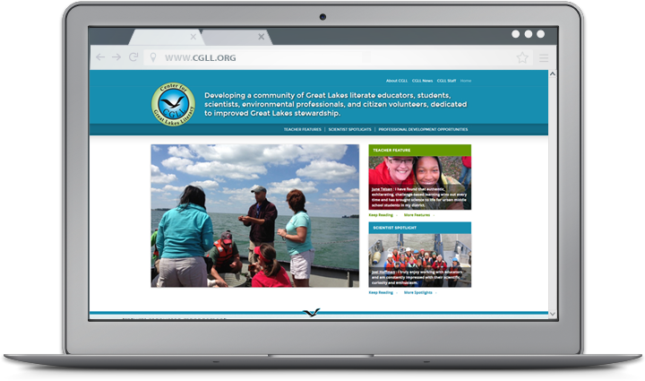
Educators interested in strengthening aquatic science programs and encouraging Great Lakes stewardship—look no further than the new Center for Great Lakes Literacy (CGLL) website. Created by Sea Grant educators throughout the region, the site is a one-stop-shop for classroom activities designed to boost Great Lakes literacy. Educators will find information on and links to teacher-tested curriculum like Fresh and Salt and Estuaries 101. And the Teacher Feature allows visitors to hear about education success stories directly from colleagues across the region. Visitors to the site can also learn about the latest professional development opportunities available throughout the region. For example, teachers interested in the annual Shipboard Science Workshop, held this year on Lake Michigan, can find workshop information and application deadlines. Featured blogs also make it possible to read about teacher experiences at past CGLL workshops and follow along with the latest projects. For more information on upcoming educator workshops and available curriculum, contact Terri Hallesy.
A closer look at web tools and sites that boost research and empower Great Lakes communities to secure a healthy environment and economy.
The Sustainable Communities program, a collaboration between IISG and Purdue University Extension, has been helping Indiana decision makers and residents improve the long-term health of their communities for years. And learning about available workshops and resources is now easier than ever with their new program website.
Visitors will find information on key Purdue University Extension programs and resources to support community planning. Enhancing the Value of Public Spaces, for example, provides a framework for collecting data on community assets and using that data to preserve and improve parks, town centers, and other public spaces. The program will also help community leaders charged with managing public spaces and implementing new projects build communities that are more resilient to economic and environmental changes. The process starts with a one-day workshop that helps participants identify best practices for improving public spaces. Collaborative activities emphasize forming partnerships to achieve community sustainability goals, and follow-up working group meetings facilitated by Purdue Extension provide the resources and technical support needed to plan and implement projects tailored to individual communities. Workshops can be scheduled now. The complete curriculum will be available for download in early 2015.
For Master Gardeners, stormwater educators, and others involved in community education programs, a visit to the website is a quick way to learn about a train-the-trainer program designed to reduce stormwater runoff and the pollution it carries. Rainscaping Education is an advanced training opportunity that includes classroom instruction, online learning opportunities, and field trips to community examples of rainscaping projects. Participants also team up with community partners to design and create a demonstration rain garden. At the end of the four training modules, participants are prepared to support rainscaping projects and associated education programs in their communities. Workshops will begin this spring.
For more information on Purdue’s Sustainable Communities Extension Program, contact Kara Salazar.
Ready for a party? Join us on the newly-expanded Wild Mile for a celebration of our urban waterways and thriving park spaces. Enjoy local beer, food trucks, and an outdoorsy prize drawing while learning about local environmental nonprofits and volunteer opportunities! This event is free and fun for all ages!
The block party is rain-or-shine, and we`ll only cancel in the case of hazardous weather! This year’s community partners include @Openlands, Current Water, @chicago_enviro, @cleanupclub_chicago, @chicago_birder, Blazing Star School, @cubillinois, Friends of the Bloomingdale Trail, @chicagoshapers, @reducewastechicago, Southern Utah Wilderness Alliance, and @honeycombproject!
Continued federal funding for Sea Grant in FY26 is crucial, and we need your help to demonstrate the nationwide support for these essential programs.
🖊️ Sign the letter urging Congress to continue funding Illinois-Indiana Sea Grant and all 34 state Sea Grant programs: 🔗 https://forms.gle/7sPGHGyh8j8a7vfGA or link in bio
Exciting news! The call for sessions for the 2026 Emerging Contaminants in the Environment Conference has been extended!
We are excited to offer the opportunity to propose a speaker or panel session during the 2026 Emerging Contaminants in the Environment Conference April 28-29. The conference will feature traditional 15-minute presentations and a poster session on the latest in emerging contaminant research, policies, and outreach in the soil, water, and air.
The deadline to propose a session is September 30, 2025.
Learn more at go.illinois.edu/ecec or the link in bio
Stay safe and have fun this Fourth of July with these 5 water safety tips! Click the link in bio to learn more ways to keep yourself and others safe as you enjoy the Lake Michigan beaches this holiday.

.png)
.png)

