 Sea Grant Illinois-Indiana
Southern Lake Michigan Water Level Variability
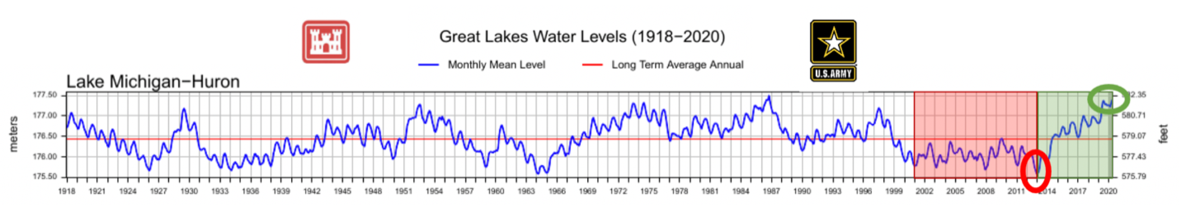
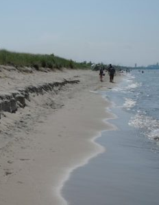
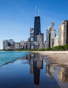
The southern Lake Michigan shoreline has recently been impacted by both historically low and historically high water levels. From record low water levels in 2012-2013 to record high water levels in 2020, communities have had to quickly respond to immediate effects while also considering uncertainty about future conditions. From erosion to coastal flooding and ecological consequences, as well as a broad range of associated economic and social impacts, water level variability on Lake Michigan—which is hydrologically connected to Lake Huron—presents a big challenge to Illinois and Indiana communities.
Building Capacity for Adaptation
In October 2020, Illinois-Indiana Sea Grant (IISG) hosted a series of four virtual workshops—titled “Improving Communication About Changing Lake Michigan Water Levels in the Chicago Metropolitan Area”—with presentations by over 10 guest speakers from organizations and agencies such as the National Weather Service (NWS), Great Lakes Hydraulics and Hydrology Office, U.S. Army Corps of Engineers, Federal Emergency Management Agency (FEMA), NOAA’s Office for Coastal Management, and more. The goals of the four workshops combined were to:
- Present information on how well researchers can currently predict water levels in southwestern Lake Michigan.
- Outline the known or predicted impacts of record high or record low water levels on southwestern Lake Michigan shorelines.
- Identify existing data and products that can help local emergency responders, weather forecasters, parks department personnel, and other community leaders communicate the risks associated with changing water levels, including probable impacts to community members and shoreline property owners.
- Develop a list of additional data sets or products that could help communicate the risk associated with changing water levels, including probable impacts to community members and shoreline property owners.
- Identify which of these data sets or products IISG can help develop or otherwise support, for example by working with local researchers or extension personnel.
It was clear from workshop activities that there is great interest in continuing efforts to improve communication about lake level change in southwestern Lake Michigan. Illinois-Indiana Sea Grant plans to consult with the workshop planning committee, as well as workshop participants, to continue to build on this effort. Read the full Virtual Lake Levels Workshop Report for a summary of the workshops, survey results from participants that identify needs, and next steps.
Ready for Lake Michigan Highs and Lows: Strategies and Case Studies
IISG21-RCE-WEB-049
Free
Following IISG’s 2020 workshop on lake level variability and communication, key products that participants said were needed are “local case studies of successful mitigation actions.” This product highlights those actions and strategies with a range of examples and case studies.
Increasing Illinois and Indiana Shoreline Resilience: Information A to Z
IISG21-RCE-RSM-058
Free
In addition to Story Map above, participants identified a list “of which organization handles what types of issues in which locations” as a need to provide information related to permitting, assistance, and the different roles of federal, regional, state and local entities. This product includes an “At-A-Glance” view as well as detailed information for each organization.
Contact Info
Research Projects
Publications
Education & Training
Related News
- New research predicts potential flooding impacts on critical infrastructure
- Meet our Grad Student Scholars: Junyi Duan
- New issue of IISG’s The Helm highlights green infrastructure projects
- We’re looking for a coastal resilience specialist for Illinois and Indiana communities
- Underwater ROVs, offshore wind turbines, and climate adaptation: Updates from the 2023 Knauss Fellows