March 31st, 2026 by Angela Archer
Meet Our Grad Student Scholars is a series from Illinois-Indiana Sea Grant celebrating the students and research funded by our scholars program. To learn more about our faculty and graduate student funding opportunities, visit Fellowships & Scholarships.
Dohyung Bang is a PhD candidate in the White Lodging-J.W. Marriott, Jr. School of Hospitality and Tourism Management at Purdue University. He is studying how complex tourism systems shape societal and economic outcomes. His project, funded by IISG, examines the impact of the home-sharing economy on housing market dynamics in the Lake Michigan area.
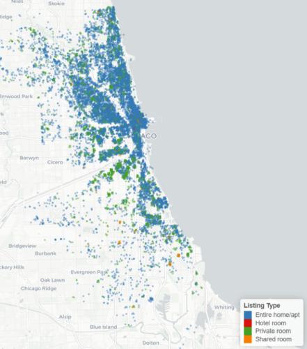
This map illustrates short-term rental distribution in the Chicago area.
Tourism is often described as a “smokeless industry” because it generates economic value without smokestacks. For regions with limited industrial bases, tourism can serve as an important engine for economic development by attracting outside spending and expanding local tax revenues. Yet tourism growth often depends on the availability of accommodations, and expanding traditional lodging supply (e.g., hotels, resorts) typically requires substantial capital investment. This challenge has made the rise of the home-sharing economy especially significant
The home-sharing economy, often referred to as the short-term rental, allows individuals to provide accommodations to other users by renting out residential properties. Over the past decade, this market has grown rapidly, driven primarily by platforms such as Airbnb. Short-term rentals (STR) are no longer limited to specialized sharing-economy platforms; traditional online travel agencies such as Expedia and Booking.com now also feature a growing number of apartments, condominiums, and single-family homes alongside conventional hotel listings.
The expansion of the home-sharing economy has created new opportunities for local economies. It has enabled destinations with limited traditional lodging infrastructure to attract visitors and has generated new income streams for property owners. At the same time, however, the rapid growth of STRs has raised important concerns about housing affordability and availability. As residential properties are increasingly converted into short-term rental units, the supply of long-term housing may decline, placing pressure on local residents and potentially weakening community well-being.
These tensions are especially relevant in communities around Lake Michigan, where the number of short-term rentals has grown substantially over the past decade. In 2024, for example, Chicago had approximately 23,000 short-term rental units, many of them concentrated along the lakeshore. Similar patterns are also emerging in smaller towns surrounding Lake Michigan. These trends suggest a possible trade-off: while short-term rentals may generate tourism-related economic benefits, they may also contribute to residential housing market instability through reduced housing supply and rising home prices.
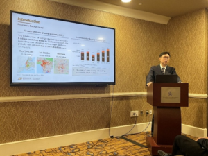
Dohyung Bang presents his research at the 31st Annual Graduate Education and Graduate Student Research Conference in Hospitality and Tourism
Through my IISG-funded project, I aim to examine how the growth of the home-sharing economy affects housing market outcomes in the Lake Michigan region. Specifically, I will investigate whether increases in STR activity are associated with changes in long-term housing supply, home values, and rental prices. Because housing prices are determined by many different factors, it is challenging to identify the causal impact of STR growth. To address this challenge, my research combines multiple datasets and applies econometric methods designed to isolate the effects of short-term rentals from other confounding influences.
More specifically, the project integrates property-level real estate data with short-term rental market data. It also considers a range of control variables, including housing characteristics, neighborhood socioeconomic conditions, and local attractiveness, such as proximity to downtown areas or the Lake Michigan shoreline. By incorporating these data sources together, I aim to identify the conditions under which the effects of the home-sharing economy on housing markets become most pronounced.
The ultimate goal of this project is to clarify the boundary conditions of the home-sharing economy’s impact on local housing markets. In doing so, I hope to generate evidence that can help local communities and policymakers better manage the trade-offs between tourism development and housing stability. Ideally, this work may contribute to policies that minimize the unintended side effects of short-term rentals while preserving their economic benefits.
Beyond this project, my broader research agenda focuses on understanding the complex dynamics of tourism systems and their societal and economic impacts from a social planning perspective. Through this work, I hope to contribute to more sustainable development and long-term economic growth.
March 18th, 2026 by Angela Archer
Meet Our Grad Student Scholars is a series from Illinois-Indiana Sea Grant (IISG) celebrating the students and research funded by our scholars program. To learn more about our faculty and graduate student funding opportunities, visit Fellowships & Scholarships.
Qianyu Zhao is a PhD student at the University of Illinois Urbana-Champaign, focusing on understanding and reducing nutrient loss pollution. His research combines diverse datasets, watershed modeling, and machine learning to trace the movement of nitrogen and phosphorus at the regional scale. Through IISG, he is working to identify the sources and pathways of nutrient loading and translate that science into actionable guidance for policymakers and land managers protecting water quality across the region.
The Great Lakes system holds about 90% of the freshwater in the United States and approximately 20% of the world’s freshwater supply. Forty million residents of the U.S. and Canada depend on this system for clean drinking water. Lake Michigan alone stretches 307 miles long and touches four states. Its beaches draw millions of visitors every summer. Its waters support commercial fishing, shipping, recreation, and the daily lives of communities all along its shores. It is one of the most precious bodies of water on Earth. And for the past century and a half, human development has been putting it under pressure.
The story of nutrient pollution in the Great Lakes is inseparable from the story of how the region was settled and developed. Over the past two centuries, western settlement and the Industrial Revolution have dramatically changed the water quality of the Great Lakes. New economic activities and cultural centers emerged, while the lakes hosted new species and were polluted by industry, agriculture, and cities. As forests were cleared and farmland expanded across the Midwest, the land’s capacity to retain nutrients began to erode. Rain that once soaked slowly through prairie root systems now rushed across bare fields, carrying fertilizers and manure directly into streams and tributaries.
The first step in Qianyu Zhao’s research has not been to build a model or run a simulation. It has been to look backward. Before anything else, he has studied the historical record: decades of water quality monitoring data collected at river gauges, tributaries, and lake inlets across the Lake Michigan watershed. He has examined how human activities in the region have changed over time, how small farms have become industrial operations, and how drainage infrastructure has expanded to move water off fields and into streams more efficiently. He is tracing how nutrient loadings in the water have responded to each of those shifts.
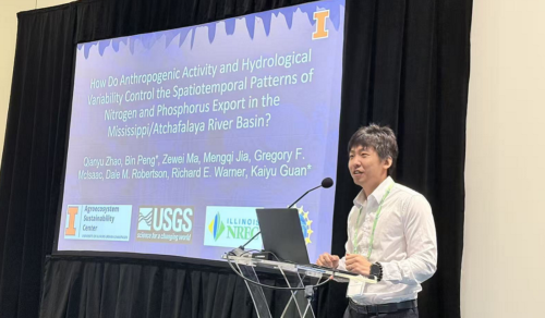
Qianyu Zhao presents research on the Mississippi-Atchafalaya River Basin at the Society of Freshwater Science Annual Meeting in 2025.
This historical foundation is not just background reading. It is the backbone of everything that follows. Understanding where nutrients have come from and how the relationship between human activities and water quality has evolved over time enables Zhao to build models grounded in reality rather than assumptions. It is also what makes his research relevant to policy: the history of the Great Lakes makes clear that technical fixes alone are not enough.
Armed with that historical understanding, Zhao is developing a comprehensive model that tracks the full journey of nutrients from their sources to the lake. The model covers three interconnected stages. First, nutrient inputs—how much nitrogen and phosphorus are being applied to the land. Second, transport—how those nutrients move across the landscape, into drainage ditches, down tributaries, and ultimately into Lake Michigan. Third, in-stream processes—what happens to nitrogen and phosphorus once they enter the waterbody, including the biological and chemical reactions that transform them, allow them to fuel algal growth, or cause them to settle into sediments and be re-released later.
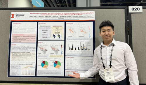
To help guide targeted nutrient loss reduction strategies, Zhao illustrates nitrogen change and anthropogenic and hydrological effects.
To capture this complexity, Qianyu integrates diverse data types and advanced modeling tools. Satellite remote sensing data provides information on land use, vegetation, and soil conditions across the watershed. Statistical watershed models structure how nutrients move through the system. Machine learning algorithms help identify patterns in large, complex datasets that traditional methods might miss. And field water quality measurements grounded the entire framework in observed reality.
The goal of all this work is not a paper. It is cleaner water. Once the model is built and validated, Zhao’s findings will be translated into practical guidance for the people who actually make decisions about Tland and water: policymakers, conservation agencies, farmers, and local governments, who try to figure out where to invest limited resources for maximum impact. It took more than a century of pollution for the Great Lakes to reach their lowest point. Bringing them back is a multigenerational project. Zhao sees his work as one piece of that effort, not a solution on its own, but a scientific foundation that enables better solutions.
March 5th, 2026 by Angela Archer
Meet Our Grad Student Scholars is a series from Illinois-Indiana Sea Grant (IISG) celebrating the students and research funded by our scholars program. To learn more about our faculty and graduate student funding opportunities, visit Fellowships & Scholarships.
Wei Wu is a Ph.D. student at Purdue University focused on building AI-powered tools for coastal resilience. His research interests are combining drone sensing, 3D modeling, and immersive visualization to make environmental change more visible and measurable. Through IISG-supported research, he is advancing innovative approaches to monitor and strengthen communities along Southern Lake Michigan.
On a windy day along southern Lake Michigan, the shoreline tells a quiet but powerful story. Bluffs gradually erode. Water levels fluctuate. Infrastructure that appears stable today may face stress tomorrow. These changes often happen slowly—almost invisibly—until a storm makes them impossible to ignore.
My research begins with a simple question: What if we could see these changes clearly, in real time, before they become a crisis?
As a PhD student at Purdue University, I work at the intersection of artificial intelligence, 3D reconstruction, and coastal resilience. With support from Illinois-Indiana Sea Grant and my advisor, Qingchun Li, and co-advisor, Yu Hou, I am developing AI-enhanced tools to help communities better understand and respond to shoreline changes along Lake Michigan.
Lake Michigan supports vibrant ecosystems, critical infrastructure, tourism, and millions of residents. Yet monitoring coastal dynamics remains resource-intensive. Traditional surveying methods are powerful, but often time-consuming and costly.
AI-enhanced reconstruction workflows provide a complementary path. By automating parts of the modeling process and accelerating data generation, we can reduce barriers to frequent monitoring and long-term observation.
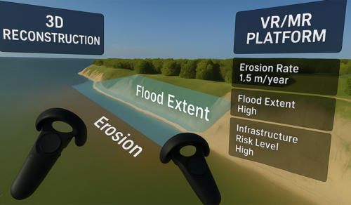
From 3D reconstruction to immersive visualization: integrating coastal modeling into an interactive VR/MR decision-support platform.
My work starts in the field. Using unmanned aerial vehicles, I collect high-resolution imagery of coastal environments, capturing bluff geometry, terrain variation, vegetation, and infrastructure conditions.
But the real innovation happens after the flight. Collecting accurate 3D data is only the first step. The ultimate goal is to transform complex spatial information into tools that communities can use.
Instead of manually processing imagery into static maps, I apply AI-driven 3D reconstruction methods to convert raw images into immersive, measurable digital environments. Techniques such as neural rendering and Gaussian-based modeling enable us to rapidly and efficiently generate high-resolution 3D coastal representations.
These digital shorelines are not just visual models. They are structured environments that can be measured, compared across time, and explored interactively.
In practical terms, this allows us to capture shoreline geometry with high spatial precision, monitor seasonal erosion patterns, quantify terrain changes over time, and support scenario-based visualization. Rather than reacting after damage occurs, communities can begin identifying patterns earlier.
By integrating reconstructed coastal models into virtual and mixed reality environments, planners and stakeholders can step into a digital version of the shoreline. Instead of interpreting abstract charts, they can visually explore bluff edges, terrain gradients, and proximity to infrastructure.
Making environmental change spatially intuitive strengthens communication. It helps bridge the gap between scientists, policymakers, and the public. When risk becomes visible, decisions become clearer.
This IISG-supported work has also been shared with the broader geospatial and research community.
At GEO Week 2026, a major industry gathering focused on geospatial technologies, remote sensing, and 3D mapping. I participated in the conference through the ASPRS-WGL Travel Grant Scholarship and engaged with researchers and industry leaders working on advanced sensing platforms and spatial data solutions. Conversations there reinforced how rapidly AI and sensing technologies are evolving—and how important it is to connect academic research with real-world applications.
Presenting IISG-supported coastal 3D reconstruction research at ICIR 2025, where the work received the Best Paper Award.
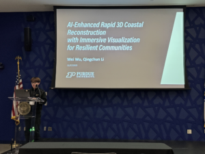
In addition, I presented our IISG coastal 3D reconstruction research at the International Conference on Intelligent Reality in 2025 where the project received a Best Paper Award. The presentation highlighted how AI-enhanced modeling combined with immersive visualization can accelerate coastal monitoring workflows and improve interpretability for decision-makers.
These experiences demonstrate that the research is not only technically innovative but also recognized as impactful in the broader community.
With IISG support, I continue to refine and validate this system using real-world shoreline data. Upcoming field campaigns along southern Lake Michigan will further test how these tools perform under dynamic environmental conditions because coastal resilience is not only about responding to storms. It is about anticipating change.
By combining drone-based sensing, artificial intelligence, and immersive visualization, my research aims to make shoreline change visible, measurable, and actionable.
If we can see the shoreline more clearly, we can plan more confidently. And that is where resilience begins.
March 4th, 2026 by Angela Archer
The Sea Grant Knauss Fellowship provides a unique educational and professional experience for graduate students with an interest in ocean, coastal, and Great Lakes resources, and in the national policy decisions affecting those resources. Located in Washington, D.C., this one-year fellowship is open to U.S. citizens, U.S Lawful Permanent Residents, or dual nationals with at least one citizenship in the U.S., and enrolled in a program leading to a graduate or professional degree.
The application deadline for the Knauss Fellowship is June 3, 2026. Please contact Angela Archer, amcbride@purdue.edu, before applying. This is to ensure that candidates clearly understand the fellowship expectations and that each application includes all required materials. For a full list of requirements, download the Knauss Fellowship 2027 Notice of Funding Opportunity.
Students enrolled at an Illinois or Indiana university or college should submit their applications through Illinois-Indiana Sea Grant (IISG) by emailing Angela Archer at amcbride@purdue.edu. Students in surrounding states without a Sea Grant program should contact the National Sea Grant College Program at oar.sg.fellows@noaa.gov for a referral.
For more information about this fellowship, other opportunities, and application requirements, visit the IISG fellowship page.
Illinois-Indiana Sea Grant is a partnership between NOAA, University of Illinois Extension, and Purdue University Forestry and Natural Resources, bringing science together with communities for solutions that work. Sea Grant is a network of 34 science, education, and outreach programs located in every coastal and Great Lakes state, Lake Champlain, Puerto Rico, and Guam.
January 26th, 2026 by Angela Archer
The Sea Grant program has selected 48 finalists for the 2026 Sea Grant Knauss Fellowship program. Two of those finalists were submitted by Illinois-Indiana Sea Grant, with the rest from 25 other state Sea Grant programs.
The Knauss Fellowship places early-career professionals in legislative and executive branch offices in the Washington, D.C., area, where they contribute scientific and technical expertise to the federal policymaking process for critical marine, coastal and Great Lakes issues. Established in 1979, the program has supported more than 1,762 fellows, many of whom have gone on to careers in public service, academia, nonprofit organizations, and the private sector, and have significantly contributed to environmental policy and management.
As part of their fellowship, the 2026 finalists will participate in professional development and mentorship opportunities and build their networks. This spring, the finalists will participate in the placement process, during which they will connect with one another and potential host offices. Sea Grant’s 47th class of Knauss fellows will officially begin their year in D.C. in June of 2026.
Both Illinois-Indiana Sea Grant finalists will be placed in the executive branch; they are Anupama Chandroth, a PhD candidate in geobiology at Indiana University, and Laura Gray, PhD candidate in environmental engineering at the University of Illinois Urbana-Champaign.
The 2026 finalists represent 40 universities across the country, and include 17 master’s candidates, 29 Ph.D. candidates and two J.D. candidates. They are biologists, resource managers, engineers, ecologists, lawyers, and more. They represent communities across the nation and are committed to making meaningful contributions to marine policy.
December 2nd, 2025 by Angela Archer
The Great Lakes Undergraduate Internship program offers college students the opportunity to help address issues affecting coastal communities through social and environmental conservation sciences. Through this program, Illinois-Indiana Sea Grant’s (IISG) interns will gain knowledge and skills to support Lake Michigan coastal communities in making more informed decisions about resource management and everyday activities. These paid internships may include research, communication, or outreach activities. Applicants may also have an opportunity to participate in activities (for example, attend a professional conference) in addition to their specific internship duties.
In 2026, IISG is hiring an intern in each of the following six areas:
- Aquatic Invasive Species Outreach
- Green Stormwater Infrastructure
- Recirculating Aquaculture Systems (three interns)
- Sustainable Communities
- Water Conservation
- Youth Education
As part of this program, IISG includes required professional development training that takes place, on average, for one hour per week, or approximately eight hours altogether. (One or more of these opportunities may take more than one hour, so in some weeks, no activities will be offered.)
For detailed information on position descriptions, hourly pay, and the application process, visit the Great Lakes Undergraduate Internship page. For other questions, contact Angela Archer at amcbride@purdue.edu.
Application packets are due by January 12, 11:59 p.m. ET.
March 28th, 2025 by Angela Archer
Meet Our Grad Student Scholars is a series from Illinois-Indiana Sea Grant (IISG) celebrating the students and research funded by our scholars program. To learn more about our faculty and graduate student funding opportunities, visit Fellowships & Scholarships.
Lena Azimi is a fourth-year Ph.D. student in the School of Civil and Construction Engineering at Purdue University, specializing in geomatics with a background in environmental engineering. During her master’s program, Azimi encountered remote sensing technology, which provides a way to collect data from a distance, especially remote or hard-to-reach places. This experience led her to pursue a Ph.D. degree and dive deeper into remote sensing and tackle urgent environmental challenges.
My current research focuses on using synthetic aperture radar (SAR) data to estimate soil moisture with finer spatial and higher temporal resolution. Measuring soil moisture is a big deal for water resource management, irrigation scheduling, and even forecasting floods and wildfire risk assessment.
Sustainable agriculture hinges on knowing how much water is in the soil. Too little, and crops suffer. Too much, and you risk diseases, soil salinity, and wasted resources. With more precise soil moisture information, farmers can fine-tune irrigation schedules, boost yields, and save money.
Soil moisture data isn’t only about agriculture. It’s a critical input for flood forecasting. When soil is already saturated, it can’t absorb much more water, making flooding more likely. Knowing soil moisture also helps predict wildfire risks, track droughts, and support ecology research. The broader water resource management stakeholders include governments, NGOs, and industries that need reliable, high-quality data to make informed decisions. I hope that by improving these estimates, we can give decision-makers a powerful tool to plan for both current climate realities and future uncertainties.
Soil moisture measurements may sound simple, but it is a challenging problem due to the complexity involved in the phenomenon. While in-situ sensors can accurately measure soil moisture, they have limited spatial coverage and don’t always capture how much soil moisture can vary across different areas. In addition, the in-situ sensors need frequent maintenance and calibration. That’s where remote sensing steps in—offering a broader view and consistent data collection across wide regions.
SAR, in particular, provides data in nearly all weather and lighting conditions, making it ideal for soil moisture estimation. However, the existing models we use to convert raw radar data into soil moisture metrics often miss the mark compared to ground truth measurements. By refining these models, I hope to contribute more accurate and higher-resolution soil moisture estimates that can benefit many stakeholders, from farmers to policymakers.
My Ph.D. research focuses on improving soil moisture estimation methods, particularly in water-scarce regions. One exciting development is our use of drone-based SAR for ultra-high-resolution data. Drones can fly low, capture fine details, and offer a level of control that satellites can’t match. That means farmers and resource managers could one day receive near-real-time, high-quality data to inform water use, benefiting their bottom line and the environment.
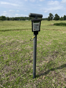
Handheld soil moisture probe used for ground reference soil moisture data collection – June 2024
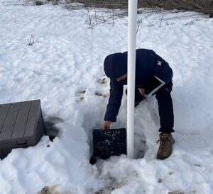
To get the best results, we collect data from multiple angles – four flights around the field. We use SAR, LiDAR, and RGB imagery. LiDAR (Light Detection and Ranging) helps us measure soil roughness and gather structural information on crops. RGB (red, green, blue) imagery provides familiar, photo-like images. And, of course, we gather on-the-ground reference soil moisture data using handheld probes or permanently installed sensors.
Combining all these data demands an interdisciplinary mindset and a willingness to juggle different file formats, sensor limitations, and analysis techniques. But the payoff is huge: a clearer, more nuanced picture of how soil moisture changes over time and space.
As much as I love my research, I’m equally passionate about teaching and mentoring. I’ve worked as a teaching assistant for courses like Principles of Geomatics and Surveying, as well as Environmental Hydrology. There’s nothing quite like watching a student’s face light up when they grasp a new concept.
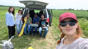
Collecting data in the Pinney Purdue Agricultural Center fields at the Agronomy Center for Research and Education.
I also mentor undergraduate students, helping them discover research topics, formulate questions, read scientific literature, dive into coding, and interpret their findings. My approach is scaffolding I guide them early on, then step back to let them learn independently. The ultimate goal is to instill confidence and competence, helping them become researchers in their own right.
My journey combines environmental sustainability, remote sensing, and education, and I believe these fields can unite to address global water challenges. By refining soil moisture estimation, collaborating with experts in other disciplines, and nurturing the next generation of scientists and engineers, we can protect our planet’s water resources and improve the quality of life worldwide.
I’ve shared some snapshots of our data collection adventures and the fun moments we enjoy in the Geospatial Data Science Lab (https://gdsl.org).
February 28th, 2025 by Angela Archer
Meet Our Grad Student Scholars is a series from Illinois-Indiana Sea Grant (IISG) celebrating the students and research funded by our scholars program. To learn more about our faculty and graduate student funding opportunities, visit Fellowships & Scholarships.
Haribansha Timalsina is a third-year Ph.D. student in Agricultural and Biological Engineering at the University of Illinois at Urbana-Champaign, under the guidance of Rabin Bhattarai in the Water Quality Lab. His research focuses on optimizing nature-based practices to mitigate non-point source nutrient pollution to improve water quality in the Great Lakes region and Mississippi River Basin. The funding from IISG supports broadening the scope of his research work on designing, experimenting, and scaling up the combined strategy for mitigating dual nutrients (nitrogen and phosphorus) from agricultural watersheds.
Nutrients like nitrogen and phosphorus are essential for agricultural productivity–they support plant growth and food production to meet the demands of a growing population. However, excessive nutrient runoff from agricultural landscapes has become a major environmental concern, contaminating water bodies and fueling harmful algal blooms. These blooms deplete oxygen levels, disrupt aquatic ecosystems, and threaten drinking water supplies, fisheries, and recreation.
The Water Quality Laboratory monitors the woodchip bioreactor control structures in Galva, Illinois.
The Great Lakes and the Mississippi River Basin are particularly vulnerable to nutrient pollution due to intensive agricultural activity. Despite decades of regulations and conservation efforts, non-point source (NPS) nutrient pollution remains a persistent challenge, exacerbated by increasing food demands and climate change. Addressing this issue requires continuous innovation in conservation strategies that balance agricultural productivity with environmental protection.
At the Water Quality Laboratory at the University of Illinois at Urbana-Champaign, we take a systematic, multi-scale approach to tackling NPS nutrient pollution. Our research integrates controlled laboratory experiments, field-scale monitoring, and hydrological modeling to develop effective and scalable conservation practices.
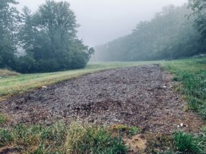
One of the key conservation strategies under investigation is the use of woodchip bioreactors—a nature-based solution designed to remove nitrate from agricultural drainage. These bioreactors provide a carbon source that supports microbial denitrification, converting nitrate into harmless nitrogen gas. While effective for nitrate removal, woodchips do not efficiently remove phosphorus, which often coexists in drainage water and contributes to downstream water quality issues.
To better understand the efficiency of the system, our research group has been monitoring full-scale woodchip bioreactors across six locations in Illinois at high precision, treating drainage from 17 to over 50 acres, including one of the state’s largest bioreactors. By analyzing hydrological dynamics such as tile flow, temperature variations, and system design, we aim to better understand the systems, improve nitrate removal efficiency, and assess potential secondary environmental impacts, such as phosphorus leaching.
One of the largest woodchip bioreactors in Illinois is installed near an agricultural field in Springfield.
Building on these field-scale insights, I designed and evaluated an integrated system that combines woodchip bioreactors with waste-derived adsorbents, including modified bottom ash pellets. This system enhances phosphorus removal while maintaining nitrate removal efficiency. Through extensive laboratory investigations, I assessed the adsorption capacities of these materials and optimized system configurations for dual nutrient removal.
Moving forward, I aim to incorporate laboratory and field study results into watershed-scale hydrological models. By simulating nutrient transport and system performance under different environmental conditions, these models will help guide informed decision-making for regional conservation planning. This approach ensures that naturally based and waste-derived conservation practices can be effectively scaled up for large-scale nutrient loss mitigation, providing long-term environmental and economic benefits.
By advancing science-driven solutions and integrating green infrastructure, we can improve water quality, protect critical ecosystems, and promote agricultural sustainability, ensuring resilient food production and clean water for future generations.
February 27th, 2025 by Angela Archer
The Illinois-Indiana Sea Grant (IISG) program, in cooperation with the National Park Service at Indiana Dunes National Park and Urban Rivers in Chicago, is offering two internship opportunities to support conservation policy efforts. Sea Grant’s national Community Engaged Internship (CEI) program aims to broaden participation in coastal, ocean, Great Lakes, and marine sciences providing training and mentorship to the next generation of scientists, decision-makers, and citizens. The program will do so by recruiting, retaining and engaging students in place-based research, extension, education, and/or communication that respects and integrates local ways of knowing.
The IISG interns will be part of a national cohort of students. Each intern is expected to participate in all aspects of the CEI program:
- On-the-ground learning experience through an 8-10-week internship over the summer months, including:
- Completion of a project that extends the knowledge of community members to address a coastal, marine, or Great Lakes issue of environmental, economic, and/or social importance, and
- Participation in all CEI professional development and training opportunities
- Mentoring by Sea Grant professionals, Sea Grant-funded researchers, and Knauss Fellows
- Virtual professional development sessions
- Peer discussions with other interns in the cohort through virtual platforms
These paid, full-time summer internships will be ten weeks long, depending on the intern’s availability, starting no later than June 2, 2025.
The application deadline is March 17, 2025. For full internship details, eligibility criteria and how to apply, please visit the Community Engaged Internship page. For questions about this opportunity, email Angela Archer at amcbride@purdue.edu.
Illinois-Indiana Sea Grant is one of 34 Sea Grant programs supported by the National Oceanic and Atmospheric Administration in coastal and Great Lakes states that encourage the wise stewardship of our marine resources through research, education, outreach and technology transfer. In partnership with the University of Illinois Extension, and Purdue University Forestry and Natural Resources, Illinois-Indiana Sea Grant brings science together with communities for solutions that work.
