In this abbreviated interview, Research Coordinator Carolyn Foley and Communication Associate Sarah Gediman ask doctoral candidate Katey Strailey about her Illinois-Indiana Sea Grant-funded work. A researcher in the River and Landscape Systems Research Group at University of Illinois, Strailey is looking at how restoration structures in streams change turbulence, or flow of water, and what effects those changes have on fish.
When restoring streams, people may add physical structures as habitat to help fish, but relatively little is know about which structures are most beneficial. Doctoral candidate Katey Strailey is exploring this question using fish physiology, some really cool technology, and impressive surgical skills.
Q: Why did you choose to pursue this research?
A: Freshwater fish are some of the most endangered vertebrates on the planet. 40-50% of freshwater fish are endangered, and river fish have it particularly bad. Rivers are some of the most altered ecosystem types on the planet, which can cause fish to die or leave.
For centuries, humans have used rivers for hydropower, irrigation, drinking water, and transportation. While we (humans) do a lot of things that make it difficult for organisms to live there, we also try to restore the systems.
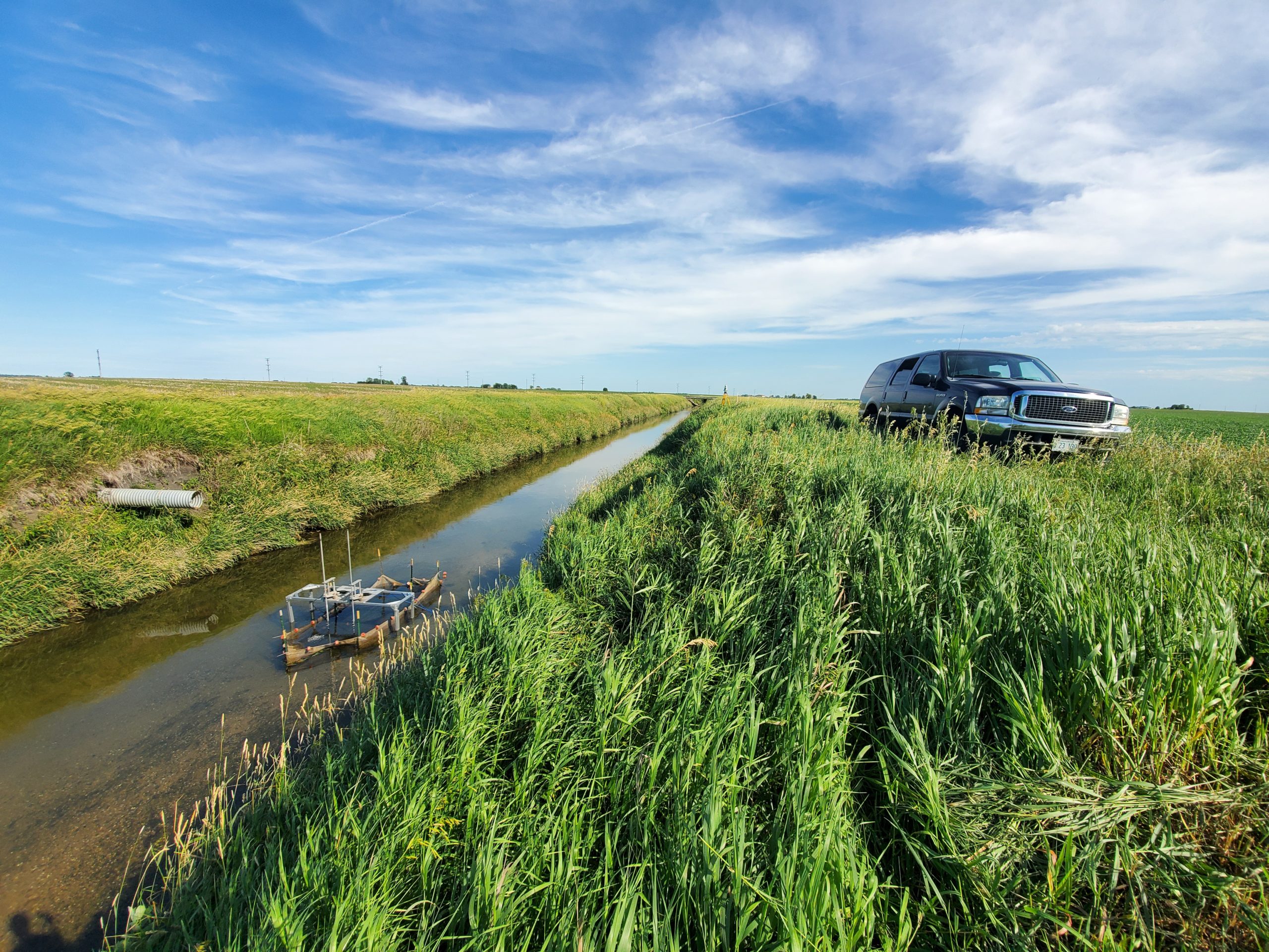
A stream where equipment to measure flow and turbulence has been installed. (Photo courtesy of Katey Strailey)
Q: How can restoration help?
A: Although we can’t always reverse all the damage, we hope that restoration can improve in-stream habitat, increase water quality, and prevent excessive erosion of stream banks. But the jury is still out on how effective current restoration strategies actually are in terms of ecological outcomes. In the U.S. alone, it’s estimated that more than $1 billion is spent on river restoration every year, and so we wanted to explore the how it’s helping question a bit more.
Q: For those of us who don’t know much about stream restoration, what new information will your research contribute to the discipline?
Our research focuses on understanding what makes certain turbulence beneficial or harmful for fish. Turbulence is the swirling, chaotic flow you see when you look at a river. That chaos can make it harder for fish to swim, but some types of turbulence actually help fish. Different structures, as the flowing water moves around them, cause different kinds of turbulence. Since structures are often placed in rivers or streams with a goal of helping fish, we need to be sure that fish actually want to be by them, and that they’re not driven away by them.
One issue with this type of research is that, between limited funding and short funding timelines, it’s really common for people to do a project, monitor it for a year or two, and then move on. But we know that it can take 10-15 years to see the effects a single project has on fish populations. This is where studying fish physiology has an advantage—we can use short-term experiments to understand how restoration actions directly affect individual fish. When you can measure a fish’s oxygen consumption before and after placing an object in the water, and immediately calculate the difference, it’s easier to establish that causal link. It can also hint at how fish might be affected over the long term. So, with the information we generate, we want to develop a tool that can help scientists and practitioners create restoration plans that will most benefit the fish in streams that are being restored.
Q: What types of structures do you use to test fish?
Structures in a stream, whether they be natural or designed and placed by people, are often fairly complex. But for the purposes of our experiments, we break them down to basic components. An example is what we refer to as “large woody debris”, which can be logs, branches, and root wads tangled up together. To test how they might affect fish, we can break them down to the characteristics of their components: how big might a branch be? What is its diameter? How is it oriented in the flow?
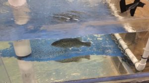
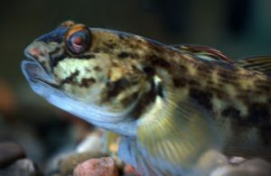
A smallmouth bass is held in a tank during experiments to understand how turbulence around structures affects fish. (Photo courtesy of Katey Strailey)
In my work, I place cylinders that vary by diameter and orientation into tanks to explore how the basic components of structures change the flow. This allows me to very finely link fish responses and flow characteristics to the cylinder and orientation I’m using. For example, lunkers are popular hiding spots for many fish; they look like small wooden caves in the riverbank. Because the overhead components do not affect the flow, we can simulate these structures in our lab experiments using vertical cylinders, then assess their unique turbulence. We can also assess structures found in other natural habitats, such as riffles, that are often incorporated into restoration projects.
Q: What are the mechanics of your experiment?
I honestly think I get to do really cool stuff! Essentially what we’re doing is measuring the decline of oxygen in water as fish do their thing (swim). How much oxygen a fish uses as it swims is linked with how much energy it’s using. By measuring the oxygen they use, we also know how hard they’re working and how much energy they’re using to swim. The catch with oxygen consumption is that with fish, it has to be measured in a completely closed environment with a limited amount of water. If you have too much water, open to the environment, you can’t really know how much of that oxygen is being used by the fish specifically. I use what’s essentially a fish treadmill to measure the oxygen they use: it looks like a little racetrack, the fish hangs out in one section of this racetrack, and the flow recirculates so they can keep swimming while staying in place.
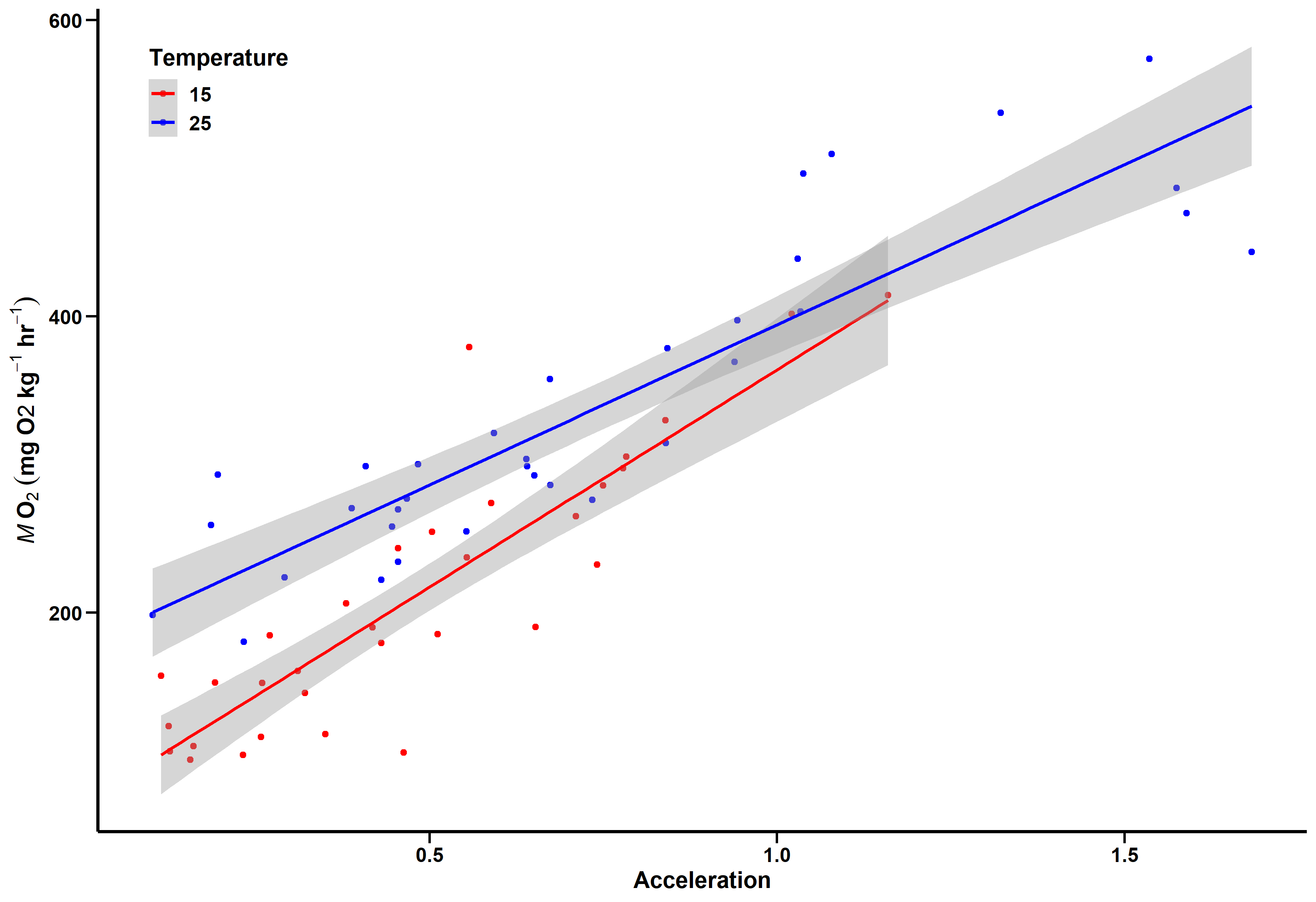
Katey Strailey uses graphs like this to understand how a fish’s oxygen use and their acceleration are related. (Graphic courtesy of Katey Strailey)
Since I can only directly measure this in the fish treadmill, if I want to test them in other environments I have to use a proxy. For my research, that proxy is acceleration. While they’re swimming in the treadmill and I’m measuring the oxygen use, I also measure their acceleration using an accelerometer. This same type of technology is used in smartphones to tell if you’re holding the phone upright or on its side.
Q: How exactly do you use an accelerometer with the fish?
A: I do fish surgeries! I just take these tiny accelerometers and slip them into the fish and let them recover. My fish are very resilient and recover quickly – within minutes, they’re back swimming with their fish buddies. I’ve done well over 100 surgeries and I’ve never lost a fish, ever. When the accelerometer is in a fish and can communicate with a receiver I have, I can put the fish in any kind of environment and then estimate how much energy they’re using to swim, thanks to the link to the fish treadmill that we already talked about.
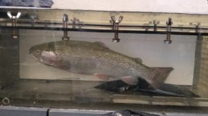
A rainbow trout is held in a tank while oxygen and acceleration are measured. (Photo courtesy of Katey Strailey)
Q: What gets you most excited about this project?
A: We aren’t just sticking with the lab! We are moving towards real world and real river environments. Other studies have looked at the interactions between fish and turbulence, but it oftentimes comes from an interesting novelty angle. There’s not much research that applies this to a conservation or restoration context. Our ultimate goal here is to find new tools, or something that can complement other methods, to help refine best practices during restoration efforts.
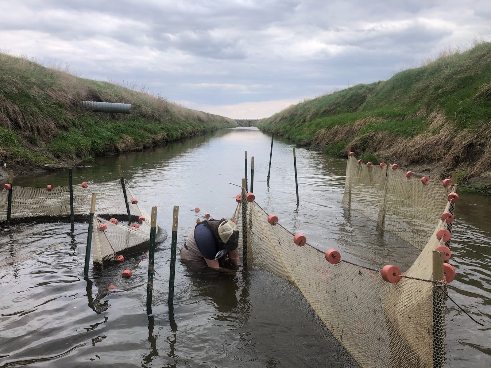
Researchers repair field enclosures. These help understand effects of river and stream restoration on fish. (Photo courtesy of Katey Strailey)
Q: What species do you use?
A: I’ve used two species: rainbow trout and smallmouth bass. The rainbow trout are the ideal species for any study looking at fish and turbulence because of their body shape, which is sort of narrow like salmon and other fish that are raised in hatcheries and then released into streams that feed Lake Michigan.
Another thing I am excited about is that when I was doing my large-scale lab experiments, a lot of my fish would go behind an object oriented vertically in the water. The fish position their bodies so that when a vortex of turbulence comes towards them, their body takes advantage of it and propels them forward into the turbulence. Some fish have this great body shape that can swim upstream without exerting energy. It looked like the smallmouth bass may have done that, but I need to do more trials.
“Meet Our Grad Student Scholars” is an article series from Illinois-Indiana Sea Grant (IISG) celebrating the graduate students doing research funded by the IISG scholars program. To learn more about our faculty and graduate student funding opportunities, visit our Fellowships & Scholarships page. Shuyu Chang, a member of the inaugural Illinois-Indiana Sea Grant graduate student scholar cohort, began her Ph.D. program at the University of Illinois Chicago and is now a Ph.D. candidate in the Department of Geography at Penn State University. Trained as a physical geographer, hydrologist, data scientist, and researcher, Shuyu strives to develop data-driven and process-based models to support decision-making within the realm of water policy and landscape management. She is particularly interested in exploring the ways in which human activity changes the delivery of nutrients (nitrogen, phosphorus, carbon, silicon) to, and water quality of, downstream water bodies by combining remote sensing techniques, machine learning, and hydrological modeling.
Microscopic nutrients, like nitrogen and phosphorus, determine the composition and health of entire ecosystems. Shuyu Chang, a Ph.D. student in ecohydrology, is using remote sensing and machine learning to study how humans influence nutrient flow in the Upper Mississippi River basin, including the Lake Michigan watershed. Ecohydrologists study connections between living things (eco) and characteristics of water such as movement (hydro), and Shuyu’s research will ultimately help managers who wish to create and implement policies to protect Lake Michigan nearshore waters and ecosystems.
While nutrients are needed to support a healthy system, nutrients at very high concentrations may be considered pollutants because they support extremely fast rates of algae growth. This can be dangerous to other lifeforms because algae may use up all available oxygen and their mats may block sunlight, essentially suffocating plants and other organisms in the area. Excess algal growth may also lead to Harmful Algal Blooms (HABs), where particularly toxic forms of algae grow and thrive. HABs are hazardous to humans who take their drinking water from an affected area, as well as pets, wild fish and shorebirds exposed to the toxic algae. While HABs are typically not a major problem in nearshore Lake Michigan, they are considered one of the greatest inland water quality threats to public health and aquatic ecosystems, such as inland reservoirs, and they may occur more often or in different areas as the climate warms. Locations such as the Montrose Dog Beach in Chicago may be at risk, and Shuyu’s research aims to help managers prepare for these possibilities.
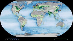
Yellow circles on this map show the location of observed eutrophic (or nutrient-rich) zones. Red dots show where hypoxic (or oxygen-poor) zones have been observed. Satellites can observe changes in the way the ocean surface reflects and absorbs sunlight when the water holds a lot of particles of organic matter. Darker blues in this image show higher concentrations of particulate organic matter, an indication of the overly fertile waters that can potentially lead to HABs or other issues. (Image source https://svs.gsfc.nasa.gov/30479)
Shuyu uses existing data about land use, temperature, climate and other aspects of her study sites, then references remote sensing data to help understand where algal blooms occur. Remote sensing is a way to gather information without physically visiting a location, for example from a NOAA or NASA satellite that has passed overhead. The satellites can detect different aspects of the earth, including the presence of algal blooms, over broad geographic areas. Shuyu then gathers in situ data, for example, water samples from a specific location that are analyzed to help her understand and ground-truth—or verify the accuracy of data with real-world conditions—the remote sensing images.
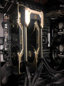
Two titan Graphics Processing Units, used by Shuyu Chang for deep learning and machine learning research.
Because Shuyu has so many different types of data from reservoirs across the Upper Mississippi River Basin, she needs a way to efficiently process the information. For this, she uses machine learning, or writing code to combine large amounts of different types of data and create models based on detected patterns. With enough data and good ground-truthing, this system can predict how climate change, human activities and changing land use may affect delivery of nutrients to water bodies. Developing and calibrating models is always time-consuming, especially when working on a very complicated model with lots of data. For her first scientific publication, Shuyu calibrated each catchment in the Chesapeake Nontidal Watershed more than 50 times because data kept being updated or the model structure needed to change. This is a great example of real-life scientific challenges, and Shuyu’s tenacity has led to various accolades.
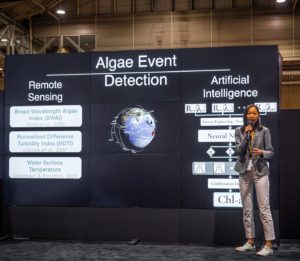
Shuyu Chang presents the work from her NASA DEVELOP project at the AGU 2021 Conference.
The code Shuyu wrote for her Upper Mississippi River Basin project can also be applied in other parts of the world. During the summer of 2021, she served as a NASA DEVELOP intern, where she used machine learning to develop a HABs detection system. This work earned Shuyu the grand prize in the highly competitive 2021 American Geophysical Union (AGU) Michael H. Freilich Student Visualization Competition, and the second prize of the Association of American Geographers (AAG) Remote Sensing Student Illustrated Paper Competition. A keen scientist, Shuyu first learned about remote sensing and Geographic Information Systems (GIS) in her undergraduate studies, and believes that technology like this can expand the traditional scope of hydrology, to weave together elements of practice and thinking among different disciplines.
As successful as Shuyu has been in her project, research isn’t always easy. She said, “Research is a process that I have to try and try again. It is a struggle sometimes, but I also really enjoy the moment I make progress and breakthrough.” For anyone considering pursuing academic research, Shuyu said it’s important to make a routine and stick with it. She starts her day with a cup of coffee, then moves to her workstation to write code about water. Shuyu’s interest in water is not confined to her studies—she loves to kayak, surf and swim in the Great Lakes and the ocean. Her research will help those waters become healthier places for people and animals alike.
Illinois-Indiana Sea Grant (IISG) will award $892,000 to 14 research projects in 2022. Five projects are already underway and will inform decision making for some of the region’s pressing coastal issues, including protecting shorelines, improving aquaculture, and preventing drownings. Several projects will recruit youth to engage in research, opening up opportunities and potentially inspiring tomorrow’s scientists.
This summer, nine more projects will form the latest cohort of the IISG Faculty and Graduate Student Scholars Program, which, through one year of funding, helps develop a community of scientists to research critical issues related to Lake Michigan and the Great Lakes region.
The five 2-year research projects in progress will support and expand IISG efforts in key areas.
Robin Mattheus of the Illinois State Geological Survey will engage in research to support coastal resilience. This team will build on previous work with the Chicago Park District and the Illinois Coastal Management Program, specifically studying how the lake bottom near Chicago affects movement of sand and sediment, and how that impacts shorelines.
Paul Brown and Yu-Ting Chu of Purdue University will study the potential for expanding marine aquaponics in the Midwest. Aquaponics is a circular system for growing plants and fish simultaneously. The team will identify possible salt-tolerant plant species, explore marine aquaponic systems, and quantify the demand for marine aquaponic products in Chicago markets.
Michelle Macy of the Ann & Robert H. Lurie Children’s Hospital of Chicago will lead a team focused on decreasing drownings at Lake Michigan beaches. They will assess the impact of the Chicago Park District’s community water safety training and develop a swimming instruction program in Evanston, Illinois that will be adapted for implementation in other Chicago communities.
Brian Murphy of the University of Illinois Chicago and Will Edmonson at the James R. Jordan Boys & Girls Club of Chicago will directly involve students in Great Lakes-based antibiotic discovery research. Students will help collect samples from the Chicago River and Lake Michigan. Plus, they will learn how to use robotics to build a bacteria library and to test their samples against human pathogens.
Nadine Folino-Rorem of Wheaton College will lead a team of community scientists and students as they investigate invasive freshwater jellyfish blooms in Lake Michigan to get some insight into how the organisms may respond to climate change.
The 2022 group of IISG Faculty Scholars includes Jessica Ward of Ball State University, who will study the effect of microplastics and contaminants on larval fish and Lopamudra Chakraborti from Loyola University Chicago, who will conduct economic analyses on tourism in response to the cleanup of the Waukegan Area of Concern. In addition, Eleftheria Kontou at the University of Illinois at Urbana-Champaign and Chengcheng Tao of Purdue University will use modeling to explore improving the resiliency of southern Lake Michigan communities to flooding.
Five new IISG Graduate Student Scholars from University of Illinois Chicago, Northwestern University, Loyola University Chicago, Ball State University, and Purdue University will improve their research in the areas of antibiotics, thermal pollution in the Chicago River, economic benefits of water quality improvements in Great Lakes Areas of Concern, and fish health, specifically alewife and lake sturgeon. Their projects and stories will be featured in the IISG newsroom and on social media channels throughout 2022 and 2023.
“We are so excited to support these research projects,” said Carolyn Foley, IISG research coordinator. “They cover a broad set of issues in support of the Lake Michigan communities we serve, including introducing younger students to scientific research, and we cannot wait to see the outcomes.”
“Meet Our Grad Student Scholars” is an article series from Illinois-Indiana Sea Grant (IISG) celebrating the graduate students doing research funded by the IISG scholars program. To learn more about our faculty and graduate student funding opportunities, visit our Fellowships & Scholarships page. Alexis Arias is a doctoral student in the College of Architecture at the Illinois Institute of Technology, and part of inaugural Illinois-Indiana Sea Grant Graduate Student Scholars cohort. He is studying the urban design implications of driverless vehicles. In his current work—which is also supported by the National Science Foundation—he interviews transportation, water management and policy experts to help him design models for better urban water treatment. He is broadly interested in how upcoming technologies can help maintain or create positive social and environmental benefits for cities and the many stakeholders in and around them.
For many, the idea of driverless cities may belong in a futuristic world or on a different planet, but this is not the case for Illinois-Indiana Sea Grant Graduate Student Scholar Alexis Arias. A PhD student at the Illinois Institute for Technology, Alexis is part of the Driverless City Project team. Collectively, the team is exploring how planning decisions would change for cities that use self-driven transportation services. For his Illinois-Indiana Sea Grant-supported piece of the work, Alexis is specifically interested in how driverless cars will affect urban water quality in and around Chicago. While car developers are understandably focused on the safety and technology of driverless cars, no one knows much about their environmental impact. Alexis believes driverless cars are “a sort of environmental Trojan Horse” and hopes his research can ultimately be useful to developers, industry leaders and others who design infrastructure. Alexis shared, “I would like for them to be able to employ new technologies to achieve desirable social and environmental benefits.”
In his first stage of research, Alexis is interviewing experts in urban water, and transportation infrastructure, and policy. This includes planners, landscape architects, academic researchers, and representatives from the Chicago City Council, Metropolitan Planning Council of Chicago, and the Metropolitan Water Reclamation District. Alexis is aware that his interviewees are very busy, so once someone has agreed to an interview, he and his collaborators carefully craft questions for that particular chat.
Overall, the main objective of all Alexis’ interviews is to answer two questions: Firstly, how does current transportation infrastructure affect urban waters? And secondly, how can we employ new mobility technologies to improve the health of urban waters?
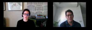
Alexis Arias holds a virtual interview with Mary Pat McGuire of the University of Illinois at Urbana-Champaign.
Experts agree that two major sources of pollution in cities are stormwater runoff and point-source pollution from impervious surfaces including gas stations, garages and parking lots. Some of Alexis’ interviewees have suggested that driverless cars may need far fewer parking spaces, street lanes and gas stations as they become increasingly efficient and electrified. Reduced infrastructure could lead to less pollution, which could be a great benefit to waterways in and around Chicago. In addition to predicting changes in the amount of pollution, Alexis is exploring what can be done to remediate contaminated land and water. Possibilities include repurposing old infrastructure, changing the way that roads are paved and exploring land use ordinances changes. Any and all of these changes could lead to positive outcomes for humans and other lifeforms that rely on clean water sources.
After the expert interviews, it is time to quantify gathered information. Alexis’ favorite research activity comes after the interviews are transcribed. “We are getting the big ideas from experts and trying to create models. We have to figure out ways to put this into GIS mapping and 3D models to generate predictions,” he said. “The fun part is when we start developing scenarios and use a lot of computational assisted drawing systems.” For this, Alexis uses around eight types of software: AutoCAD, Rhino, GIS, Adobe Illustrator, Photoshop, Ladybug, Honeybee and Grasshopper. Each program serves a specific purpose that can help predict pollution as accurately as possible. For example, Grasshopper software allows Alexis to develop parametrical models, which are based on pre-programmed plugins that help with environmental analysis. According to Alexis, “The cool part is when we see how all of these programs work together.”
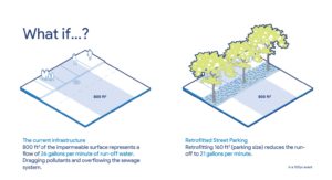
The research team that Alexis Arias is part of asks “What If?” questions. What if Driverless Cars don’t need parking or service? Can we retrofit those spaces for social and environmental purposes? If we retrofit street parking into water management systems, we can reduce the runoff water in a 100-year event by 20% from about 26 gallons per minute to 21 gallons per minute.
While the main goal is to produce data-driven predictions about urban water quality, Alexis has been pleasantly surprised by social ideas for driverless cars that have come up during the interviews. Experts have exciting ideas for how to write public policy, use public funds for infrastructure, and use urban planning code for education. Alexis says each interview has been a fruitful learning process and he always leaves excited about new ways to use urban planning to improve quality of life and water quality simultaneously.
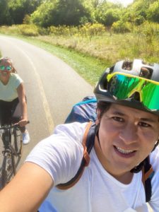
This doctoral project is massive and requires a lot of time management. Alexis spends his mornings researching driverless cars and collaborating with other people in his lab. In the afternoons, he works on modeling, which is mostly self-taught. Some days can be frustrating, and others are very satisfying. To anyone considering pursuing graduate school, Alexis recommended, “Be very open-minded about where grad school will take you.” His time in the Illinois Institute of Technology’s architectural school began with a life-changing layover, and he has ended up working with people in many other departments by asking big questions and making an effort to connect with his mentors. In his free time, Alexis enjoys biking along the Chicago Lakefront Trail with his girlfriend, Jacqueline, and enjoying Lake Michigan with his puppy Pacha (Pachamama).
“Meet Our Grad Student Scholars” is an article series from Illinois-Indiana Sea Grant (IISG) celebrating the graduate students doing research funded by the IISG scholars program. To learn more about our faculty and graduate student funding opportunities, visit our Fellowships & Scholarships page.
Arunim Bhattacharya is a doctoral student in the Emergent & Autonomous Systems Laboratory at Northern Illinois University and part of the inaugural Illinois-Indiana Sea Grant graduate student scholars cohort. He is interested in invasive species monitoring in the Great Lakes region and currently seeks to identify aquatic invasive species (AIS) using machine learning techniques. He is also interested in studying interactions between human AIS monitoring and robot-swarm AIS monitoring. Robot swarms can explore a large environment, but humans have better situational awareness, and Arunim is particularly interested in how these strengths can complement one another.
Closeup of a round goby. Photo credit Michigan Sea Grant.
Aquatic invasive species remain a major threat to Great Lakes ecosystems, and Arunim Bhattacharya, a PhD student at Northern Illinois University, is using machine learning techniques to help. Round gobies, a fish introduced to the Great Lakes in the 1990s, have since invaded many nearshore regions. Scientists know they are playing key roles in local ecosystems, but the round goby’s tendency to live in rocky bottom areas, plus their cryptic coloring, makes them very hard to detect.
One method that scientists have used is to take pictures or video of the lake bottom, then count the round gobies that are present. In some cases, humans do the counting, while in others, computers do it. Unfortunately, different species of fish can look similar on camera, especially in murky waters with a cluttered background. Through his research, Arunim is developing a clever way around this issue: instead of identifying round goby by the way they look, Arunim has found a way to identify them by the way they move. He is using machine learning techniques to identify round goby movement in videos, which will allow scientists to better understand the role they are playing in Great Lakes ecosystems and (hopefully) slow or stop expansions to new areas.
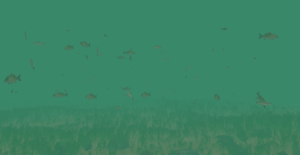
To teach a computer to identify and recognize round goby, Arunim is creating a virtual aquatic world. His model Great Lake includes five fish species: common carp, lake perch, lake whitefish, yellow perch, and round goby. The virtual aquarium is based on videos of fish that had been gathered on the citizen (or community) science platform Zooniverse as part of the Deep Lake Explorer project. Frame-by-frame, Arunim identifies the round goby and annotates the video using a software called Peregrine. In addition to drawing a box around the fish, Arunim tries to identify specific behaviors, like foraging, shoaling, which is swimming together, and any quick jittery movements to and from the school.
“The idea is if I have one or two minutes of footage, I see what percentage of that is fish schooling or shoaling and that gives me an idea of how to code them to behave in the virtual reality setup,” said Arunim. Though the videos are relatively short, the process of annotating each one takes 2-4 hours. It is important, though, as this training of the machine algorithm sets up the next part of Arunim’s work: training a computer.
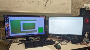
Arunim uses two computer screens while annotating videos.
Like all machine learning projects, this algorithm needs to be developed using an immense amount of data to increase its ultimate accuracy. That’s one of the reasons Arunim likes the Zooniverse-sourced videos: they provide lots of data without being intrusive or costly.
The annotated video footage is then fed through a machine learning algorithm—machine learning refers to how computers can generalize some behavior, for example how a particular fish species moves without a human needing to program that behavior. The algorithm trains on trajectory data: the squares Arunim drew around the fish in the first part of his research and the percentages of types of movement he identified. Arunim uses equations to help understand the optimal, or “just right,” model that explain the information well, but do not try to add a lot of extra information. Models with more extra information are “overfit” and may explain current conditions well, but typically do not perform as well when used to explore new videos or information.
An example of a simulated underwater aquatic world that Arunim will create.
Once the learning algorithm has trained on enough data, it will be able to identify round goby in new, unannotated footage. When an unknown trajectory is passed through the program, it will output the probability that the trajectory belongs to round goby.
The type of program Arunim uses here is called a neural network, because it behaves a bit like a human brain with respect to how it pulls data together, groups it, analyzes it, and sends it out again. By tracking organisms and matching their trajectories, Arunim’s program will be able to ultimately identify round goby in brand new videos captured from the wild.
This machine learning is part of a bigger project—making underwater robots that will be able to capture and identify footage to mitigate round goby and their ecological damage If it is successful, the algorithm could be used to identify other species.
Arunim’s advice to students considering graduate school is to find a great advisor who will be supportive, and just go for it.
You can learn more about Arunim’s research by following @ArunimBhattach1 on Twitter.
Illinois-Indiana Sea Grant is a part of University of Illinois Extension and Purdue Extension.
“Meet Our Grad Student Scholars” is an article series from Illinois-Indiana Sea Grant (IISG) celebrating the graduate students doing research funded by the IISG scholars program. To learn more about our faculty and graduate student funding opportunities, visit our Fellowships & Scholarships page.
Victor Schultz is a recent graduate of the Van Meter Ecohydrology lab at the University of Illinois at Chicago (lab now located at Pennsylvania State University), and part of the inaugural Illinois-Indiana Sea Grant Graduate Student Scholars cohort. During his master’s work, Victor studied groundwater nitrate in the Upper Mississippi River Basin, specializing in hydrology, statistical and numerical modeling, and Geographic Information Systems (or GIS). An avid runner, Victor previously studied Environmental Studies and Political Science at Knox College in Galesburg, Illinois, and Spanish Language and Literature at the Universidad de Palermo in Buenos Aires, Argentina. A highlight of his graduate school experience was participating in the NASA DEVELOP program, where he applied new skills and techniques to drought monitoring in Illinois.
While Victor Schultz was a master’s student, he was interested in the effects of nitrate runoff on both ecology and human health. Nitrates form when nitrogen (or N, an essential element for plant life) combines with oxygen or ozone. Nitrates are among the most common aquatic human pollutants in the United States. Through his research, Schultz studied nitrate contamination in the Upper Mississippi River Basin, which includes large areas of Lake Michigan states like Wisconsin, Illinois and Indiana. However, it is separate from the Lake Michigan watershed, with one artificial exception: the Chicago River, whose flow was reversed around the turn of the 20th Century.
(Graphic by United States Geological Survey)
Agricultural land is very common in the Upper Mississippi River Basin. Nitrogen fertilizer, livestock waste, and nitrogen converted into a biologically usable form by crops like soybeans are common sources of N. Nitrogen can be transported by rivers and streams through the watershed, or accumulate in the soil and groundwater of the area. Either way can cause problems: excess N that is transported by rivers and streams can cause low-oxygen ‘dead zones’ and algal blooms in lakes and coastal ecosystems, while the N that is stored in the soil and groundwater can create health hazards in well water, and may pose future risks to surface water.
Nitrate contamination in lakes, rivers, soil and groundwater is about 20 times what it was 70 years ago, but the amount of nitrogen that has accumulated in underground aquifers of the Great Lakes region remains relatively unknown. This is an important data gap, as approximately 40 million Americans rely on private wells for drinking water. Nitrogen introduced via the landscape can affect drinking water safety and surface water quality for more than 30 years, and, as climate change affects the Midwest, more and more individuals and organizations may need to use groundwater in their daily activities.
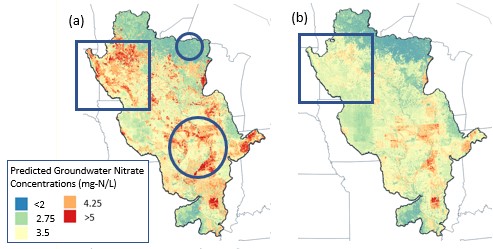
These two maps show the results of the Random Forest model. Map (a) shows predictions of nitrate in groundwater that is closer to the surface, while map (b) shows predictions of nitrate in deeper groundwater. The two circles show locations that are the same depth, but have very different landcover, and the model predicts very different nitrate concentrations. The two squares show how the same location can have very different nitrate concentrations, depending on how far down you go. (Graphic provided by Victor Schultz)
Through his research, Schultz tested the ability of more than 70 variables to predict nitrate concentrations in groundwater. The variables included land use, soil type, bedrock and even the density of hogs. He used Random Forest, a machine learning method, to combine many models into one prediction. The amount of nitrate in groundwater wells was best predicted by the depth of the well, the surrounding land use, and the amount of bedrock.
Many people helped Schultz during his project, including the owners of the wells that he sampled for nitrates. He hopes that his work can be a starting point for localized studies in the Great Lakes region, as high nitrate levels in drinking water may lead to greater risk of thyroid, bladder and breast cancers, or birth defects in babies. Most water treatment plants remove some level of nitrates, but for the about 25% of Indiana residents who rely on well water as their main drinking water, additional information on where nitrate levels could be highest should help. Victor is also excited about the modeling framework he used because it demonstrates machine learning modeling as a powerful tool for estimating contaminant levels on a regional scale.
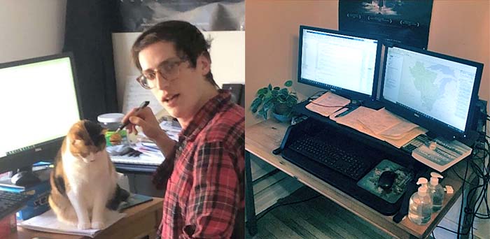
Much of Schultz’s research happened during the COVID-19 pandemic, so he and his cat Chili Flake had to adapt to working from home. He found that the combination of a standing desk, more houseplants and the same computer setup as in his office on the UIC campus led to a nice balance, and Chili Flake found new places to sit. After graduation, Victor will be looking for jobs in environmental science as a consultant or researcher. In his future career, he hopes to showcase the GIS, programming, data analysis, science communication and long-term project management skills that he gained through his graduate research experience.
You can learn more about Victor’s research by following @voschultz on Twitter.
Illinois-Indiana Sea Grant is a part of University of Illinois Extension and Purdue Extension.
One of Illinois-Indiana Sea Grant’s (IISG) long-term goals is to help build a community of researchers and outreach professionals focused on critically important Lake Michigan issues. The IISG Scholars programs are designed to help build this community by introducing researchers to the issues and the stakeholders affected by them. In addition, the programs are intended to help graduate student scholars further the impact of their research, and help faculty scholars develop innovative, fundable proposals for future work in the region. View examples of past scholar projects in our newsroom.
The 2022 IISG Scholars competition is now open for Graduate Students and Faculty. Awards are issued for one year and activities should be completed during that year. IISG expects to support 5–7 Graduate Student Scholars and 3–4 Faculty Scholars in 2022. The full Request for Applications can be found at https://iiseagrant.org/wp-content/uploads/2022/02/2022-IISG-Scholars-RFA.pdf.
Applicants for both opportunities (graduate students or faculty) should submit materials via https://esg.iiseagrant.org/ by 5:00 p.m. Central time on March 18, 2022. Applications should be submitted to the “IL-IN SG 2022 Scholars Competition”. Late applications will not be accepted unless the applicant has contacted IISG staff before the deadline to make them aware of potential issues (e.g., computer, power, or internet issues).
Illinois-Indiana Sea Grant is a part of University of Illinois Extension and Purdue Extension
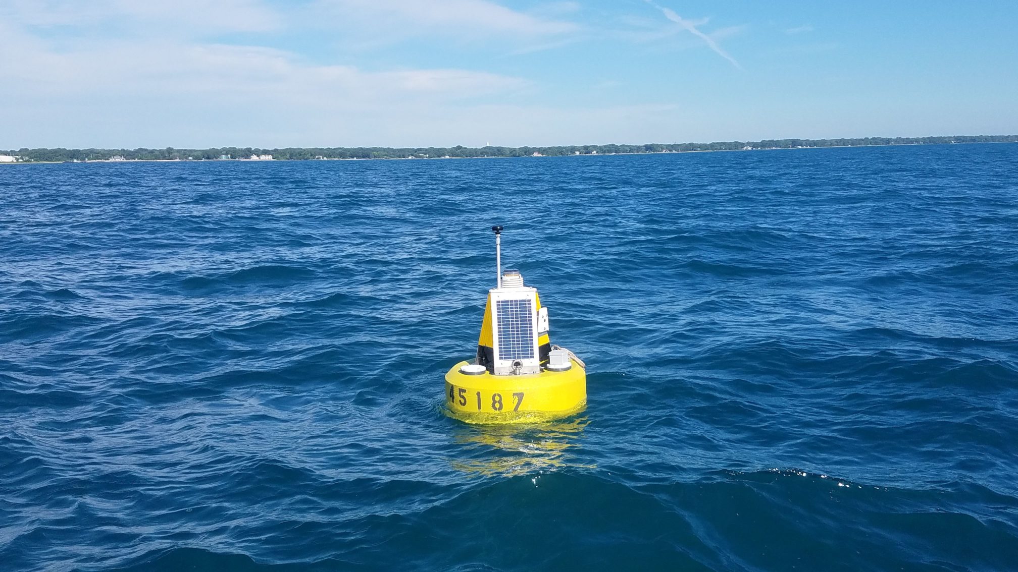
Lake Michigan now has two new buoys that monitor lake conditions in real-time. Placed about a mile offshore in Illinois waters—close to Waukegan and Winthrop Harbor—each buoy will measure air and water temperatures, wave and wind conditions, and water currents every 20 minutes while deployed. The buoys are also equipped with webcams that transmit an image and video once per hour during daylight hours. Illinois-Indiana Sea Grant will host the most recent data and images on their program website, while data will be managed by Great Lakes Observing System (GLOS).
Ethan Theuerkauf and colleagues from the Illinois State Geological Survey (Prairie Research Institute, University of Illinois at Urbana-Champaign) and the Illinois Department of Natural Resources Coastal Management Program have been working to deploy these buoys for several years. “We plan to use the buoy data to study the drivers of erosion along the Illinois shoreline,” said Theuerkauf, a scientist with the Illinois State Geological Survey and an adjunct professor at the University of Illinois at Chicago. “It is a bonus that so many boaters and swimmers can also use the information.”
“It’s great to have two more systems that will help scientists and weather forecasters understand what’s happening in the Illinois and Indiana waters of Lake Michigan,” said Jay Beugly, an aquatic ecology specialist with Illinois-Indiana Sea Grant, who helped place the buoys in the water on July 19 and is the main support for the Illinois-Indiana Sea Grant real-time buoy program.
Photo credit: Ed Verhamme, LimnoTech, Inc.
Ed Verhamme, a project engineer with LimnoTech, Inc., designed and custom-built these buoys for application along the Illinois shoreline. “These buoys are closer to shore than other buoys in Lake Michigan, which helps scientists better understand how waves and currents affect the shoreline, but also required us to use a different type of buoy”, said Verhamme who also joined Beugly and Theuerkauf during the buoy deployment.
As of July 23, 2018, data from the two new buoys can be found via the GLOS data portal and the National Data Buoy Center by searching buoy numbers 45186 (Waukegan) and 45187 (Winthrop Harbor). These buoys were supported by a NOAA Coastal Zone Management Projects of Special Merit Grant.
Illinois-Indiana Sea Grant (IISG) is proud to support two real-time monitoring buoys in southern Lake Michigan, one located just north of Michigan City, Indiana and the other near Wilmette Harbor, Illinois. Recently, users have started pitching in with donations to help keep the buoys afloat.
The buoy program started when a Purdue researcher pointed out that there were no real-time data being collected in Lake Michigan’s Indiana waters. A few years later, concerned citizens and sailors pointed to a similar need for the Illinois shoreline. Now, the two IISG buoys are filling information gaps for anglers, sailors, swimmers, and weather professionals who are interested in this part of the lake.
Over the years, buoy users have made phone calls, emails, and interactions through Twitter and Facebook to share that the buoys are valued and needed. We at Sea Grant have enjoyed hearing how our fans use buoy information. All told, lake enthusiasts are checking our real-time buoy data nearly 30,000 times per year!
Putting a buoy in the water, year after year, requires many things to happen. Weather conditions, equipment, people, and technical services have to come together perfectly to keep the buoys operational. This program would be impossible without sufficient funding.
Sea Grant’s buoy managers, Carolyn Foley and Jay Beugly, try to support the buoys with grants, but those funds can be hard to come by. When the unexpected happens, like a power-generating solar panel comes loose, or it takes three trips to remove a hook found tangled in wires at a depth of 30 feet, we burn through our funds pretty quickly.
IISG is constantly on the lookout for partnerships to help keep the buoys afloat, but you can also make a donation. The funds raised will go directly toward the buoy program, supporting data charges, travel costs, repairs, and upgrades. Already, folks are stepping up and donating to keep the buoys operational.
We love providing the buoy data as a service to everyone and helping families stay safe during these summer days. Please join your fellow buoy fans and consider donating today!
Illinois-Indiana Sea Grant is a part of University of Illinois Extension and Purdue University Extension.
What does a career in natural resources look like?
This month, a group of 4-H youth joined us at Martell Forest to find out! From tree climbing and birding to creating scent traps and dissecting owl pellets, participants spent three days exploring the many ways people work with and protect our natural resources.
Thanks to everyone who joined us! We can’t wait to see where your adventures take you next!


